The wet weather continues for northern England, with more rain in places than in the whole of spring. Into the 20sC this weekend but still a scattering of heavy, even thundery showers.
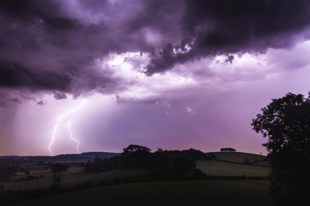
June has brought heavy showers, incredible shows of Noctilucent clouds (the night shining very high summer ones) and yesterday some significant thunderstorms. A friend in Hampshire texted about the “SERIOUS thunder this afternoon, never heard a rumble go on for so long”. Also, in Hants on Thursday:
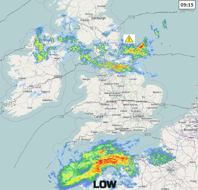
The key low pressure for our showery or just plain wet weather is lurking in the Bay of Biscay. Around it, there will be brisk winds today, with a flow off the North Sea. This flow has brought rain over northern England, SW Scotland, the Isle of Man and Northern Ireland through the night and a Met Office weather warning continues for NE England and Yorkshire until early afternoon. There has been more rain in some areas in the past 18 hours than there was in the whole of spring, with over 50mm.
The low pressure will edge north again today. This nudges the rain band over Scotland later and brings heavy downpours back to southern Britain. At the same time, more humid and warm air will be moving in from the east off the continent. This will bring a noticeable change for some, from the cool fresh air to a more close feeling. SW Britain won’t feel the effects as much.
Today
There are two areas of rain showing on the Netweather radar. The frontal band from overnight which will wave about slightly today before heading north this evening. Also, further south, a mass of rain bringing a wet start to the Channel Islands. Around these, there is a lot of cloud, although with breaks and sunshine for southern England, including London and also parts of NW Scotland where the thick low cloud has not seeped in from the north.
North of the rain band, Scotland will see more sunshine as the day progresses, mainly for the west and northwest. Also brightening at times for Northern Ireland particularly for Co. Tyrone.
The rain in the Channel will move over southern England by lunchtime, pivoting round over Wales this afternoon and evening. There will be the risk of a few thunderstorms within the band of showers. The heaviest showers over SW England this afternoon extending to Wales and the West Midlands by late afternoon. Temperatures will be lifting into the low 20sC with a light to moderate east to NE wind. Cooler under the thicker cloud and rain.
The heavy showers head to north Wales later in the evening, there will be one or two other sharp well-scattered showers behind and another pulse of showery rain appears from the Low Countries heading towards The Wash, still rotating around the low to the SW. More technical details in the severe convective forecast about today's thunderstorm risk.
Saturday
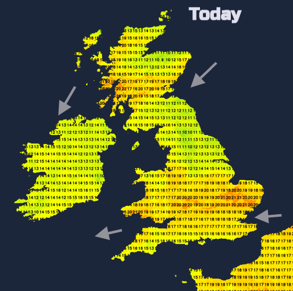
The picture for Saturday is quite mixed. Central England and SE Britain look fine, bright and warm. The rain over the North Sea will spread over more of the northern half of the UK with showers breaking out. Some of this will be heavy and thundery. This won’t reach the far north of Scotland and there will be drier slots in between with that warmer, more close feeling in the air. So showery rain but then longer bright even sunny spells when it will feel strangely warm in the west. Temperatures in Scotland into the low 20sC, away from the east coast and around 19C for Northern Ireland. Northern England also into the 20sC but still cooler for NE England’s coastal counties. Wales will see high teens or low 20sC with a few heavy showers breaking out in the north across northern England in the afternoon.
The low centre will be closer to SW England on Saturday and bring lots of showers to southern Wales and the West Country, again with the risk of heavy downpours even thunderstorms. There will be more cloud and temperatures in the high teens with an east to SE breeze along the Channel coast.
Weather apps will show this risk of showers, but they may miss your location completely, or you get a heavy downpour. Keep an eye on the radar and you can see where they develop and are moving to. In the warmer air, more parts will have temperatures into the 20sC with up to 25 or 26C possible on Saturday, around Cambridgeshire looks most likely.
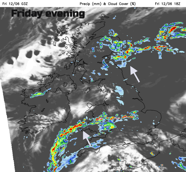
Heavy showers move over SW Wales as the evening becomes quieter and calm. Thick low cloud will drift in off the North Sea over NE Britain and later down to Norfolk, so a grey, cool start here on Sunday. Further west heavy showers break out again, still with the risk of a few thundery ones as temperatures lift into the 20sC with hardly any breeze.