The already very dry May will end with more dry, sunny and warm weather across all of the UK. This theme continues into the first few days of June, but there could be a change on the way later next week.
There are tentative signs of a pattern change as we head into early June, to something cooler and more unsettled. However, there is little or no rain likely for most over the next five days at least, as high pressure remains firmly in control. So May 2020 will likely end up very dry for most, perhaps record-breaking for parts of the southeast – where there’s been little or no rain.
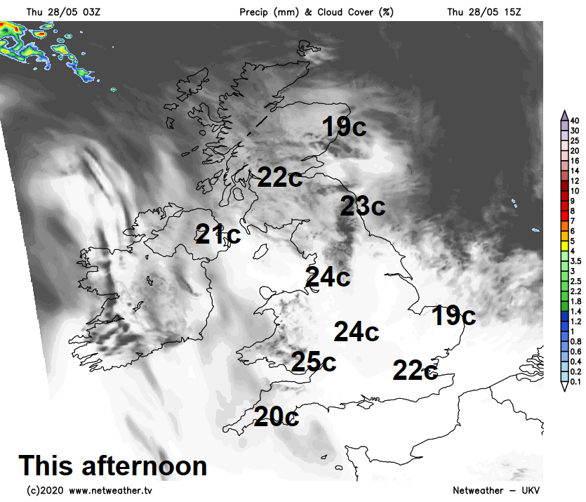
Warmth and sunshine were more widespread across the UK on Wednesday and the same will be true over the next few days, with temperatures widely in the low to mid-twenties Celsius, perhaps high twenties across south Wales. Cooler than recent days across East Anglia and SE England – where there will be a brisk easterly wind developing.
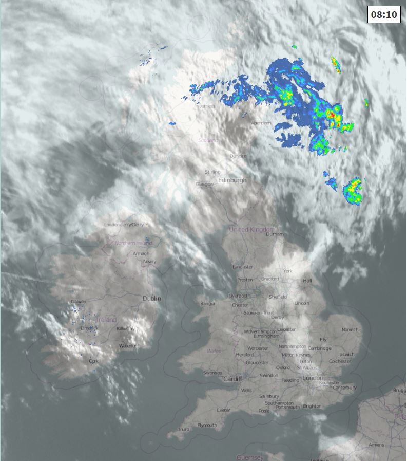
For now, a cloudy start across large parts of Scotland and N. Ireland, with some patchy light rain across northern Scotland. Further south, a mostly dry and sunny start, blue skies across large parts of England and Wales. The cloud and early rain in the far north should clear and it will brighten up across much of Scotland and N. Ireland to join England and Wales to a dry and sunny day, with lengthy spells of warm sunshine.
Temperatures this afternoon reaching 21C in Belfast, 22C in Glasgow and London, 23C in Newcastle, 24C in Manchester and Birmingham, 25C in Cardiff. SE England saw the highest temperatures over recent days, but a easterly breeze picking up here and East Anglia will mean the west will see the highest temperatures.
Perhaps some mist and low cloud rolling in along North Sea coasts of eastern England and also cloudy across the Northern Isles tonight. Otherwise, the rest of Britain will see clear spells. All parts staying dry overnight.
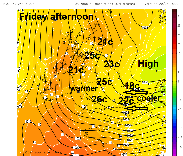
More of the same on Friday, high pressure close to the east keeping weather fronts at bay to the west, with most seeing sunshine from dawn to dusk, with very little in the way of cloud for many. Very warm for most in the light southeasterly breezes, still a brisk easterly breeze towards the southeast, which means the highest temperatures will again be towards the west. So, we could see 25C in Glasgow and Manchester, 26C in Cardiff, 20-24C elsewhere, cooler around coasts, particularly North Sea coasts of East Anglia and Kent with the onshore breeze.
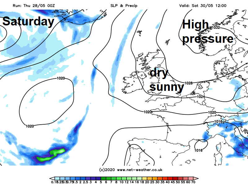
The weekend is looking fine, dry, sunny and warm for most, with high pressure close to the east continuing to keep weather fronts at bay over the Atlantic. Both Saturday and Sunday will see plenty of warm sunshine, though there will be an increasingly brisk southeasterly breeze – particularly in the east. Temperatures widely reaching the mid-twenties inland, even across Scotland, perhaps up to 27C across south Wales and inland parts of SW England, cooler across eastern coastal areas.
Mostly dry, sunny and warm conditions are likely to continue into early next week, the start of June. However, there are signs that high pressure could retreat westwards to allow low pressure to drop south across Scandinavia and eastern Europe from mid-week, bringing a cooler northerly flow with showers. But some uncertainty over this outcome for now.