


Slow changes in our weather during the coming days as high pressure slips south. That will allow warmer air to pull up from the south but also some less settled weather at times across the north.
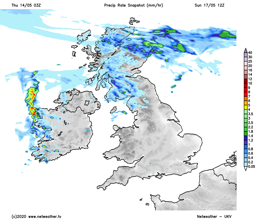
Just as we've had for most of the Spring, high pressure is well in control of the UK's weather at the moment. It is on the move though, heading south during the next few days - allowing warmer air to pull up from the south. It'll also open the door to some less settled weather across the northern half of the country, initially with some showers in the north of Scotland. Then there's the potential some longer spells of rain to become more widespread across Scotland and perhaps into Northern England later in the weekend and early next week, before the high re-asserts itself across the whole UK once again.
Today, the action is at the top and tail of the UK, with some showers affecting the north of Scotland and one or two just grazing into the far southeast. Elsewhere is set fair with lots of sunshine during the morning, but the cloud will tend to bubble up a bit more into the afternoon. Temperatures will reach the heady heights of 11-15c typically, with the warmer end of the range in southern and central regions, with places like London and Southampton likely to be the warmest spots.
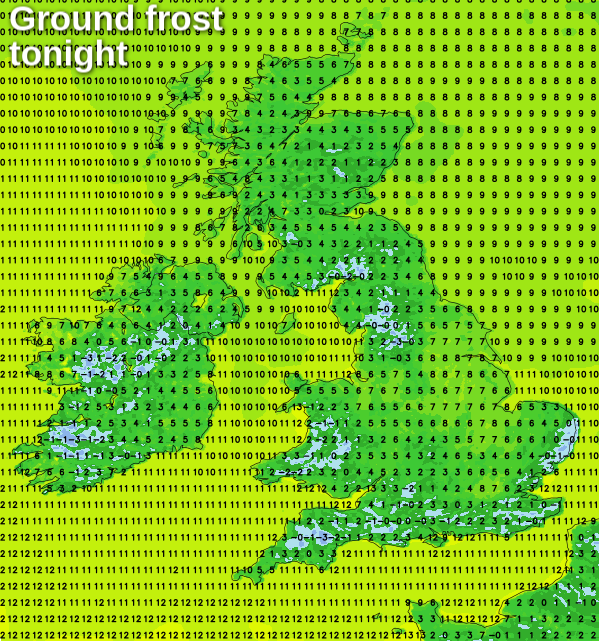
Another chilly night then follows, with a risk of frost in places - gardeners take note! And also if you've not seen it yet, our guide to all the must-do garden tasks in May is well worth a read.
After a cold start, Friday will follow a familiar pattern, with sunny spells, varying amounts of cloud along with the threat of some showers across the northern half of Scotland. The high pressure will be on the move though and will have sunk a little further south than it was on Thursday, which in turn will mean slightly warmer temperatures. So 11-15c will become 13-16c for many parts. Not a huge jump, but that's getting back toward the average for the time of the year.
The weekend then takes off where the working week ended with very little change to the pattern. Saturday will be a notch warmer again at 14-18c across England and Wales, but it'll 11-15c will be about the limit for Scotland and Northern Ireland where there'll be some showers again - blown in on a keen westerly wind.
Sunday will bring a greater threat of wet weather into Scotland, with showers also affecting much of Ireland and the risk of a few into Northern England and maybe also some other western counties of England and Wales too. It'll be windy in the north and west as well, with gusts of 40mph plus in places. Further south and east though, it's a quieter picture with sunny spells and temperatures rising into the high-teens or low-twenties.
The north-south split is then likely to continue as we start next week, before high pressure ridges back north to bring the settled weather back across the whole country.


