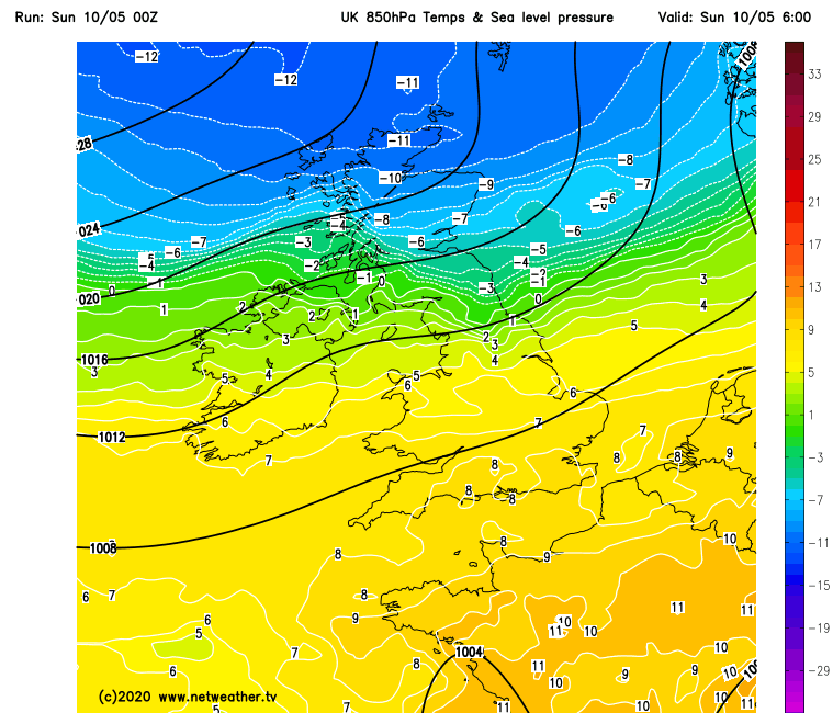
Cold arctic air sweeping south today, far south hanging onto warmth. Coming week mostly dry with high pressure in charge, cold and windy start, but slowly warming up by end of week.
It will turn markedly colder from the north through today, behind a cold front sweeping south, with this afternoon’s highs in many places a 10C or more drop in temperature compared to yesterday’s highs. The colder air is sweeping down direct from the arctic and will bring a noticeable wind chill, with wintry showers in the northeast. It will remain cold and windy on Monday and Tuesday, but as high pressure builds in from the northwest, for many it will be dry for much of the coming week, though Scotland and NE England will be exposed to showers at times, which will be wintry at first. After the cold and windy start to the week, winds will ease and it will gradually warm up towards the end of the week, but more like temperatures recovering to mid-teens rather than low to mid-twenties like recent days.
For now, a cold front bringing a band of cloud and patchy rain is slipping south across northern England at breakfast time and will clear south across England and Wales to leave cold and windier day for Scotland, northern England and N. Ireland, with sunny spells but also showers, mostly across northern and eastern Scotland, where they’ll be wintry with some snow above 100/150 metres. Winds gusting to 30-40 mph, accentuating the wind chill.
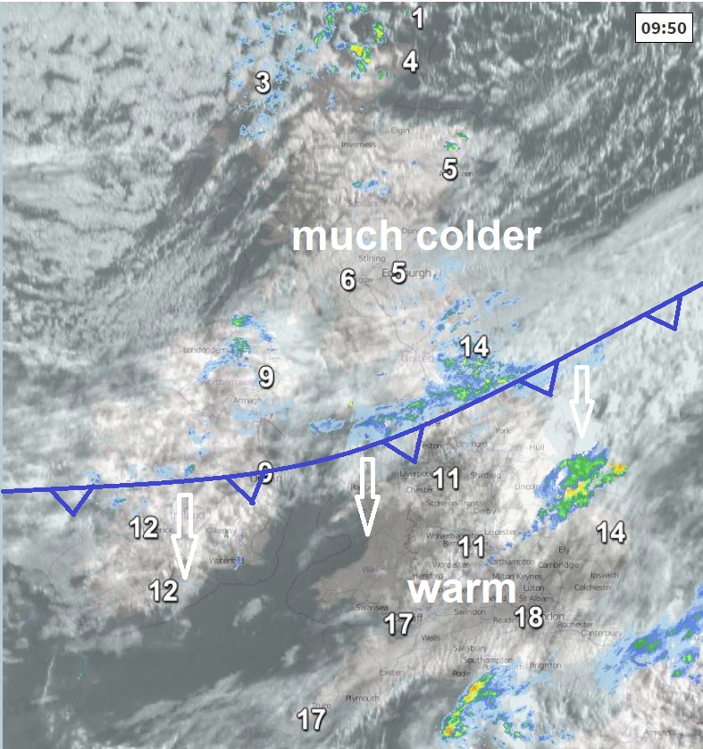
The cold front will continue to track south across England and Wales through the morning and afternoon, not much rain left on it when it reaches southern England in the evening, but will bring cloudier skies with it, followed by brighter but much colder conditions this afternoon for central Wales and the Midlands northwards. Warmth and sunny spells hanging on across the far south of Wales and southern England this morning and early afternoon ahead of the front moving down from the north, though there will be some showers across eastern England and along English Channel coasts for a time this morning. Cloud and patchy light rain arriving from the north this afternoon.
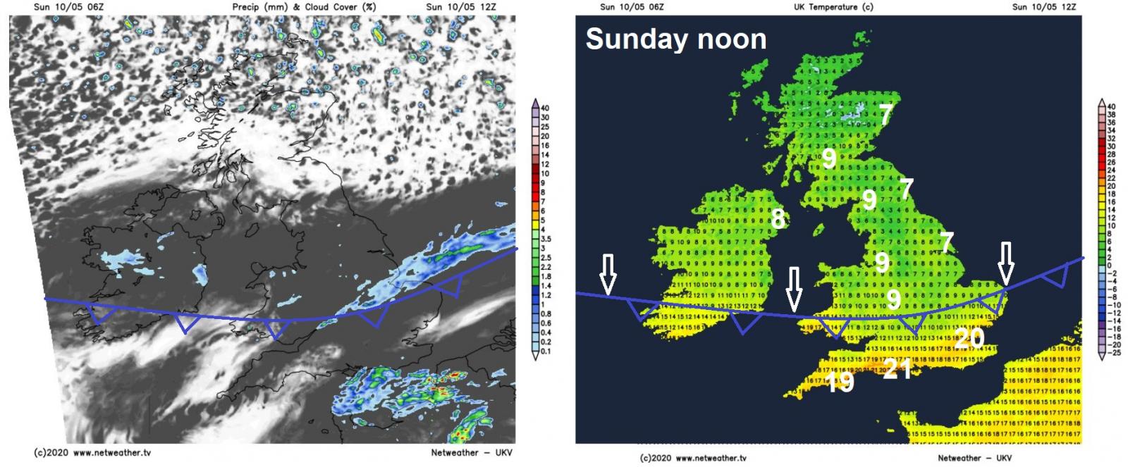
With the warmth hanging on across the far south, afternoon highs reaching 14C in Cardiff, 15C in London, 17C in Southampton, maybe 20C in Plymouth. But a big drop in temperature to the north of the cold front moving south, with afternoon highs reaching 7-9C from central Wales and the Midlands northwards, perhaps only 3-6C in the far north of Scotland and Northern Isles. A strong northeasterly wind bringing a distinct wind chill.
Cloud and patchy light rain or drizzle clearing southern England this evening, then for most a cold and windy night with clear spells but also some showers across northern and eastern Scotland and down eastern coasts of England, wintry in the north with snow over high ground. A risk of frost developing in sheltered rural areas, so gardeners may want to bring in or cover frost-sensitive plants.
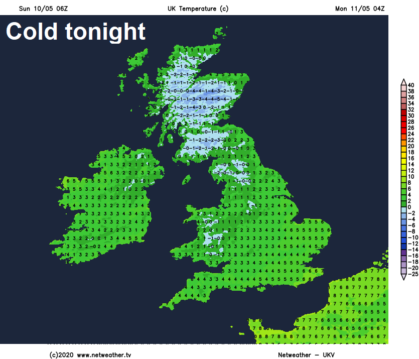
A cold and windy day on Monday, but it will be mostly dry with sunny spells and variable amounts of cloud, further showers at times across northern Scotland and eastern coastal areas of England. Afternoon highs reaching 10-12C at best, 8-9C along eastern coasts, the strong northeasterly wind making it feel more like 4-5C, 2-4C along eastern coasts exposed to the wind.
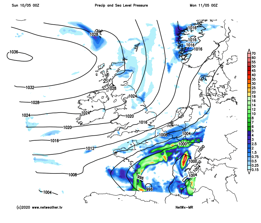
For the rest of the week it will remain predominantly dry, with high pressure centred close to the west, though occasional fronts dropping southeast across the far north will bring showers at times across Scotland and NE England. Temperature will slowly recover towards the end of the week to more normal values by day, but there will be a risk of frost at night where skies stay clear.