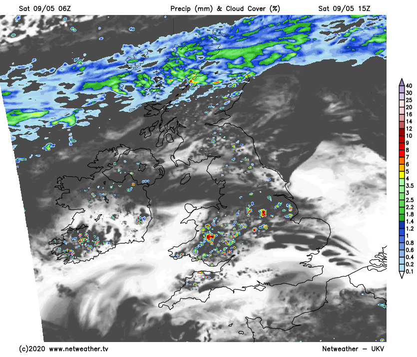
Arctic air is starting to move south into Scotland now and will spread to all parts tomorrow. So, make the most of the warm sunshine if you have it today, and keep an eye out for the risk of some sharp showers and thunderstorms this afternoon in places.
We see a major change from summer to winter this weekend as northerly winds sweep down from the Arctic overnight and tomorrow bringing a stark drop in temperature. It's already colder over the Northern Isles where together with Highland we have some rain. This'll spread South across Scotland today to reach the Central Lowlands later. Southern Scotland will be milder and brighter, but with a lot of cloud at times and the odd shower. Meanwhile across the North showers turn increasingly wintry, falling as snow on hills and at lower levels over Orkney and Shetland later.
Elsewhere in complete contrast, it'll become very warm again, once patchy cloud and mist have cleared from Northern Ireland and the North of England. The best of the sunshine will be from the Midlands southward where it'll be mainly dry, but a few locally sharp showers will develop later, over Northern Ireland and northern England.
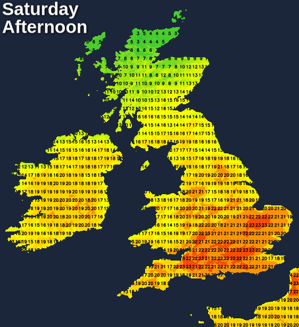
Winds generally will be light, but with a colder North Easterly spreading South over Scotland through the day. This'll lead to a huge range of temperature across the country, from only 6 or 7C in the far North to 17 or 18C over southern Scotland, with the Midlands, South and South East seeing 22 to 24C again by afternoon.
England and Wales particularly the South see another warm summery evening, but with a few sharp showers breaking out and perhaps the odd thunderstorm, but you'll be unlucky if you catch one. Across Northern Ireland and northern England, it'll be turning cloudy and cooler from the North overnight with some mostly light showers. Across the South, however, it'll stay mild and dry until morning in a mainly light breeze.
Over Scotland, a North East or northerly wind will freshen, making it feel increasingly raw. There'll continue to be scattered showers across the North and East that'll fall as snow on hills and at lower levels in the far North. Needless to say, it'll be much colder here, with clear spells in the West leading to a slight frost in places as temperatures fall to -1 to +2C. Meanwhile across southern England, the thermometer shouldn't fall below a much milder 9 to 12C.
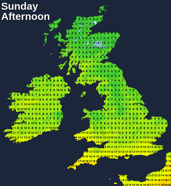
After a mild start in the South, Sunday is much colder with cloud bringing light showers in places clearing to the South in a blustery North East or North wind. This'll give gusts of 35 to 40mph along some North Sea coasts making it feel particularly raw. Here together with other parts of the East, you'll also see a few showers, that'll continue to fall as snow on northern hills and at lower levels in the far North. Elsewhere it'll become mainly dry, with the best of the sunshine in the West. Top temperatures only 4 to 8C in the North and East and 11 to 15C in the South and South West.
The East sees a few showers into the evening and after dark, but for most, it's a dry night. The blustery wind will also decrease a little, allowing clear spells to develop especially in the West. Here, in particular, there'll be the potential for a damaging frost, so gardeners beware as temperatures fall mostly to between -2 and +3C.