Warm sunshine for the next few days with a few sharp showers but what a change at the weekend! Cold winds, frost even ice and hill snow in the forecast.
Getting warmer over the next few days before a cold chill this weekend, up into the 20sC Thursday / Friday then single figures this weekend.
Clear skies overnight have brought a chilly start this morning, but high pressure is bringing a lot of settled fine weather to the UK. It’s a full moon tonight, a super moon as the moon is on a closer part of its orbit around the earth, Perigee. Venus is still bright in the night sky and in the early morning, Jupiter is visible to the naked eye too.
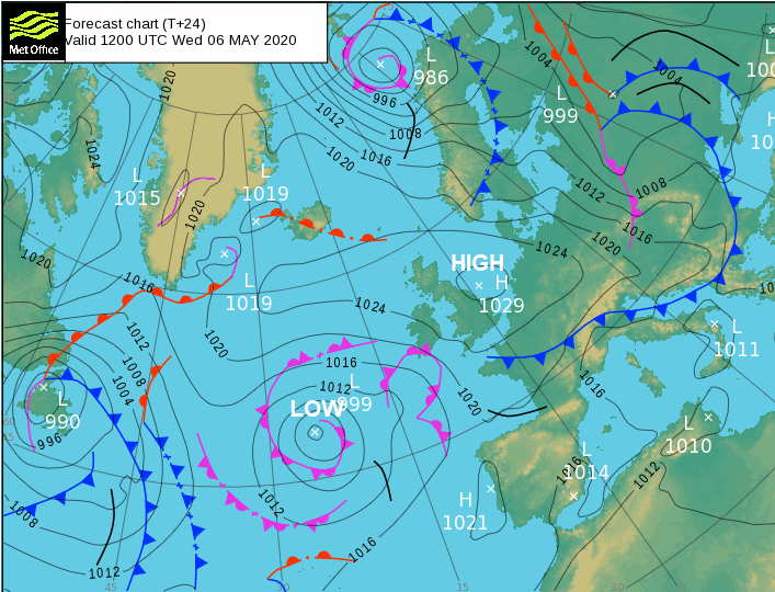
There is a little mist and fog about this morning, frost too as temperatures in northern Britain and Northern Ireland have dipped below zero for some spots inland. High pressure is over the UK today but low pressure out in the Atlantic is lurking and will affect western areas tomorrow.
Today
Much of the UK has clear skies and sunshine. There is a little low cloud in the Thames estuary this morning, some over Lincolnshire and for SW England, linked to that low there is more cloud and murk, even dampness for Cornwall. But brightening up and Wednesday will be a fine day, feeling warmer than yesterday for many. The winds will be light for Scotland, northern England and north Wales. A light easterly for the rest of England and Wales although a moderate SE wind for Cornwall and a nip in the air around the Thames Estuary making it feel cooler for north Kent and Southend. County Down will also have a moderate SE wind.
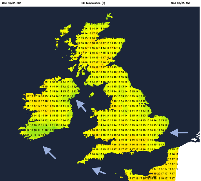
Temperatures today for Northern Ireland will be 14 to 17C. For Scotland, 13 for far SW but 21C possible for Grampian inland. Wales in the high teens with warm sunshine. Mid to high teens for England but again cool along North Sea coasts.
Tonight, eastern Britain will be clear and cold with a touch of frost. Further west there will be more cloud, keeping the temperatures up.
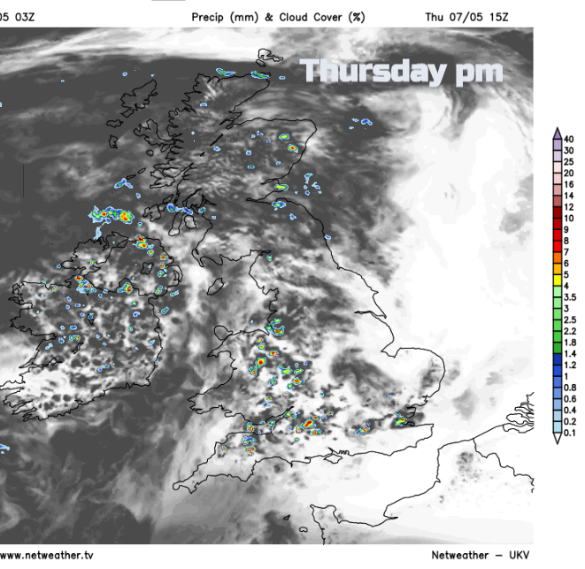
By Thursday morning there will be more cloud over Northern Ireland, western Wales and SW England with a few showers. BY the afternoon there will be some hefty showers even thunder but still well scattered with the risk extending inland over more of Wales, the Midlands and also Scotland. A shift in the wind direction, more southerly for most, a westerly into Scotland and it will feel warmer, up into high teens even low twenties.,
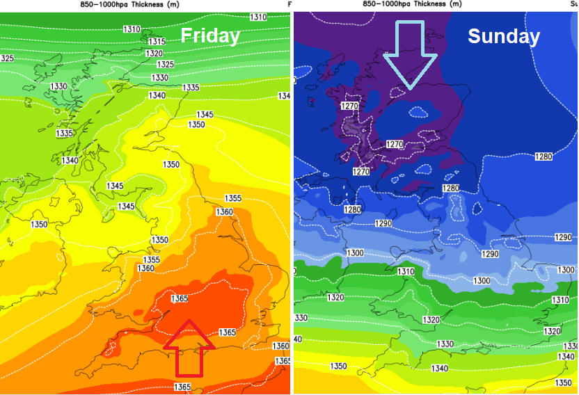
By Friday warmer air will be flowing up from the south, with mid 20sC forecast for London. There will be weather fronts over Scotland with more cloud and showery rain so cooler in the north. Also, the risk of some sharp showers developing in the warm air over central Wales and the Midlands, into East Anglia. Again, these could be thundery. With light winds and sunshine, it will be a fine day for many.
Weekend
By Saturday morning the frontal band in the far north will be a more distinct feature, a cold front that means business. Ahead of this, it will still be warm and sunny but with scattered showers. A cold north to NE wind will move in as the rain band moves southwards over Scotland during the day. By the evening much colder air will be pulling into the far north with snow for the tops of the Scottish mountains and wintry flurries possible by early Sunday for NE Britain, over the Pennines and north coast of Northern Ireland. A widespread frost inland for Scotland with an ice risk as the cold winds reach more of the northern half of the UK. Meanwhile, as the cold, wintry frontal band affects northern areas, there will be a line of heavy, thundery showers lurking over northern France and the English Channel by Saturday evening. This could bring some hefty downpours to the south coast of England.
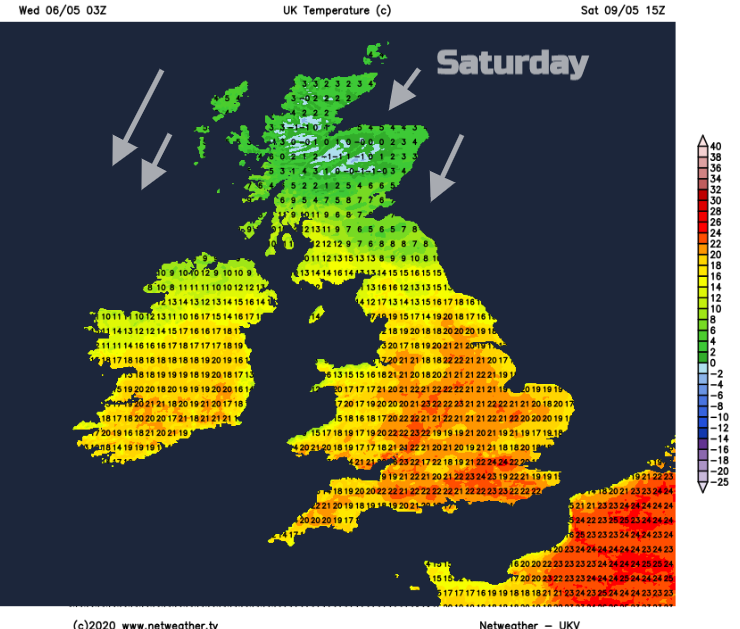
By Sunday morning these two areas of unsettled weather look to combine over southern or Southeast England. As the last of the warm air is pushed away, it will be a miserable morning with cold fresh NE winds, rain and cloud. What a difference. Rain, sleet and hill snow showers coming down in the cold flow for northern and eastern Scotland, particularly Grampian and also for NE England. Stays cold into next week.