
Temperatures will be rising over the next few days, into the 20sC but a change at the weekend with next week looking colder with frost, even snow showers for the hills.
Low pressure is lurking in the Bay of Biscay and another one away to the SW of the UK in the Atlantic. These have been bringing strong winds to SW England overnight, with a yellow wind warning from the UK Met Office and an Orange gale warning for the Channel Islands with an easterly wind gusting to 50 knots.
.png)
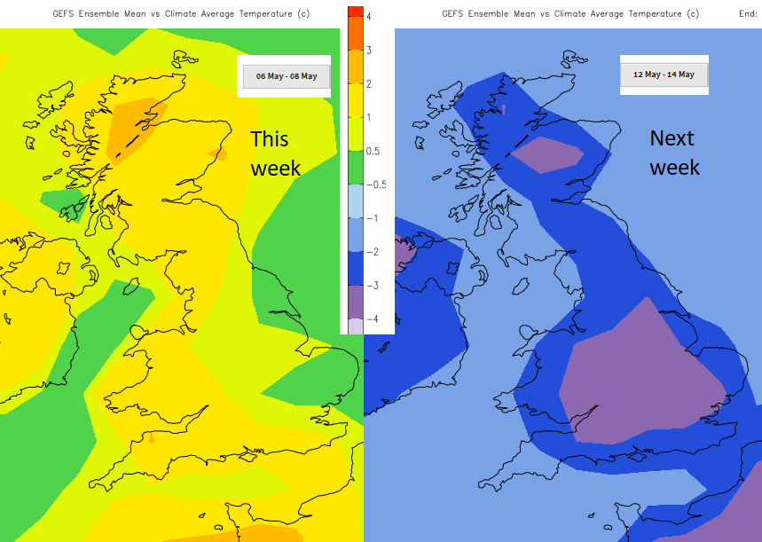
However High pressure centred near to Aberdeen will stay over the North Sea for the next few days and bring a lot of settled fine weather to the UK as temperatures begin to rise. 24C is forecast for London by Friday as this week warms up. However, during the weekend colder air will move in from the north and next week starting on Sunday looks chilly. Quite a change on the way.
The rain over SW Britain and through the Channel will ease by lunchtime and slowly fade this afternoon, always with more cloud for the SW and dampness. For the rest of the UK, it is a fair, dry day with sunshine but a cool breeze. Temperatures along the North Sea coast will only be 10 or 11C, for much of the UK just in the mid-teens today.
Tonight, cool again. Light easterly winds for southern Britain, almost calm for northern Britain with the risk of frost. Gardeners take note especially for southern Scotland, northern England into the Midlands.
Wednesday- for most Wednesday will be a fine, sunny day, slightly warmer with temperatures in the mid to high teens with lighter winds. There will still be a few showers for Cornwall with a moderate then fresh east veering SE wind so feeling cool here.
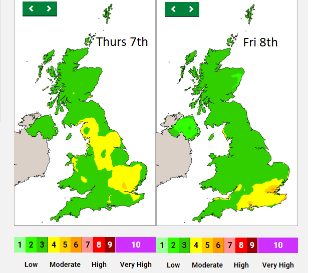
Pollen – moderate levels of tree pollen this week in the sunshine.
Air pollution. Moderate levels of air pollution, even if the NOx levels have reduced in lockdown with less traffic about. “Southern England and Wales, with the central belt of Scotland on Wednesday and more widespread for England by Thursday, increasingly confined to SE England by Friday, locally High possible for Kent coast. “DEFRA. Particulate and Ozone levels remain an issue.
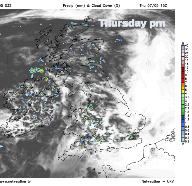
Under the high pressure, much of Britain continues to have settled, dry weather. The slowly descending air begins to stagnate with airflow drawing in from the continent as well. Around the High, to the west, there will be more cloud and some rain by Thursday. Showery outbreaks for Northern Ireland, western Scotland, Wales, SW England, later into NW England. Some of these showers could be heavy. For the rest of Britain there will be a quiet day, with some early mist or fog and then it will be fine and warmer as temperatures move into the high teens and low twenties Celsius. And a milder night.
By Friday the high will have slipped over southern Britain. Southerly flow for England but a westerly for Scotland. SE England will see temperatures in the low to mid 20sC, the peak of this week’s warmth but it will feel cooler for NW Scotland with a breeze off the sea. Birmingham 22C, Manchester 21C, Newcastle 20C, Norwich 22C. There will be warm sunshine but it’s not a completely dry picture. Again, there will be areas of cloud with showers.
By the weekend, a colder Arctic flow will be making its way towards Scotland. It will be noticeable by Saturday morning with lower temperatures for eastern Scotland and NE England with a brisk wind off the sea. Southern Britain will have another warm day, into the low twenties before a frontal band of cloud and patchy rain works its way southwards. By Saturday evening there will be a brisk wind making everywhere feel cooler. During Saturday night colder air moves down over Scotland with a frost and snow showers for the Scottish mountains, into the Pennines by Sunday morning. Another band of rain and cloud will be lurking over northern France into the Channel which could push northwards bringing rain to southern Britain by Sunday but the cold flow from the north may keep that at bay.
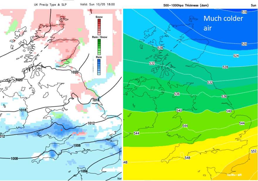
Sunday looks cloudy, will feel cold and damp with a chilly wind and temperatures in the low to mid-teens if this cold plunge manages to reach down to southern areas.
Into Monday there could be a few more wintry flurries for the north and east as showers appear in the cold flow. There will be more widespread frost and the lower temperatures remain into next week. That’s May for you, unreliable.
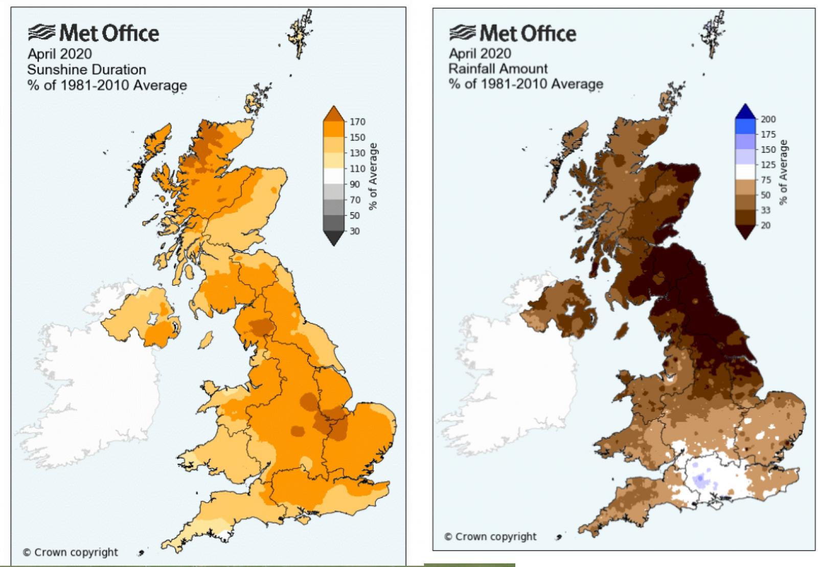
April 2020 was the sunniest on record for the UK. It was also very warm and very dry, just the last week seeing rain.


