Showers for northern and eastern areas this weekend, drier elsewhere. Apart from a wet blip on Tuesday in the south, much of next week dry and sunny as high pressure regains control.
The weather has been a bit unsettled over the last few days, with showers affecting many areas. Over the weekend, we will see fewer showers across southern and western areas, and feeling a bit warmer in the sunny spells with lighter winds. However, there will still be a risk of showers across northern and eastern areas. As we head through next week, there will be a battle between low pressure to the southwest and high pressure centred close to the northeast. Low pressure will win out across the far south for a time, bringing some heavy rain on Tuesday, but high pressure will build back in for the rest of the week, with most places staying dry and bright or sunny.
For now, clearing skies overnight means it was a chilly start earlier, but with many places dry and sunny this morning, it is warming up in the late Spring sunshine. The exception to the dry and sunny picture this morning is across northern Scotland – where it’s cloudier and there will be some scattered showers. As we head through the afternoon, most places will stay dry and bright, but showers will continue across NE Scotland while breeze convergence along eastern Scotland and NE England will allow showers to develop here this afternoon too, some on the heavy side. With lighter winds today, it will feel warmer than the last few days in the sunshine, highs this afternoon reaching 14-18C, chillier across northern Scotland and along North Sea coasts of Scotland and NE England , where temperatures will be pegged back to 9-12C.
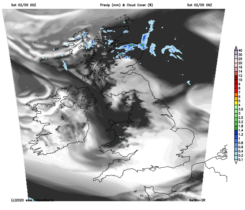
Any showers across the northeast will ease and die out, to leave a largely dry night with clear spells across Britain, though a few showers may continue across the north of Scotland, while cloudier skies spilling north across southern Britain may thicken to bring some patchy rain across SW England in the early hours.
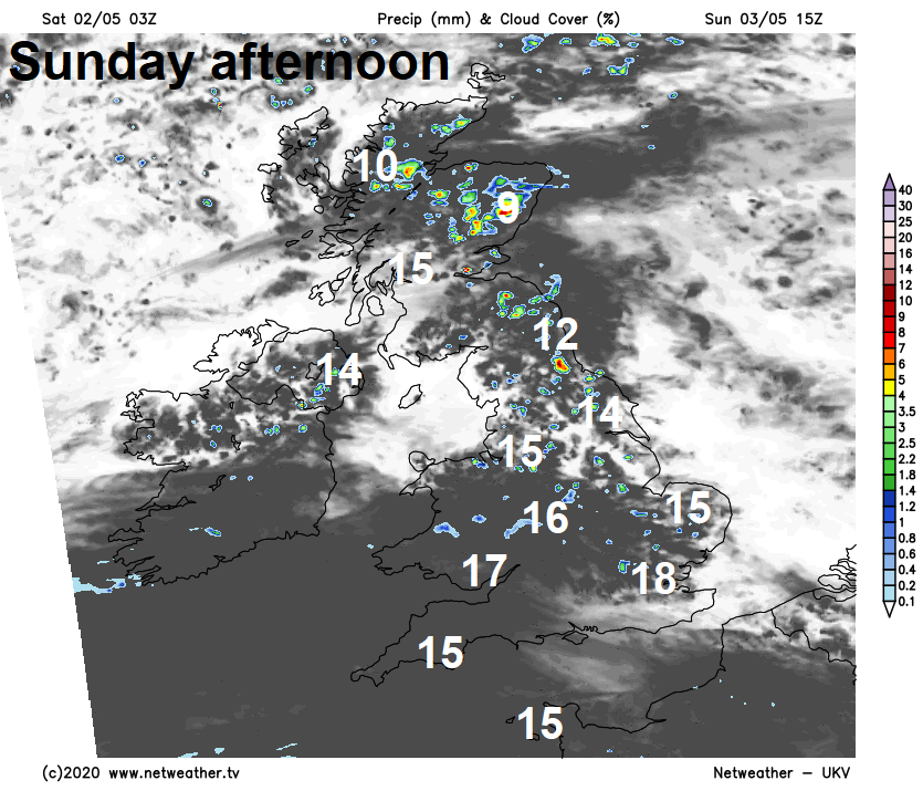
A cloudier day across southern England and south Wales on Sunday, with some patchy light rain or drizzle in the far southwest. Sunnier further north, but with scattered slow-moving showers developing across northern and eastern England along with eastern Scotland, some showers on the heavy side. Temperatures reaching 15-18C generally, cooler near eastern coasts and across the north of Scotland.
High pressure will build in from the north on Monday, bringing a largely dry day with sunny spells, though a few showers are likely across northern and eastern England, especially in the morning. Temperatures ranging between 11C in Edinburgh to 17C in London.
Tuesday will likely see a frontal system with outbreaks of heavy rain try to push in across the south against high pressure establishing across the north. Some uncertainty how far north and east the rain will get for now, certainly SW England and south Wales turning wet, perhaps further east towards SE England too. But further north another mostly dry and sunny day.
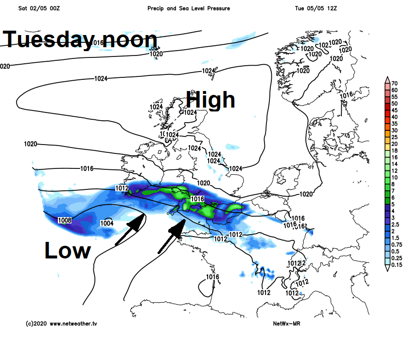
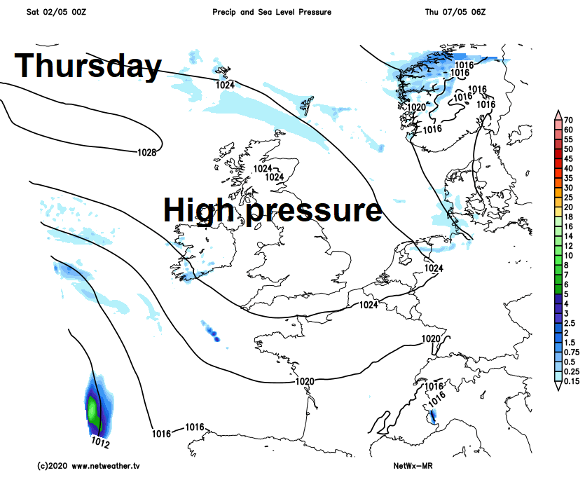
Cloud and rain easing back to the near continent by Wednesday, with high pressure close to or over the UK dominating the weather for the rest of the week, so Wednesday and Thursday mostly dry and fine with sunny spells, warmer too with light winds. Most looking dry on Friday too, but we may see showers arrive in the west as high pressure begins to retreat, but some uncertainty on this.