


Low pressures are lining up to bring unsettled weather and rain to parts of the UK. It will be cooler, blustery at times with frontal rain or hefty showers this week.
A different outlook for the last week of April. It will be cooler and there is rain in the forecast, a fair bit for Wales and parts of England over the next few days, moving up to Northern Ireland and then Scotland later in the week.
Recently it has been very settled, warm and dry for weeks. High pressure over Scandinavia has steadied our UK weather with the jet split well away to the north and far south in Europe bringing low pressures through the Mediterranean.
There is a high pressure over Iceland today and tomorrow which will bring cooler air down from the north to the UK until the low pressure moves in on Wednesday. Some parts of the UK haven’t had air temperatures above 12C anyway in weeks, but the glorious sunshine has been cheery. This week temperatures will be in the teens, settling to the mid-teens and away from the low 20sC and 24C of last Thursday. There is more moisture in the air, unstable conditions and so more scope for convection. When the high was nearby there was slowly descending air, now we have some lift in the atmosphere and so there will be showers as well as frontal bands of heavier rain.
Good news for the gardens after such a lengthy dry spell.
We start today with one low pressure over southern Norway and its cold front bringing more cloud to England and Wales with patchy rain, you can see that over North Yorkshire out in the North Sea. There are clear skies to start the day over SE England up to Norwich and some gaps in the frontal cloud too. Behind the front is a distinct change to clear skies with sunshine and a cooler feel. Northern Ireland has seen temperatures dip below zero with frost and mist
Swinging into northern Scotland is more cloud and showers swinging around the low, a little snow for the mountain tops, in that cooler air with a few showers reaching the north coast of Northern Ireland. There is not much movement today. The cold front edges southwards with patchy light rain extending to mid-Wales the Midlands and into Lincolnshire by this afternoon still with a lot of cloud.
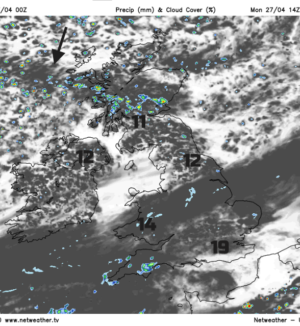
There will be some infill of Cumulus cloud today with a scattering of showers over Scotland and Northern Ireland and a few for northern England this afternoon. The winds are very light, just a moderate NE wind for the Scottish Islands. To the north of the cold front temperatures will be 9 to 12C, to the south in the sunshine, London could see 19C but for many, it will be mid to high teens and cooler in any patchy rain.
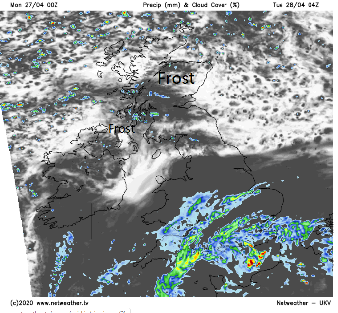
Tonight a low pressure which has been over the Bay of Biscay nips over northern France and will bring rain to southern Britain where it remains mild. The rain will become heavy in places. Further north it will be clear and colder with a touch of frost and still a few showers.,
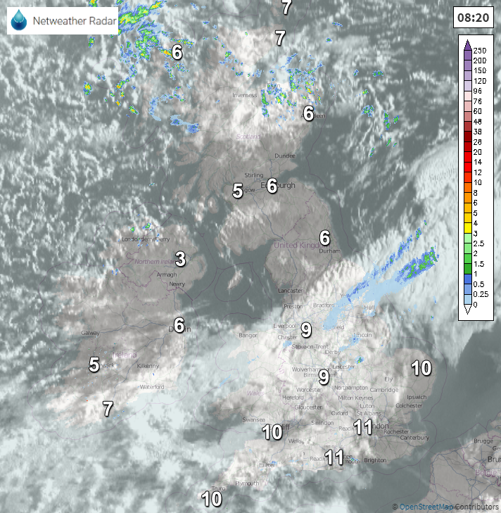
By Tuesday morning there will be proper rain over southern Britain, starting over southern England and then spreading through Wales and central England into East Anglia. The forecast at the moment sees Cornwall and Devon miss most of the rain as the low pivots around. Synoptically it is quite a messy picture so there maybe a few changes to this rainfall totals picture.
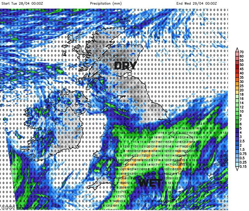
Even so, this will be the first decent rain that many places have seen in ages. Water butts and gardens can take in the water, the fields and dusty paths. Although it won’t offset what has been a very dry April. Temperatures on Tuesday under the rain will be around 11 or 12C, so much cooler for SE England than today. Further north there will be bright spells and still a few showers, the best of the sunshine for northern Scotland. Light winds but we are back to the easterly flow so cool for North Sea coasts and temperatures of 9 to 13C. Quite a change, find your jumper or coat. The rain turns more showery and drifts northeast, clipping NW England and pulling away from the Wash in the east to NE breeze on Tuesday night. A hint of wintriness over the tops of the Pennines as it clears in this colder air.
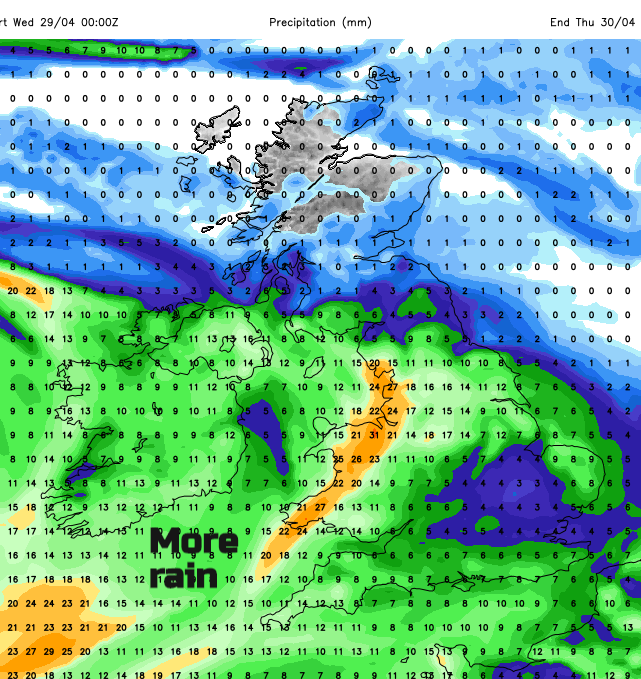
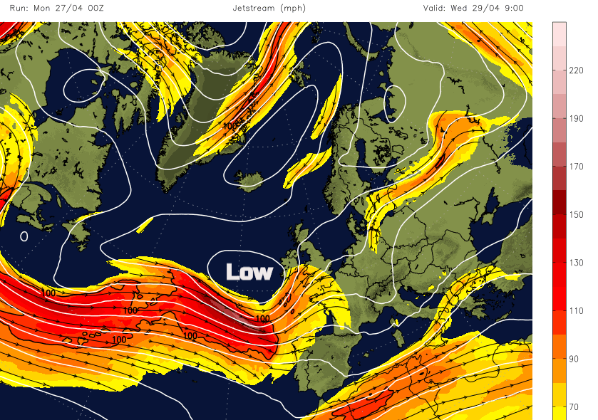
Next is the larger Atlantic low which is set to bring heavier bands of rain from the SW for the start of Wednesday. As this low moves over the UK through Wednesday and Thursday, there will be heavy and thundery downpours as frontal bands swing around the low and the weather turns much more unsettled. Don’t take hourly forecasts for midweek at face value, the timings will change as showery bands come and go. The winds also freshen around the low particularly along the English Channel and Bristol Channel. Quite a change this week.


