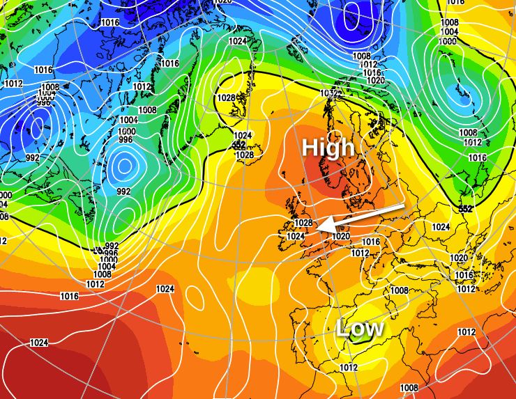
With a large anticyclone over Norway dominating for much of this week, it's going to continue fine and dry.
With a large anticyclone over Norway dominating for much of this week, it's going to continue fine and dry. Several places have already exceeded their average amount of sunshine for April, and with more to come in the next few days, this'll certainly help to cheers things up a little in these particularly challenging times.
The far South West, Isles of Scilly and the Channel Islands have cloud and a few showers at the moment, but this'll move away through the morning. There's also some patchy cloud over East Scotland and eastern slopes of the Pennines, but this'll quickly disperse to leave for most another day of crystal clear blue skies. After a chilly start with a touch of frost in some Scottish glens, it'll become warm in the West, where the sunshine will lift temperatures to about 21 or 22C in sheltered spots around Cardigan Bay and across the West Country.
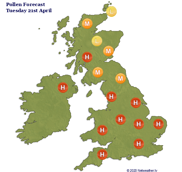
There'll be a high pollen count for many regions today and throughout this week. Check your local pollen forecast here.
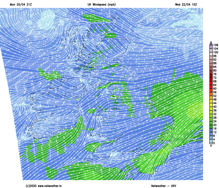
Meanwhile in the East, 17 to 19C is more likely due to a nagging and blustery East or North-East wind. This'll feel a little chilly out of the sun giving gusts to around 30 to 35mph in exposed areas and will be most felt along the beaches of the North Sea, where temperatures will struggle to get above 11 to 13C.
After a sunny early evening, the North East wind will decrease a little after dark. It'll turn chilly under mostly clear skies although later in the night, a few patches of low cloud may drift off the North Sea into some central and eastern areas. It may turn cold enough again for a touch of frost in sheltered Scottish glens, but this shouldn't be an issue, with temperatures generally not falling below 4 to 7C despite a cold wind. Clear skies will mean a chance to see the Lyrid Meteors tonight.
Tomorrow looks like being another day of wall to wall sunshine for most after a chilly start. Many central and western areas become warm again, with afternoon temperatures in the range 20 to 22C Some eastern regions however may see patchy cloud to begin with, but any should soon burn off. A North Easterly wind shouldn't be quite so boisterous either, allowing temperatures to reach 18 or 19C inland but along North Sea coasts, only 12 to 14C where it'll continue to feel quite chilly in the wind.
Another sunny early evening follows in most parts, and it continues dry after dark with the North East wind decreasing to become mostly light. This could allow it to turn misty in places later in the night when patchy quite low cloud could return to some eastern areas. While a touch of frost is still possible chiefly over sheltered western parts of Scotland, temperatures generally shouldn't fall below 4 to 8C.
Thursday should be the warmest day of the week, as we see more sunshine in lighter breezes. By Friday though it's may begin to turn cooler and more cloudy, with perhaps a few showers around by the weekend giving much-needed rain in what is fast becoming a drought situation.