High pressure is well in charge of the UK's weather now and will stay that way through much of the upcoming week. It'll be positioned to our northeast for a few days, so we're going to have to get used to fresh easterly winds being a feature. Later in the week, they should ease though.
High pressure is well in charge of the UK's weather now and will stay that way through much of the upcoming week. It'll be positioned to our northeast for a few days, so we're going to have to get used to fresh easterly winds being a feature. Later in the week, they should ease though.
As you may expect with easterly winds, the east coast of the country will feel the chill, with western and central regions enjoying a bit more shelter and the warmer temperatures. Today, there shouldn't be as much cloud coming inland from the North Sea, but that will start to change from Tuesday. The cloudiest region today will be the far south and southwest of the country - a hangover from yesterday's rain, and in the southwest, there's the outside chance of a shower or two.
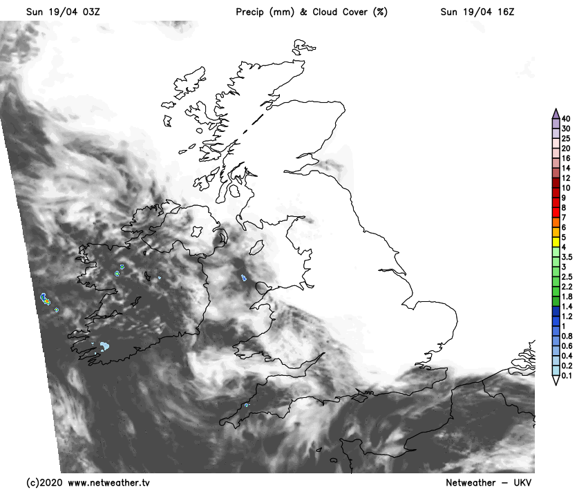
Temperatures today will rise into the mid-teens away from the east, where it'll be a struggle to get to 10-12c with the wind making it feel a few degrees colder than that. Overnight tonight, with often clear skies, it'll cool down quickly with a touch of ground frost in places.
Into Monday, the wind will be noticeably fresher, making it feel even colder down that east coast. Like today though, most parts will be sunny. But with low pressure not so far away, the southwest is likely to see more in the way of cloud with the potential for the odd isolated shower. Temperatures won't be too dissimilar to Sunday's values, but that wind will knock the edge off of them just about everywhere, with the east coast feeling more like 4-7c.
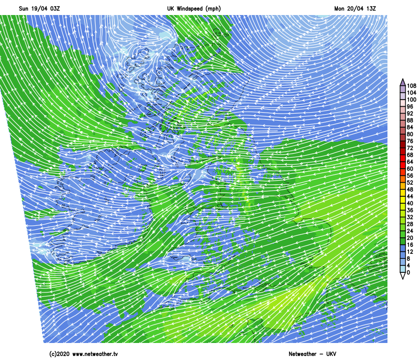
Another chilly night follows, then into Tuesday the winds will start as they were on Monday but should begin to ease down during the day. At the same time, though, we'll begin to see more in the way of cloud drifting in off the North Sea.
Overnight and into Wednesday morning the cloud and murk is likely to become quite widespread across the northern half of the country - especially in eastern and central parts. It'll take a short while to burn off, but once it does most of the country will see plenty of sunshine. Close to east coasts, especially in northern England and Scotland, it could be another tale, with cloud, mist and haar never too far away.
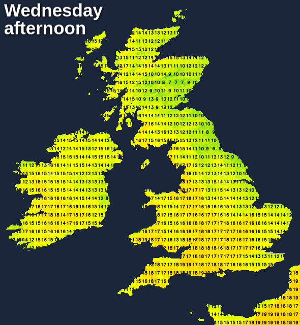
In the sunnier spots, temperatures will be up a notch with the high-teens, maybe even low-twenties likely to be reached in western and central parts - some 10c or so warmer than eastern coastal counties.
Thursday and Friday will start grey for many again, but away from those prone eastern coastal counties, the cloud should burn off. By this point too, winds will be much lighter, allowing temperatures to climb a touch higher again, with highs more widely troubling 20-21c or so. What we will need to look out for by this stage though, is the risk of some showers, perhaps also thunderstorms breaking out in the south and maybe especially the southwest of the country as pressure begins to fall.