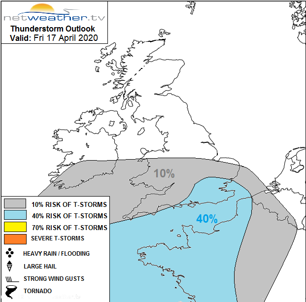
High pressure is keeping the weather dry across the northern half of the UK but thundery rain will affect southern and central regions today and into the weekend.
The current weather pattern seems to be set until at least the end of the month, with winds mostly between East and North. This'll keep Scotland and the North mainly dry, where a drought situation is developing. Further South though there'll be showers today and tomorrow, but how far North the showers come is somewhat of a forecasting headache.
Patchy cloud over Scotland, Northern Ireland and the North of England mostly in the East, will break to leave lots of sunshine, particularly in the West. But towards Lothian and The Borders and across parts of North East England the cloud may be more persistent. This together with a North Easterly breeze will keep it fresh, even quite cold along North Sea coasts.
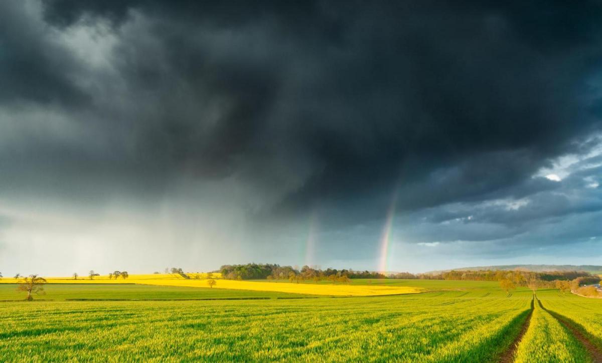
From Wales and the Midlands southward there'll be more cloud than recently, but with some hazy sunshine. We have already seen showers some of them heavy and thundery across the Channel Islands and South of the M4. Others will move in from the South during the afternoon probably getting as far North as South Wales and the South Midlands. Some of the showers will be heavy with the odd thunderstorms thrown in, but such is the nature of showers that not everywhere will see them.
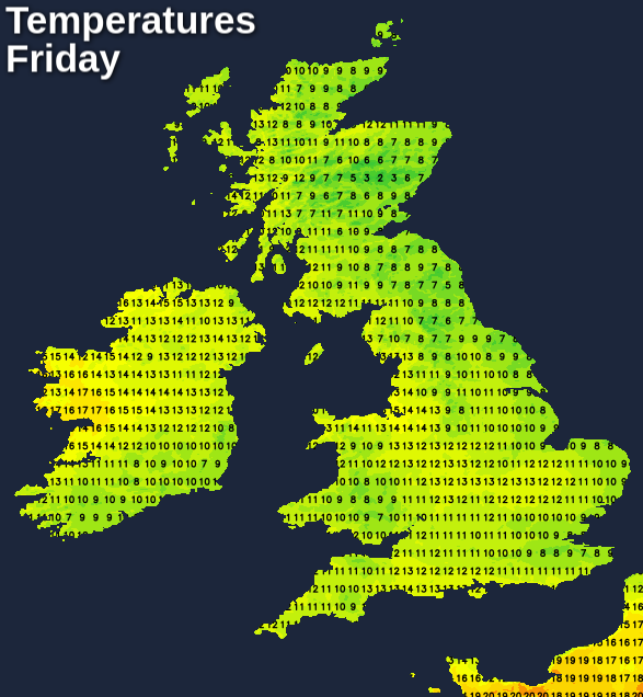
Although becoming pleasant in the West, it'll feel somewhat chilly in the wind across the North. Top temperatures will be in the range 14 to 17C, but along North coasts, you'll struggle to get much above 9C. Across the South 15 to 18C in the brighter spots will be 'nearer the mark', with an East wind keeping eastern areas cooler.
After dark Wales mostly the South, the Midlands and the South remain subject to showers. Some will be heavy giving thunder, but they'll continue to be 'hit and miss'. North Sea coasts turn misty with patchy low cloud returning by morning on an East wind, but temperatures in the South shouldn't fall below 6 to 90C Further North it stays dry with clear spells mostly in the West. Temperatures drop to between 1 and 4C giving a touch of frost in places, while some sheltered Highland glens could fall as low as -4C again. Eastern areas see mist and patches of low cloud returning later in the night.
Saturday sees a North/South split, with the North remaining dry. Here there'll be sunny spells particularly across Northern Ireland and in the West, while eastern parts continue to see patchy cloud. From Wales and the Midlands southward there'll be more cloud, but with sunny intervals particularly later. Wales and South, in particular, will still subject to locally sharp showers, but again not everywhere will see them. An East or North-East wind keep it cooler along North Sea coasts where temperatures get no higher than 8 to 10C, but most parts reach 13 to 16C with the bulk of the warmth in the sunnier West.
By the evening the showers should be clearing, but it'll feel colder in the South, as chillier spreads from the North. Sheltered western areas have a touch of frost again with some Scottish glens falling as low as -5C, but 1 to 4C will be a more general minimum. In far the South and South-West; however, the thermometer probably won't fall below 6 to 9C.