More warmth today for England and Wales, especially in the south - but colder temperatures are on the way from the north. There will also be some sharp, thundery showers developing through the day.
After another very warm day over much of England and Wales, it'll be turning much colder from the North later and overnight with a drop in temperature of more than 10C in places by tomorrow. We will then all notice the chill, but it's only a temporary blip in what has been a particularly warm, very dry April so far over England and Wales. By mid-week, it'll be finer and turning warmer again with lots of sunshine, but after a couple of frosty nights. So growers and gardeners beware!
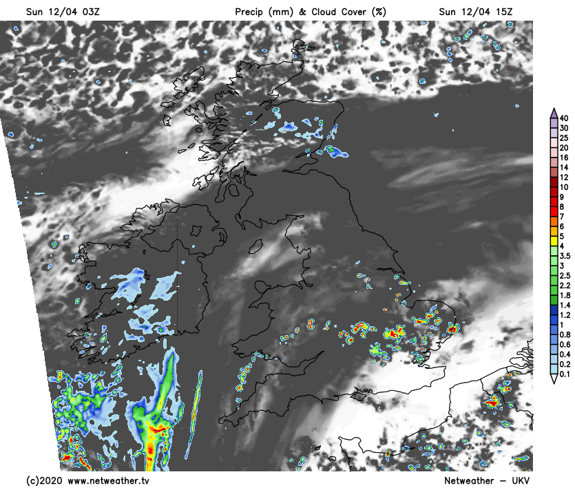
Apart from the odd shower, for England and Wales, it's a fine start, with sunshine albeit hazy in places soon bringing warmth. By the afternoon temperatures of 21 to 25C again will be enough to trigger some heavy showers and thunderstorms. These will be mostly over Wales, the Midlands, parts of northern England and later across the South, but they will be hit and miss with some parts staying dry. Winds generally will be light, with colder northerlies over the far North of England later bringing a marked drop in temperature.
Much of Scotland is also beginning fine, but showers in the North work there way South followed by winds of Arctic origin that'll bring a sudden drop in temperature to between 7 and 10C. Cold northerly winds will also spread to Northern Ireland after some showers here this morning. In the far North scattered showers may turn wintry on hills later, where temperatures will be no higher than 4 to 6C.
It'll be another summery evening across parts of the South, but with showers around and a few thunderstorms at first, giving local heavy downpours. These will fade before it turns cloudy from the North during the night followed by much cooler weather that should have reached all but the far South by morning. Here though temperatures shouldn't fall below 6 to 9C.
Wales and the Midlands may also see heavy showers and a few storms into the evening before the showers fade as it turns much colder and cloudy from the North. Across the North of England, Scotland and Northern Ireland skies will break after dark with clear spells in the West leading to a frost as temperatures fall close to freezing in the coldest spots, although 2 to 4C will be a more general minimum. In the East, however, a fresh and blustery North East or northerly wind will bring cloud and a few light showers chiefly towards North Sea coast but here you'll escape a frost.
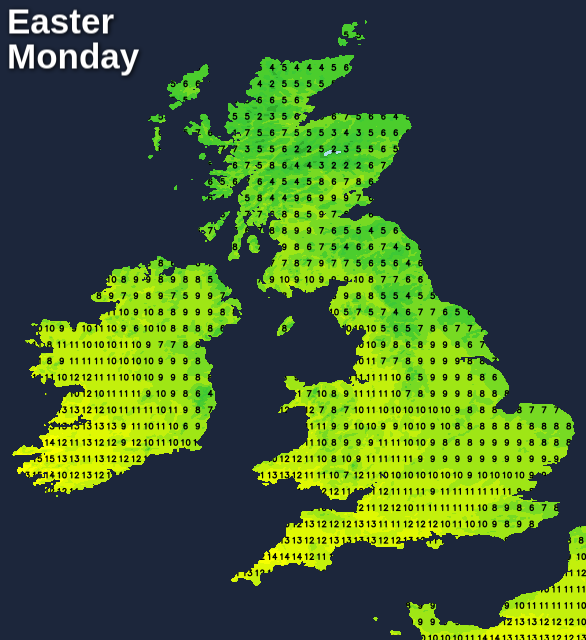
After a few showers in the South at first on Easter Monday, most parts are dry but much colder. The best of the sunshine will be over Scotland, Northern Ireland and in the West, with eastern areas continuing to see more cloud and a few coastal light showers. It'll feel raw in a North East or North wind that'll be blustery in the East and South, with top temperatures only 12 to 14C in the West and 7 to 11C further East.
A cold evening will be followed by clearing skies after dark. As winds fall light, this'll lead to a widespread frost, with temperatures perhaps falling as low as -5 or -6C in some sheltered Scottish glens. A few mist or fog patches may also form towards dawn, but these will be short-lived.