


UK weather- an intense, dominating high to our right is bringing cold air down over the UK. A lot of fair, bright weather this week, sometimes windy but a shift for next week.
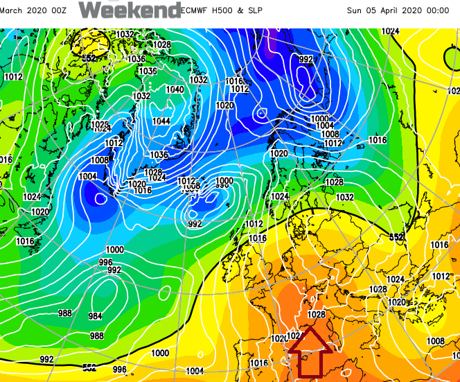
Another intense high pressure has developed this weekend, reaching 1055hPa in the northern Atlantic with 1051.2hPa being recorded on South Uist, Western Isles on Sunday. This broke the record for the highest March surface pressure reading in the UK. It doesn’t mean much for our actual weather, high pressure can bring settled, steady conditions within the anticyclone but as we are to the east of it, there have been brisk cold winds from a more northerly direction.
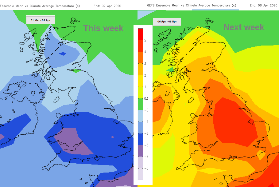
High pressures tend to stick around and the flow for the UK stays cool into April. We are now in British Summertime (hope you changed your clocks) and the sunshine is feeling strong in sheltered spots but there will be a nip in the air, a definite chill after dark and the risk of frost remains.
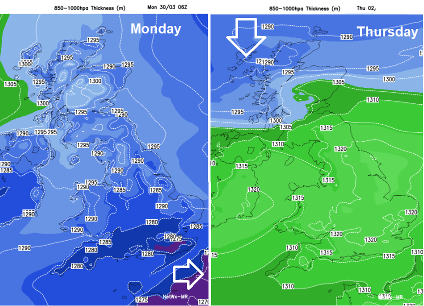
Over the next few days, the high shifts westwards as low pressures skirt over the north past Iceland to Scandinavia and after mid-week a cold front from one of these will push down from the north over the UK.
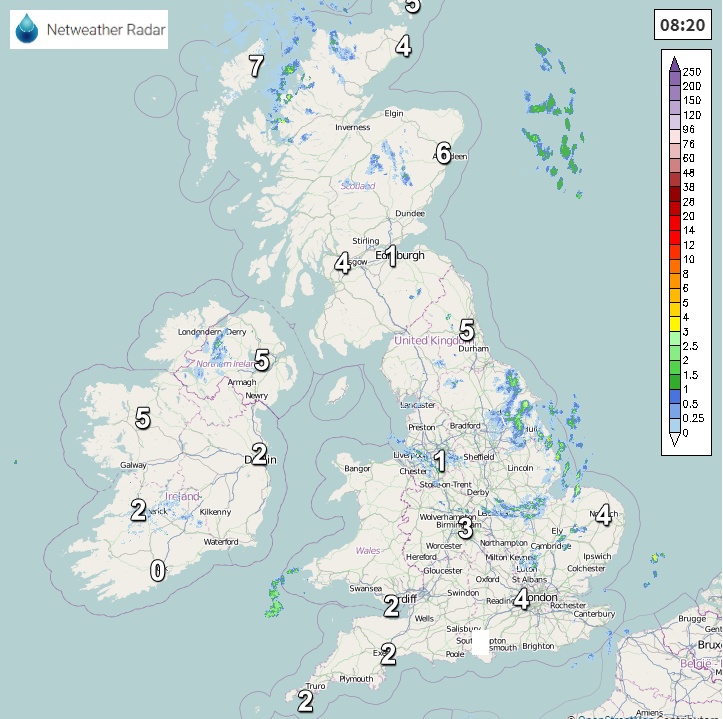
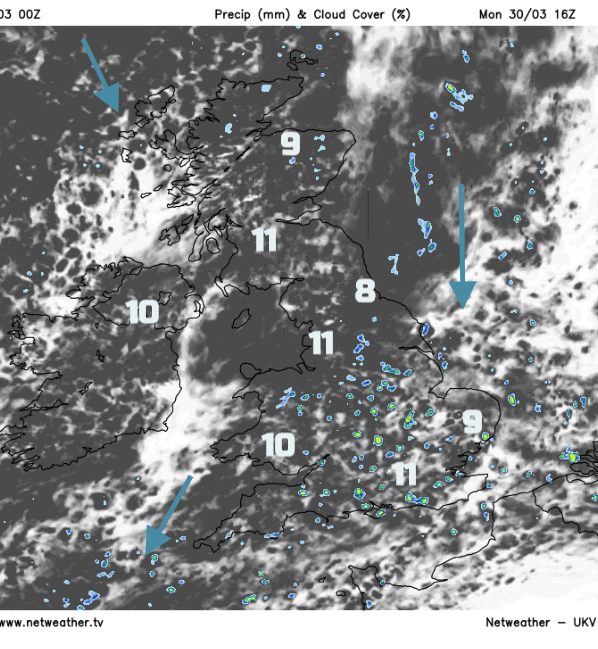
There were a few flurries at the weekend, even down as far as Kent. Snowflakes briefly whirling past, sleet, rain and hail. That very cold air has shifted eastwards and it will only be the highlands of Scotland where there will be a few snow showers. Otherwise, there will still be a few rain showers today coming in from the east. You can see those on the Netweather Radar
This morning, quite a crop over North Yorkshire down to The Wash moving south in the cold north wind. Temperatures today will vary from 7 to 11C with most of the showers for SE Britain.
Tonight, there will be variable amounts of cloud and a few spots, mainly for inland Scotland, just down below zero. The winds will be light. By Tuesday there will be a brisk NE/E wind for southern England in the morning but that eases and overall it won’t feel as cold as it has done by the afternoon as temperatures rise to 9 or 10. Most places stay fair and bright although the moderate NW wind will bring a few rain showers to the far north of Scotland.
By Wednesday there will be a strong west wind for N. Scotland, freshening across the rest of Scotland in the morning. England and Wales will be calmer with sunny spells and see temperatures into double figures. Northern Ireland will be cloudy but not too windy. The cold front will bring patchy rain for the far north and more cloud.
Thursday will be colder with wintry showers over Scotland, maybe reaching other northern hills. All but southern England will be windy, with gales for northern Scotland as the low moves past. So, another cold, windy blast, with a more widespread frost as the weather settles again on Friday as the high moves over us.
By next weekend a more southerly flow looks possible so it could feel more like last week, briefly in the sunshine. Some warmth as we stay at home.


