Glorious weekend for many but next weekend looks much colder with frost and ice, even wintry showers. Before that, there is more fair weather and March sunshine but heavy rain for far NW.
Well, what a weekend! Blue skies and sunshine for a good part of the UK, warm March sunshine out of the breeze. The first decent weekend for many and we were staying at home. There aren’t any signs of real warmth or heat for the rest of the month. A southerly flow will lift the temperatures into the mid-teens at times this week and with the strengthening sunshine that will feel pleasant. But overall, there is a cold theme to the weather for the rest of March, chilly nights and always a slight nip to the air especially in the shade or breeze. Next weekend looks decidedly cold with wintry showers from the north. That’s not you getting snowed in, it's flurries and snow on the hills.
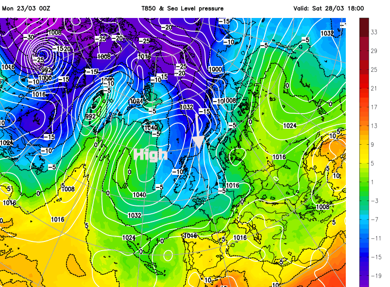
The fine, settled weather was thanks to an area of high pressure which has now slipped over the Baltic States. We start with a southerly flow which fades to barely any breeze by midweek and then a colder NW wind kicks in during Friday veering to a significant northerly by Saturday.
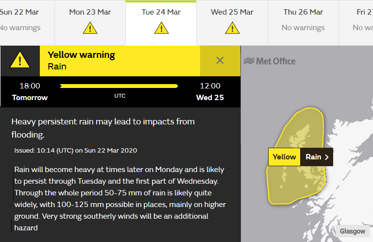
Before that most of the UK will continue with dry, settled often fine weather on Monday, however, there is a weather warning for heavy rain for the far NW of Scotland from Monday evening, through Tuesday into Wednesday morning. This is for the Western Isles, Wester Ross, Skye -
“Heavy persistent rain may lead to impacts from flooding… with 100-125 mm possible in places, mainly on higher ground. Very strong southerly winds will be an additional hazard” Met office
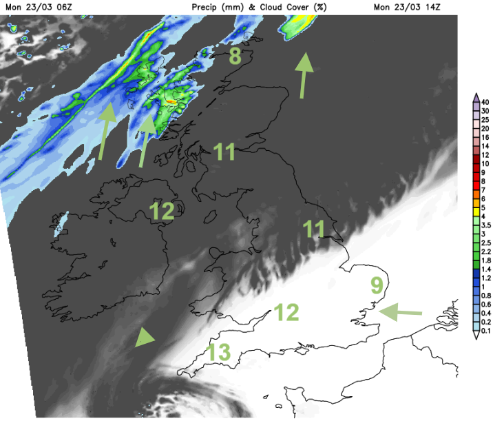
There will be more cloud from this frontal rain over Northern Ireland and Scotland with high cloud reaching over northern England and north Wales. These fronts link to a low pressure over Iceland and there will be gales and rough seas around The Minch this afternoon as the wet weather really sets in this evening.
The high pressure blocks the progress of Atlantic weather and slows this frontal band considerably. Hence the ongoing wet weather in the far NW. Tuesday looks mild with temperatures up to 15 or 16C for a few spots in England and Wales, 12 or 13 for Co. Down, the Central Belt or Moray coasts. It manages to creep over more of western & northern Scotland and some of Northern Ireland by Wednesday morning with more patchy rain here. Ahead of this there will still be clear skies and cold start on Wednesday and Thursday
By Friday the frontal band will have managed to move further south, it will be weaker then with light patchy rain. A new high pressure will be building in the NW and this will move the airflow to a colder NW then northerly. Everywhere will feel colder as the air comes down from the Arctic.
Does this mean snow? For most no. There will be more frosts by night and some wintry showers in the cold wind off the North Sea but areas affected by the clusters and bands of rain, hail, sleet and mostly hill snow will vary with the wind direction, Early Friday maybe some snow on the back edge of the front moving south, for say Cairngorms and Cheviots. Then wintry showers for the NW Highlands and western Isles after all the rain.
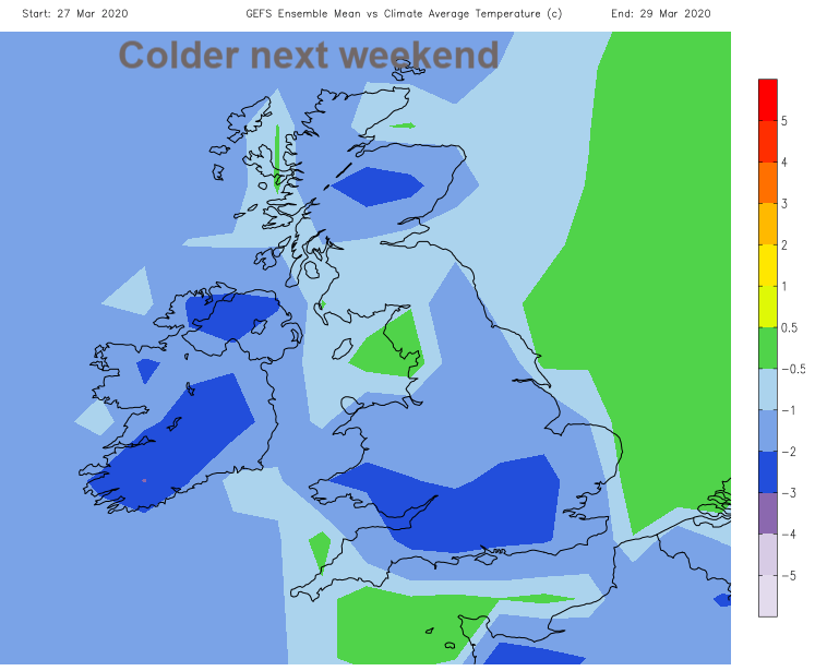
By early Saturday the winds veer to the north so for a time, wintry flurries would be expected for north Wales, north coast of Northern Ireland, north and NW Scotland. Northern Scotland does look like it will see snow, but again these are showers so hit and miss. There are signs in the current forecast for a band of heavier showers to move south through Britain on Saturday, but we’ll have to wait a few days for the fine detail. It won’t be as dry by next weekend and the Polar maritime air mass will make it feel cold and there will be the risk of Ice. Another reason to stay in, elderly people slipping on ice is a load on Accident and Emergency in the winter months anyway, the gritting services may be affected on some routes.
Then North Sea coasts look more prone as the winds veer again to NNE. So, a covering over the Pennines and North York moors is likely. An interesting week of weather with a growing colder theme.