Quite a divide in temperatures either side of the rain band across the UK. Drier, more settled conditions later this week but colder for everyone particularly at night.
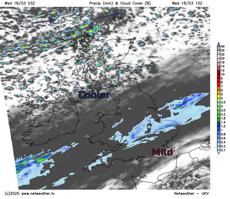
A troublesome front moving slowly South is the dividing line between colder air in the North and much milder conditions towards the South East. This is currently affecting central parts giving mist, rain and some snow over the tops of the Pennines, with the front continuing to move slowly southwards through the day.
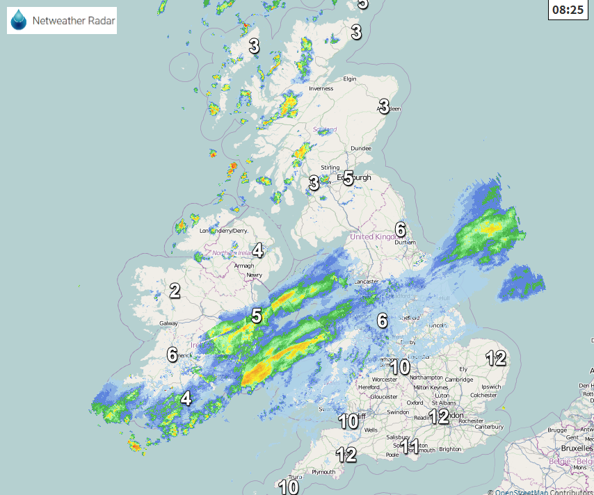
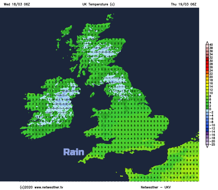
So you'll be waking to a damp start over the North and West of Wales much of northern England and the North Midlands this morning, with remaining parts of Wales, the Midlands, South West and Norfolk seeing some rain or drizzle later. Through the day the rain will become lighter and patchy, but with still a few heavier bursts possible along the front itself. Across Suffolk, southern England and the South East it'll stay dry with some sunshine in places, that'll lift temperatures to 14 or 15C in a South Westerly breeze that'll decrease to become light.
Across Northern Ireland and Scotland, it'll be brighter with sunny spells, in a West or South-West wind that'll be fresh in the far North West. It'll be mostly dry, but North West Scotland will see scattered showers, with Fermanagh, Derry and perhaps Antrim seeing a few later. It'll feel chilly across these more northern areas though despite the sunshine, with top temperatures of 6 to 9C disappointing for mid-March.
South Wales, southern England, much of the Midlands and East Anglia remain cloudy after dark, with further mostly light patchy rain in generally light winds. It'll stay mild though in the South, where temperatures shouldn't fall below 7 to 9C. Further North, there'll be clearer skies and it'll be mostly dry, although parts of Northern Ireland and the North and West of Scotland continue to see a few showers. These'll be wintry on Scottish hills in a cold Westerly wind, but elsewhere winds will be lighter leading to a slight frost in places, with lowest temperatures mostly in the range -1 to +2C.
Southern and central parts continue to be plagued by cloud and patchy rain on Thursday when a chilly North East or northerly breeze will 'spring-up'. Northern Scotland will also see a few showers, but elsewhere it'll be mostly dry and bright. After an early slight frost in places, there'll be sunny spells in a mostly light breeze between West and North but it'll be noticeably colder in the South, with maximum temperatures only around 8 to 10C.
Little overall change seems likely during the evening and overnight, with a lot of cloud in the South giving bursts of rain particularly across the South West. Despite a chilly North East wind though temperatures in the far South shouldn't fall below 5 to 7C. Elsewhere apart from a few showers over northern Scotland wintry on hills, it'll be mostly dry. There'll be clear spells and with a northerly breeze fairly light, sheltered rural areas, in particular, will see another slight frost. Temperatures could fall as low as -4 or -5C in some Scottish glens, but -1 to +2C will be a more general minimum.
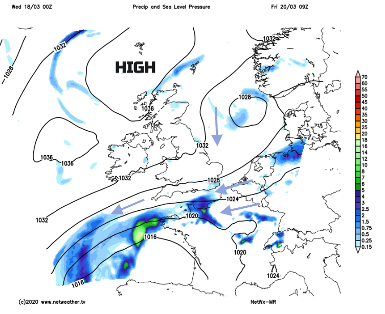
During Friday, an anticyclone becomes established to the North bringing mostly dry weather over the weekend. There'll be sunny spells, but an East or North East wind something that we haven't seen since the autumn will feel chilly with night frosts.