High pressure is the trend through this week but we do have some Atlantic rain, strong winds and even snow in the forecast before a settled weekend.
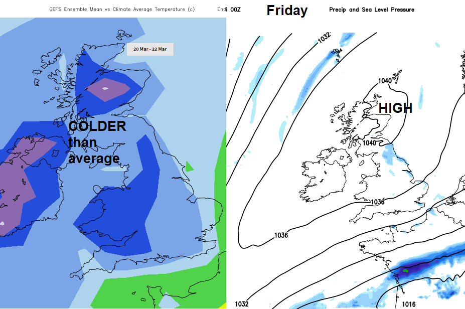
High pressure is the growing theme in the UK weather forecast. This week looks a bit mixed, particularly for Northern Ireland and N Britain in the next few days but there is a signal for more settled, drier weather by next weekend although with colder air. That is set up against stronger mid-March sunshine and at least it won’t be raining as much. Those puddles should begin to dry up.
This morning is starting off fine and nippy, some places have been down below freezing overnight with frost. There is a little light rain over NE England with some lingering cloud down into Yorkshire but overall, we have blue skies and sunshine. Still a little cloud over Kent from Sunday’s cold front which has cleared the SE. There is already high cloud over Ireland and western Scotland from the next Atlantic weather system, a low pressure in between Iceland and Greenland which will bring wind and rain later today.
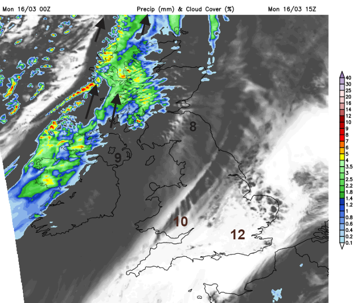
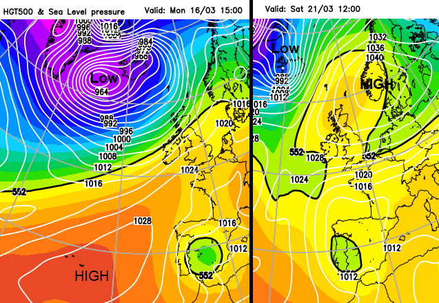
High pressure from the Azores is reaching the UK today but this low away to the NW squashes in. Much of England and Wales, eastern Scotland hold onto fine, bright weather today with very light winds for SE England and temperatures into double figures but more of a SW wind picking up for Wales also southern and eastern Scotland. Northern Ireland and the rest of Scotland will have fresh to strong SW to S winds with gales even severe gales through The Minch. County Down and County Antrim will stay fair this afternoon, up to 9C but become windy with patchy rain this evening. Western Scotland will see some heavier rain with snow over the mountains as the rain band moves SE and settles over northern England (particularly the NW and Pennies) and Wales tonight
With clear skies over SE England temperatures will dip, there will be this area of frontal cloud and then clear skies with blustery and wintry showers for NW Scotland in cooler air.
These three areas continue into Tuesday morning but with the cloud over SW England, Wales and the Midlands and damp weather around the Bristol Channel. It will be a blustery day.
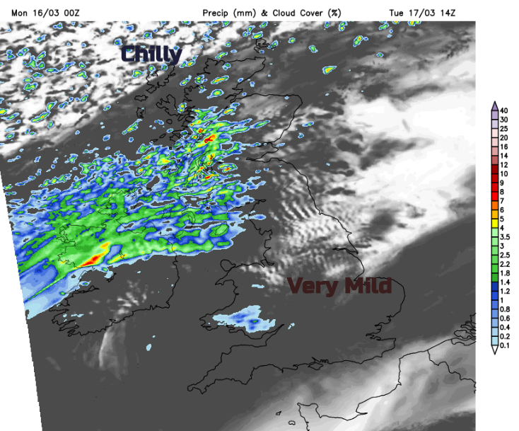
Waves develop on the frontal band, so heavier rain is likely to move in from the west but give some leeway to the timing and extent if you are looking at a weather app for your location. The air to the south will be very mild, up to 14 or 15C for eastern England but still cold in the far north. For Highland, there will be a bit more snow over the hills and mountains and brisk winds. By Tuesday evening there could be snow on the back edge of the rain for other parts of Scotland, just something to watch and heavy rain over the hills of northern England, southern Scotland.
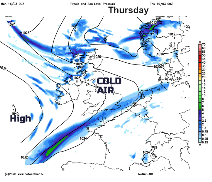
Midweek the frontal band sinks south-eastwards and allows that colder air to spread over the UK. There could be some wintry bits in the northerly flow on Thursday into Friday, coming off the North Sea but there are signs of a lot of dry, sunny weather with light winds. We’ll just have to see if we are still allowed out to enjoy it.