Gales and blustery showers, wintry in the north, as Storm Jorge moves in across the north. Winds slowly easing but more showers Sunday. Quieter with less rain and just occasional showers next week.
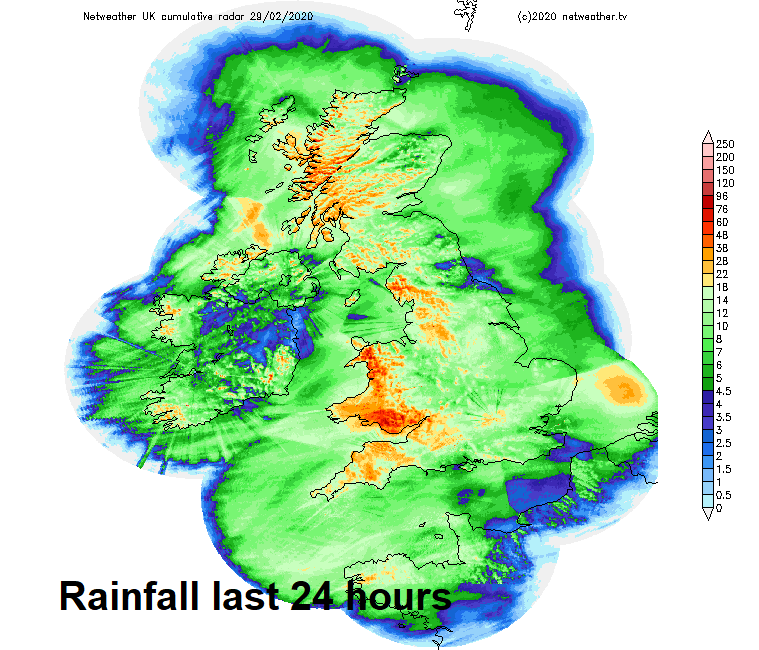
Today is the last day of what has been a wetter than average meteorological winter on the whole across the UK. And although this winter has not been record-breaking in terms of rainfall, February has seen well over double the average monthly rainfall so far, across parts of the northwest England - three times the average February rainfall. This will make it one of the wettest Februaries on record and the wettest calendar month since December 2015.
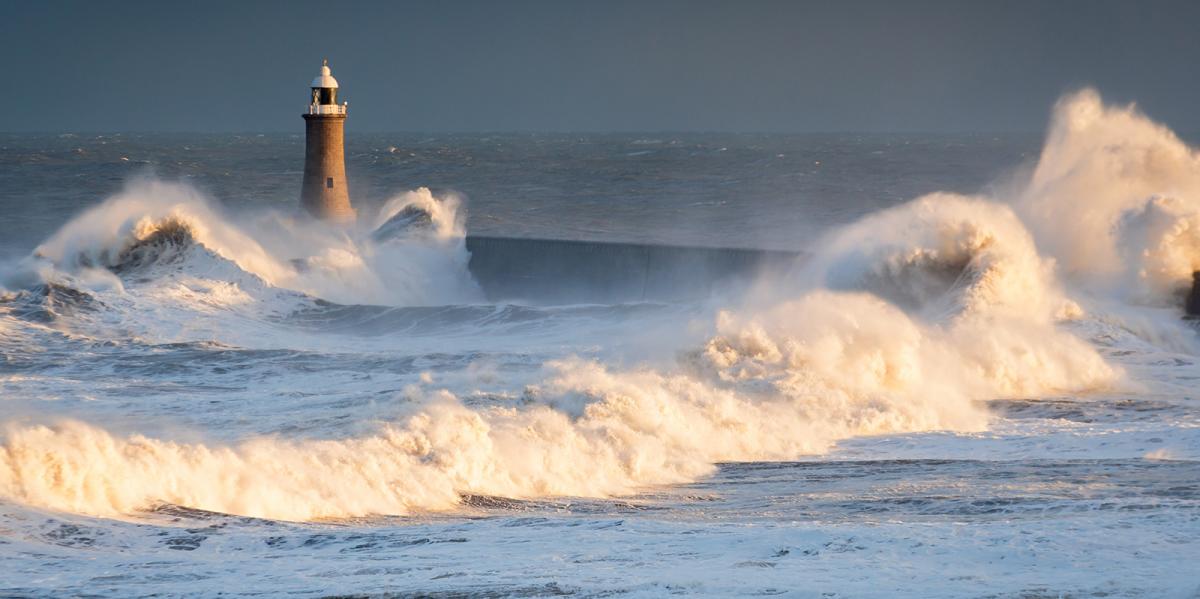
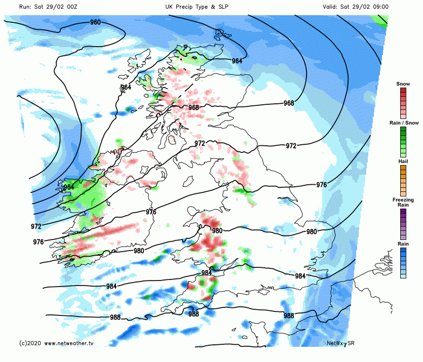
We’ve already seen Storm Ciara and Dennis over weekends this month and the weather will make sure this wet and stormy month finishes on wet and windy theme, with Storm Jorge (pronounced Haw-hey) arriving to the northwest today, centred close to Northern Ireland at noon today, before tracking northeast to over northeast Scotland tomorrow. The worst of the heavy rain over the past 24 hours arriving ahead of Jorge will clear east this morning, then becoming very windy with gales widely along with scattered showers for the rest of the weekend. It will turn colder too, with showers turning wintry in the north, with snow over higher ground.
In more detail for today, a band of locally heavy rain accompanying a cold front across eastern England and NE Scotland will gradually clear east by late morning, then becoming drier and brighter for a time for many eastern areas, however, it won’t take long for showers already across the southwest to get going across most western areas for the rest of the day. Some of these showers will reach the east through the day, particularly along southern counties, but they will tend to be most frequent towards the west. Showers falling as a mix of rain, hail, sleet and hill snow in the west, merging into longer spells of rain, sleet and hill snow across parts of Scotland, NW England and Northern Ireland. Turning increasingly windy and colder through the day from the west, afternoon highs reaching 4-6C in the north and west, 6-7C across southern and eastern areas.
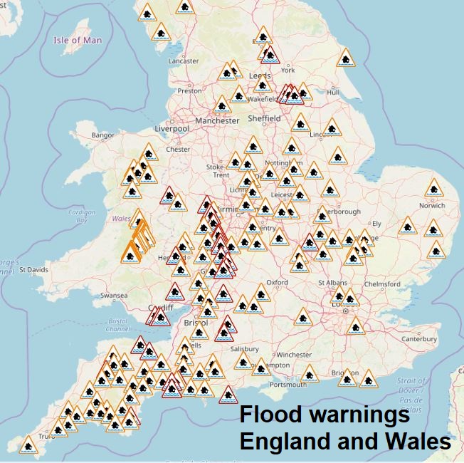
Although the worst of the rain, in terms of prolonged rain, will clear this morning, with just showers over the next few days, the flooding risk in the north and west will remain over the coming days, as all the rain over the past 24 hours works it’s way down rivers, with rivers recently vulnerable to flooding, such as the Severn, Wye and Aire probably peaking again over the next few days after falling a little. There are 81 Flood Warnings across northern and western areas of England along with 8 Flood Warnings across Wales.
Then our immediate attention will turn from the rain to the wind this evening and overnight into Sunday, as Storm Jorge passes across the north. Gales will develop widely this evening and overnight, severe gales in the northwest. Winds will widely gust to 40-50mph, but for a time this evening gusts of 60-70mph are likely across N. Ireland, southern Scotland, northern England and Wales, across west Wales 70-80mph gusts are possible in exposed spots. This is likely to cause some disruption to travel and perhaps power supplies.
The centre of Storm Jorge will move over northern Scotland, driving further spells of heavy squally rain and hill snow across N. Ireland, southern Scotland and far north of England overnight, gales could bring blizzard conditions over the southern Uplands and northern Pennines. Either side of these spells of more persistent rain and hill snow will be clearer conditions but also a scattering of showers, which will be wintry over higher ground. The clear spells will allow temperatures to fall to around 3-5C across England and Wales though it will remain very windy preventing a frost away northern Scotland – where winds will be lighter allowing temperatures to reach or fall below freezing.
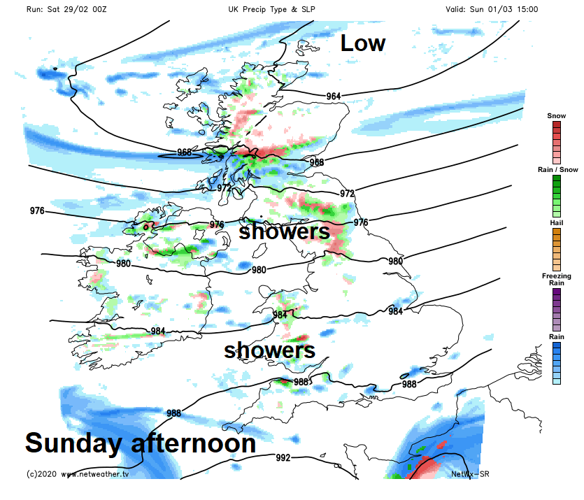
The centre of Storm Jorge will be close to northern Scotland on Sunday, though tending to fill, so winds will gradually ease but it will still be a windy day for all, gales across the north. The strong westerly wind will blow in scattered showers with sunny spells in between showers, which will be wintry over higher ground in the north and west, perhaps merging into longer spells of rain and hill snow in the northwest, fewer showers in the east. A spell of rain could clip the far SE of England through the afternoon. Temperatures reaching 6-7C across Scotland and N. Ireland, 7-9C across England and Wales.
 Next week
The theme going into the first half of next week looks to be sunshine and showers and winds easing, most of the showers across the north and west – where they’ll be wintry over higher ground. Some uncertainty from mid-week, showers easing across the north and west Wednesday and Thursday and becoming drier and sunny for many, there could, though, be a low running through the English Channel on Wednesday that could bring some rain to southern parts of Wales and England for a time. Perhaps turning unsettled again by Friday.