


Temperatures up into double figures as we change into February. So snow looks confined to the highest peaks as wind and rain still whizz in from the Atlantic.
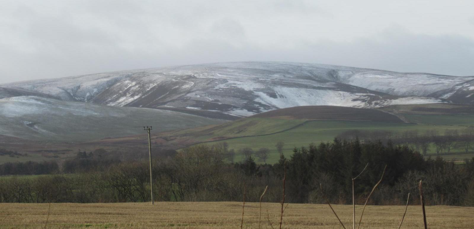
I went out in search of a bit of snow for Wednesday’s video update, just in the background. It remained distant even as I ventured up into the hills of SE Scotland. Tuesday 28th January had brought a brief covering to parts of Scotland and the higher Peak District and Welsh Mountains. But it’s all been a bit scarce this winter. Just wet and rather mild. Time is slipping away for another year, another UK winter. There was last week with the mega high which brought colder conditions to SE Britain and under the gloomy skies a real chill but it was dry.
It’s not always about the air temperature that shows on the sheltered, shaded thermometer. Those gloomy grey skies and the dampness made it feel bitter at times, especially when the wind did blow. Anyone who works in an air-conditioned office will know the feels -like temperature varies greatly from person to person.
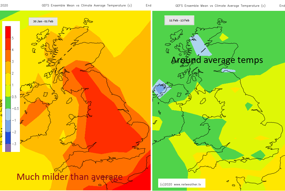
It is January, nearly February you would expect it to be cold which is why the “compared to average” temperatures charts are useful . This week they show a warming, much milder air from the south or SW, a tropical maritime air mass replacing the current cold Polar airmass which originates from near Greenland.
Temperatures have been around 4 to 8C but will lift later this week and over the weekend into double figures, so up to 12C but with blustery winds and rain at times. The weather looks very unsettled. The only snow will over the tops of northern hills.
Do you remember last year? February 2019 was record-breaking, the first time the UK had seen over 20C in wintertime.
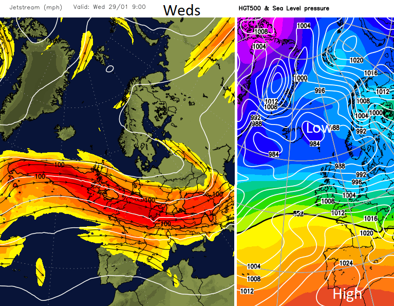
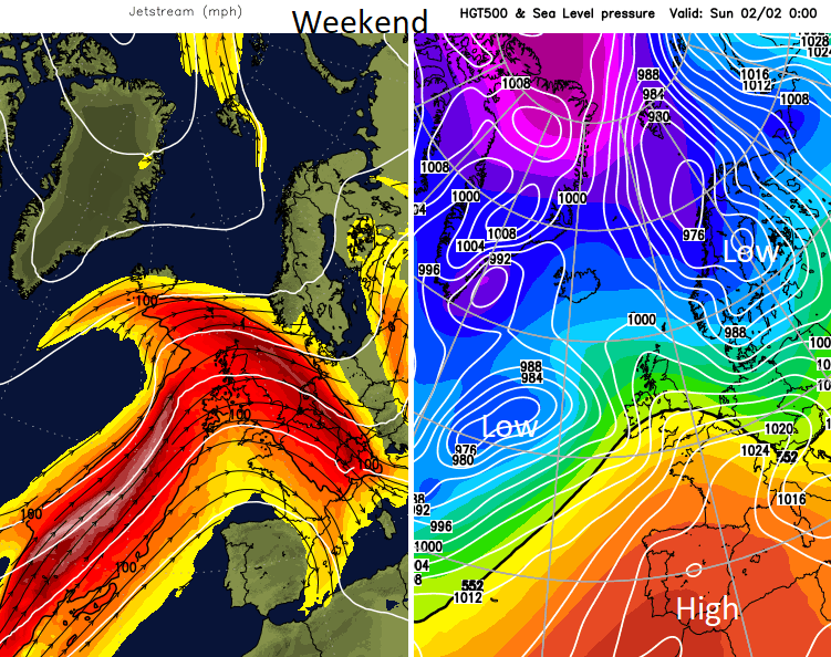
As we see a shift in the position of the Jetstream and this pull of milder air from the southwest the start of February 2020 looks milder, particularly for southern Britain. Not 20C though. Saturday night looks cold in the far north with the risk of snow for Scotland and then back to around average by Tuesday 4th, cold for some by the end of the day.
Overall, the next week looks unsettled with the flow from the Atlantic. This may vary from a colder NW to a milder SW sometimes day by day as we start the new month. Looking for another SSW and Beast for the East? There have been mutterings and hopes, small clusters of charts with hints of Stratospheric Warming but nothing substantial so the overall westerly mobile theme continues.
Nick Finnis has more in his blog looking at happenings in the upper atmosphere.


