


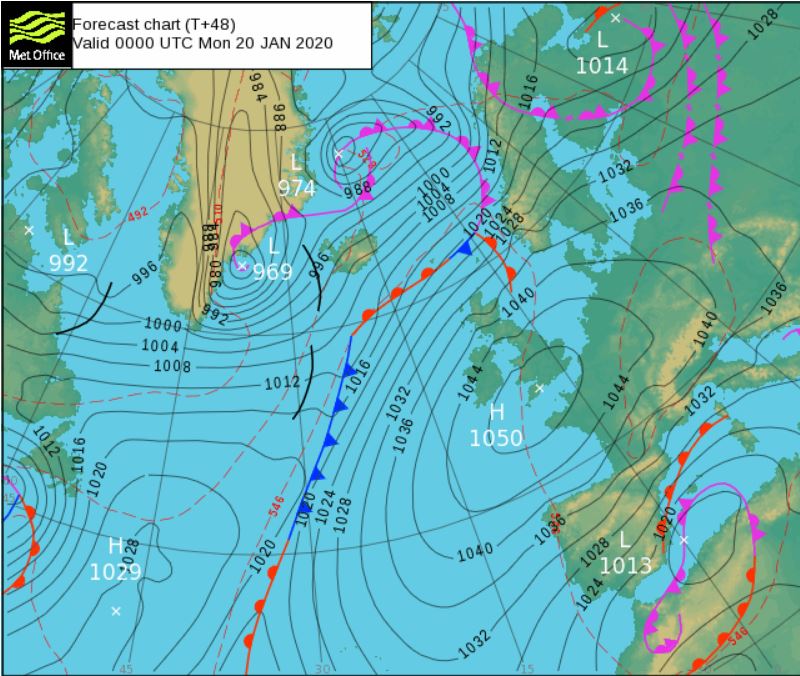
High pressure builds in this weekend and hangs around through much of next week, so turning dry and settled for most, with risk of overnight frost and fog patches.

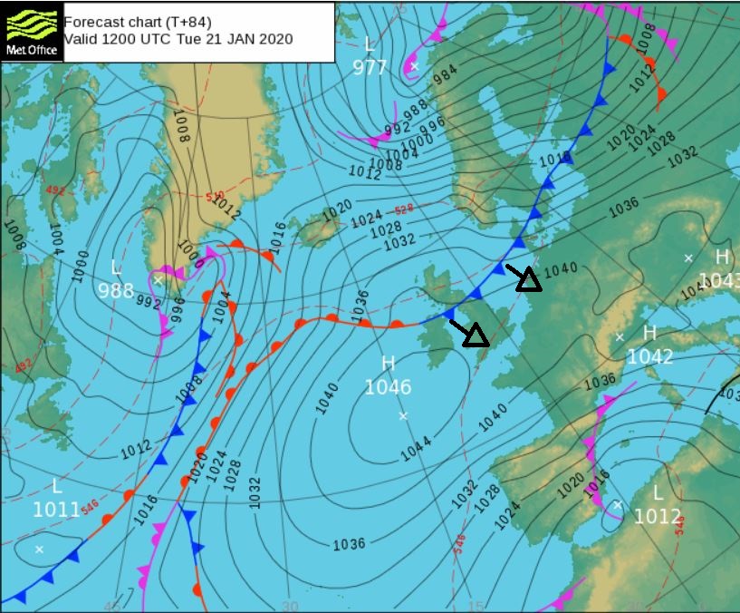
After a rather unsettled week, including Storm Brendan that brought wet and windy weather, a tornado in Hampshire and plenty of rain leading to an increase in Flood Warnings and Alerts, the weekend sees high pressure build in bringing calm, dry and chilly weather with overnight frost and fog. Barometers across the country will see a marked change in pressure compared to earlier in the week, pressure dropped as low as 941 hPa in the centre of Storm Brendan, but this weekend we could pressure rise as high as 1050 hPa across the southwest of Britain. The record high pressure for the UK is 1053 hPa in Aberdeen in 1902. And it looks like high pressure will hang around through much of next week too, continuing the dry and settled weather.
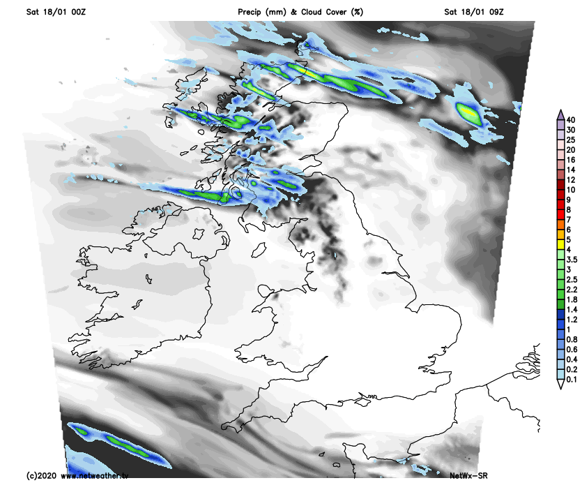
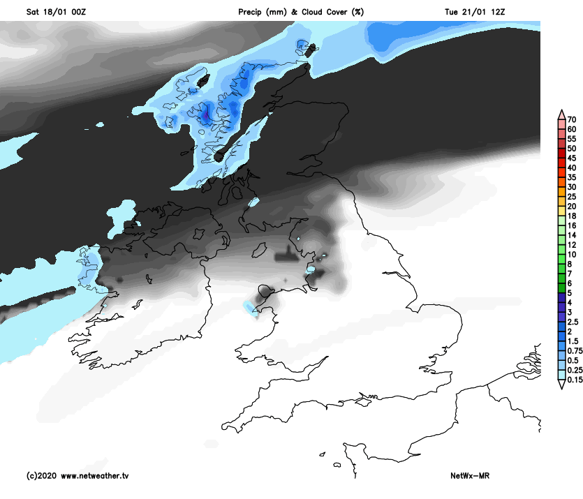
For now, much of the UK is off to a dry and cold start thanks to clearing skies overnight and a chilly westerly flow, with temperatures falling close to or just below freezing widely, allowing for a slight frost to start the day in many areas. The exception to the mostly dry start is across northern and western Scotland where showers continue, locally heavy and wintry inland with snow falling over higher ground.
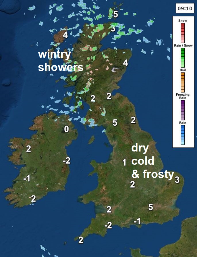
Little change through Saturday to the weather you’ve already got to start the day. So, for most it will be a dry day with lengthy sunny spells. There will continue to be showers across northern and western Scotland through the day, wintry inland with snow falling over the hills, blown in on a brisk northwesterly wind here. After mild conditions over the past week, temperatures closer to average today, with temperatures ranging between 6-8C.
As soon as the sun goes down late afternoon it will quickly turn cold this evening with mostly clear skies and winds falling light leading to widespread frost developing inland. Showers across Scotland becoming confined to the far north. Some local fog patches may form too in the south.
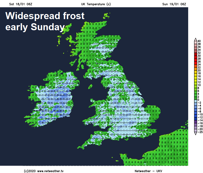
A cold, crisp and frosty start to Sunday leading into another fine and dry day with long sunny spells, wall-to-wall sunshine for some, temperatures reaching 6-8C, about average for January. The exception will be across NW Scotland where a southwesterly breeze will bring more in the way of cloud and milder air, with temperatures reaching 10C here. Maybe worth watching your barometers or weather stations in the southwest, because here we could see pressure rise to 1050 hPa late in the day.
Cold and frosty again Sunday night for much of the UK and greater chance of some fog forming in the south, so worth bearing in mind that this may cause some travel disruption for Monday morning’s commute. Northern Scotland will be milder and frost-free overnight though, thanks to a southwesterly breeze here. Perhaps more in the way of cloud generally for Scotland and Northern Ireland on Monday blown in on a southwesterly breeze, milder here too with temperatures reaching 8-10C. Otherwise England and Wales dry and sunny again, temperatures reaching 7-9C.
High pressure hangs around much of next week, though cloud will spill south around the high from mid-week, bringing some patchy drizzle
Cloudier, breezier and milder across the north generally on Tuesday, with some rain for a time across Scotland before easing. Southern areas dry and sunny after another frosty start, though overnight fog patches could be slow to clear.
High pressure across the south to start the week tending to retreat west, which will allow weakening fronts to slip down from the north Wednesday to Friday, so although it will remain mostly dry, it will be cloudier and milder for many, with overnight frost less likely. Cloud thick enough to bring some patchy drizzle at times, perhaps more general rain arriving across the far northwest through Friday.


