


The jet stream stays strong and closeby to the British Isles this week, keeping our weather very changeable and boisterous.
With a strong Jet Stream, the weather remains in a boisterous, changeable mood. As a result, there are warnings of severe damaging gales today, over Scotland, Northern Ireland and the North and West of England.
Much of England and Wales are beginning dry, with a touch of frost over parts of Kent at first. Generally, though there'll be a good deal of cloud today, with the brightest weather in the East where a little watery winter sunshine may occasionally come through. It'll also be increasingly windy, with gales developing in the North and West that'll become severe in exposed areas. Here you can expect some rain, that'll tend to become heavier and more persistent towards Cumbria through the afternoon, but any rain in the East and South will be mostly light and patchy.
Although patchy towards The Borders for a time, Scotland and Northern Ireland see bursts of rain from the word go in a windy morning. There'll be some heavy, driving rain in the North and West, before clearer somewhat colder weather, although still with blustery showers, spread to all but the East and South of Scotland before dark.
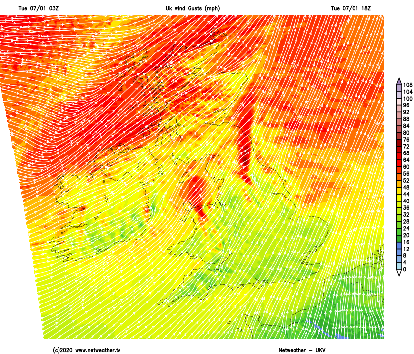
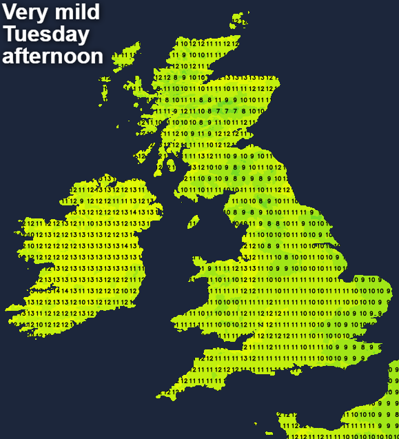
A South to South West wind lighter in the East at first becomes fresh or strong. There'll be gales in exposed areas severe over Scotland and Northern Ireland, with damaging gusts of 70 to 80mph possible in the far North West for a time. Despite the wind, it'll become very mild, with temperatures perhaps getting as high as 15 or 16C around the Moray Firth and to the lee of the Welsh mountains, with all but a few eastern areas reaching a balmy 11 to 13C, well above normal for January.
Scotland and Northern Ireland see blustery showers after dark. It'll also be colder, with the showers heavy and wintry on higher hills later giving local hail and perhaps thunder. After some rain, much of England and Wales also become clearer and somewhat colder, but across the South and South East it remains very mild with patchy rain. Although decreasing a little, a Westerly wind continues to bring a few showers to the West and will remain strong over Scotland with gales continuing in the North. Lowest temperatures 3 to 7C in the North and 9 to 12C in the South.
Wednesday for most brings sunny spells in somewhat lighter breezes, while Scotland sees a blustery West wind bringing further showers, wintry on hills, these mostly in the North and West. The other exception will be towards the South coast where you may keep cloud that could bring some rain later to the South West. It'll feel cold in the wind, with temperatures 5 to 7C in the North and 9 to 11C further South.
Scotland sees fewer showers after dark and with clearer skies and a South West wind lighter, sheltered eastern parts, in particular, could see a touch of frost overnight, as temperatures fall close to freezing. Northern Ireland and the far North of England could also turn cold with clear spells for a time, before milder air and outbreaks of rain begin to move up from the South.


