High pressure will bring a mostly dry and mild weekend with some brightness, rain in the far north. Next week turning increasingly unsettled and windy, but remaining mild.
The weekend is off to a chilly start this morning, however it will gradually turn milder for all and for much of the UK it will be dry this weekend, with some sunny spells, thanks to high pressure across the south. The exception will northern Scotland where wriggling weather fronts will bring rain at times and it will be windier too, particularly on Sunday. As we head through next week, the jet stream which is north of Britain this weekend will begin to shift further south across the UK and strengthen from the west. This will bring low pressure systems across the UK bringing rain for all of us at times and it will turn increasingly windy too. It will be rather mild for the time of year though, particularly earlier in the week, Tuesday could see temperatures widely reach the low teens, a few spots reaching the mid-teens.
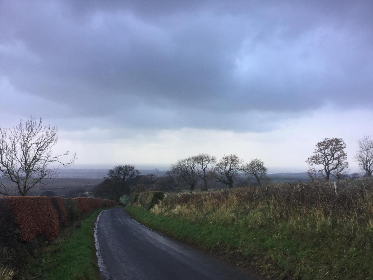
For now, most places have started the day frost-free, though it's a chilly start across the south where temperatures are widely in low single figures, some rural spots across Kent and Sussex have though dipped close to freezing bringing a local slight frost. There is more in the way of cloud and less cold across Scotland, northern England and N. Ireland to start the day, with some patchy light rain or drizzle while more persistent rain is affecting the far north of Scotland. But for many it’s dry if rather cloudy, brightest in the southeast.
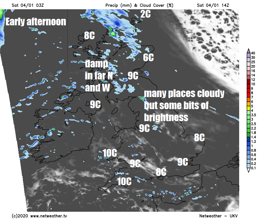
The band of rain across northern Scotland will tend to ease, but remaing cloudy here and across western Scotland, N. Ireland and NW England, with patchy light rain or drizzle at times through the day, more especially over the hills. Otherwise eastern Scotland along with much of England and Wales will have a mostly dry day, though becoming often rather cloudy from the west, thick enough for a little drizzle over western hills, best chance of brightness or sunshine towards the east. After the cold start, it will end of up mild by the afternoon, highs reaching 8-10C widely, though across the Northern Isles it will be much colder, with perhaps just 2C the high in Lerwick.
For most places it will remain dry overnight, milder than last night too, thanks to more in the way of cloud for many and an increasingly brisk southwesterly breeze. Rain will affect the Northern Isles while a cold front approaching the far northwest will bring rain back across the Western Isles and north of Scotland by the end of the night.
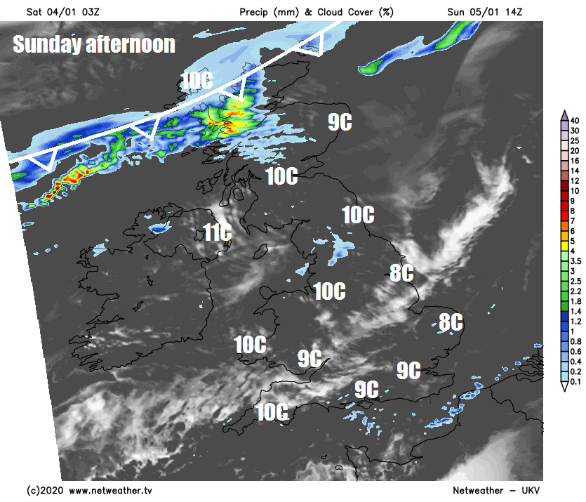
Then on Sunday, a lingering cold front will lie close to the far northwest for much of the day, bringing cloud and rain to northern Scotland through much of the day – increasingly windy here too. The rest of Scotland, N. Ireland, NW England and north Wales will be often cloudy, with the odd spot of drizzle over western hills, though some breaks east of high ground, such as the Moray Firth, may allow some sunshine. Any early cloud will break though across central, southern and eastern areas of England to allow some winter sunshine, where it will remain dry. Another mild day, highs reaching 8-10C, perhaps 11-12C in the far west.
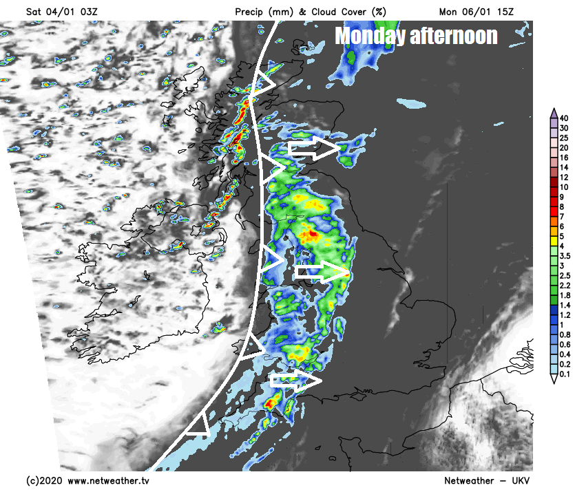
A windy day on Monday, the strong south to southwesterly wind reaching gale force across Scotland, N. Ireland, NW England and up through the Irish Sea. Mostly dry and bright at first, sunniest in the east, before a band of heavy rain sweeps in across western parts by late morning. The rain then reaching eastern parts through the afternoon, though tending to ease and turn lighter and patchy, drier and brighter conditions following. Mild again.
Wet and windy across the north on Tuesday, rather cloudy with limited brightness in the south, mostly dry though could be some patchy drizzle. Rather mild for January though, temperatures widely reaching the low teens despite the cloud, perhaps a few spots approaching 14-15C to the lee of high ground, thanks to the foehn effect.
Unsettled and increasingly windy from Tuesday until Friday - with a calmer end to the week
Colder but brighter but still windy conditions spreading across Scotland on Wednesday, but with wintry showers. England and Wales probably mostly cloudy, breezy and mild still, with patchy drizzle. Thursday windy and wet at times across all parts, gales possible in the north and west. Friday hopefully seeing a ridge of high pressure build in to quieten things down and bring a mostly dry and fine day.