


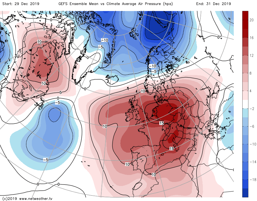
At long last, following months of low pressure driven weather, we have high pressure on the scene as we close out 2019 and move into 2020.
At long last, following months of low pressure driven weather, we have high pressure on the scene as we close out 2019 and move into 2020.
For now, the winds are from a southerly direction, so temperatures on the mild, if not very mild side with highs widely into double figures, and reaching the teens in places. As well as being a mild wind direction, it's a moist one so there's also a lot of cloud, although there will be some breaks coming through at times, especially to the north and west of higher ground.
It's not the entire country enjoying the benefit of high pressure either, with the western half of Scotland, in particular, seeing some very wet weather over the next 24 hours. And on top of that, the rain will continue to come and go here during the coming days. The odd front will try to push down from the northwest as well, but it'll be a struggle with any rain becoming increasingly light and patchy the further south it gets.
These are the rainfall totals over the next 24 hours.
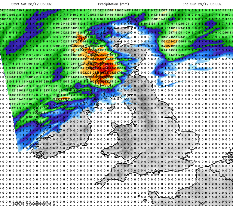
Overnight and into tomorrow, the heaviest rain in western Scotland will ease. Still, some outbreaks of wet weather will continue to come and go during Sunday - especially in the northwest and the Western Isles. Elsewhere, tomorrow will be a very similar day to today, so dry and mild but with plenty of cloud.
Into Monday, some of that rain in the northwest will be having a crack at moving further southeast. It'll start the day bringing some mostly patchy rain through to central and southern Scotland, before making gradual progress down into northern England. Ahead of that, it stays mainly dry, but some showery rain may make it into southwestern England later in the day as a small area of low pressure nears.
New Year's eve sees the last of any showery rain and extra cloud clearing the south of the country. Behind it all, it'll be a chillier, brighter picture. If you're off out during the evening to see the new year in, layer up as it'll be cold with some frost and fog patches.
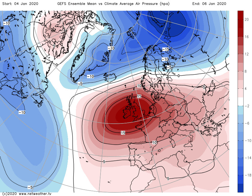
2020 then begins with a familiar pattern, with high pressure still the main influence but there'll again be some wet weather in the far northwest. Temperatures at this stage will be nearer to normal though.


