The weather is heading in the right direction this weekend with high pressure trying to settle things down. However, like stragglers in the pub after closing, some showers are just not clearing off. Time please!
High pressure is sidling our way from the Atlantic, trying to bring us more settled weather. The showery regime clings on for a bit longer in that cool breeze, but there will be a spell of quieter weather Sunday into Monday, although some showers want to linger. With light winds, patchy fog, even a touch of frost it will feel more like autumn with the nippy starts. Then weather fronts pile in from the west once more bringing rain and blustery winds.
Temperatures
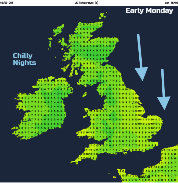
This weekend stays cool, but still with some strong sunshine. We’re back to the time of year with a chilly start, pockets of warm sunshine but overall, not taking a coat would be folly. There are signs that next week will be a bit warmer by day, into the high teens, maybe low 20s for SE Britain. The nights often dip well down into single figures.
Winds
Last week saw StormAileen bringing lively wins and gusts across parts of England and Wales. This weekend the winds are easing but still from the cool northerly direction. So noticeable today but light for Sunday. Monday keeps a northerly breeze along the east coast of England but light for the UK until early Wednesday when a brisk SW wind will pick up as that front heads in. As the low pressure develops over NW UK, it could bring strong winds maybe coastal gales, but it’s a fair way off at the moment.
Downpours
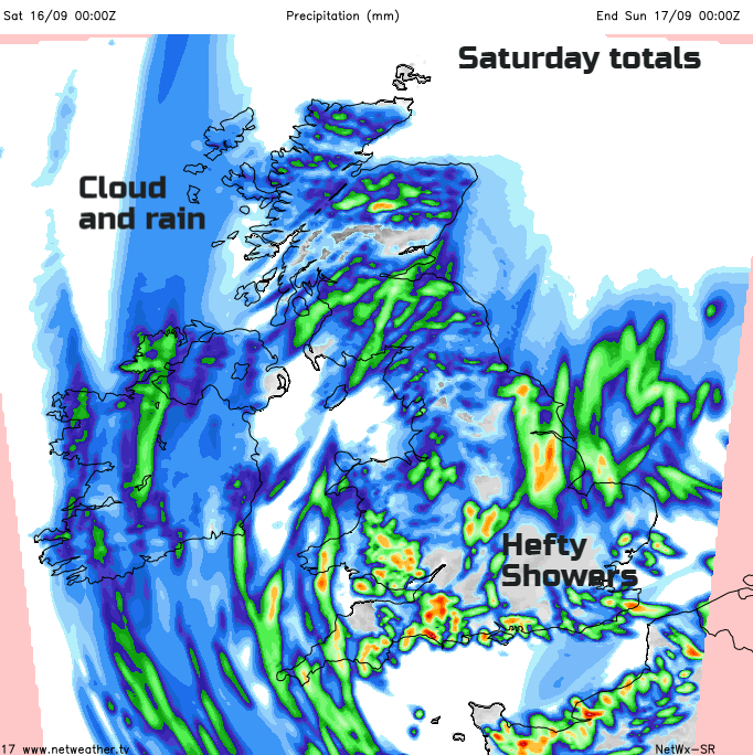
There is still the risk of hefty showers and thunderstorms today. Check out the Convective/Storm forecast which shows a risk of thundery showers across England and Wales. These will be well scattered, quite slow-moving affairs, hence higher rainfall totals. SW Britain looks quite prone later in the day. There is also a risk of hefty showers over southern Scotland this afternoon as sunny spells appear and input a bit of energy. By Sunday it will be a more isolated risk across England, particularly East Anglia.
The Weekend
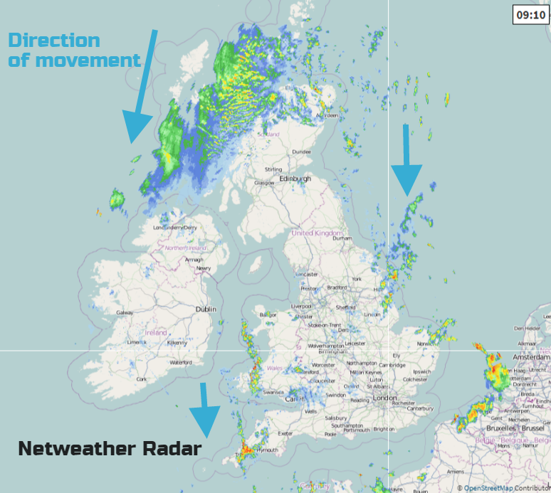
We are already seeing some of these hefty showers, feeding southwards in lines. off the sea. Cornwall and Pembrokeshire under one line, the Channel Islands another. More clipping Lincolnshire, the Humber and running into north Norfolk. Away to the NW is an area of forcing which is bringing a larger area of cloud and rain. This will run down through western Scotland into Northern Ireland today bringing grey and damp conditions before things improve over Northern Ireland this evening. Northern Scotland will also improve but southern Scotland, England and Wales keep the risk of scattered heavy showers. In between, there will be fine weather but it's all a bit hit and miss.
Overnight the showers do fade and it becomes cool with clear spells. Sunday looks much more settled with fewer showers, longer fine bright spells and sunshine for some. With lighter winds, it won’t feel too bad although there is still a small chance of a shower over England.
Next Week
Still the risk of showers for England on Monday but overall fine and bright. Tuesday looks more settled for everyone and a touch warmer.
Will it Thunder? where you are.