


The UK will see a windy few days. Nothing compared to the conditions which the Caribbean and Florida have endured thanks to Hurricane Irma but still a change for us towards autumn.
It’s looking windy for the next few days. It will feel cool and autumnal and be really quite chilly by Thursday night. We have one low pressure which has already brought gales for SW Britain this morning and big waves. The centre will whirl about over Shetland on Monday bringing fresh to strong winds across the rest of the UK. A bit of a lull before another low pressure races in from the Atlantic later on Tuesday. This will bring heavy rain and potentially stormier weather with higher gusts and gales as it rattles through Tuesday night/ early Wednesday. Then a cold NW flow sets in, with the risk of frost.
Florida
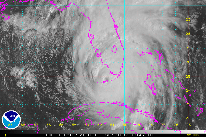
Hurricane Irma continues to batter Florida and threaten SE USA. It was bizarre to see the whole of Florida coloured red, under hurricane warning last night from the NHC, National Hurricane Centre, along with the footage of the storm surge throughout Miami as this major hurricane continued its path of devastation after its Caribbean route. Even as the worst of the winds clear northwards, there is still the risk of flooding and electrocution to people who want to venture out, but could encounter downed power cables in the water. Irma has indeed been a monster.
UK Today
There are clusters of showers littered across the UK this morning blown on by brisk winds from the Atlantic. NE Britain isn’t as windy at the moment as the low pressure centre is here but we will see windy conditions with hefty downpours for many areas this morning. Conditions on the roads will be tricky for the Monday morning rush and the Met Office do have a Yellow warning for very strong winds for SW Britain, out until 11am. There are gales around the coasts with gusts of 50-60mph and high seas.
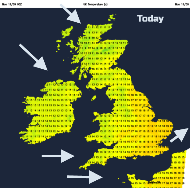
The strongest winds move along the English Channel, as it becomes more windy over SE Britain by lunchtime. Temperatures could reach 19 or 20C but worth being out of the wind and dodging the showers. The westerly winds veer to the NW, bringing cooler air into N.Ireland and Scotland. Here temperatures will struggle in the teens today. Strong NW winds and gales will blow through the North Channel and around Orkney this afternoon, where there will be more heavy and persistent rain.
There are zones of showers today, with some areas getting lots and others seeing longer dry, even bright spells. There will be hail and thunder mixed into, mainly for the NW. As more of the UK sees a NW wind, the showers ease for eastern Britain and central England.
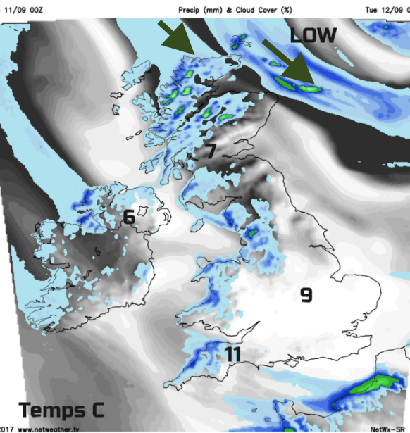
It remains wet and windy around Orkney and the far north of the mainland with brisk winds for coastal Scotland in the west and north. Elsewhere, the showers fade as pressure rises slightly from the west. So, Tuesday starts off on a much better note but there is another low heading our way.
Tuesday
There will be a fine morning with a scattering of showers from the west. There will still be a noticeable breeze but East Anglia could reach 18 or 19C and feel okay. Then the next development begins to arrive in Eire. There is another yellow warning for Strong winds out from the UK Met Office and it will be worth watching developments on this low as it looks like it could bring stronger winds to more of the UK, mainly England and Wales.
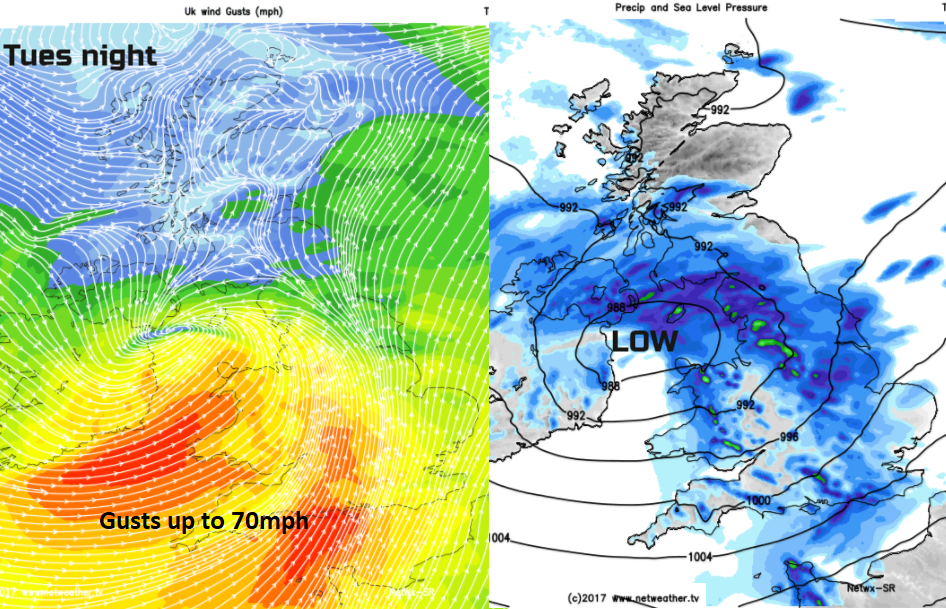
Tuesday into Wednesday there will be a spell of wet and windy weather with heavy rain. The strongest winds look to be for England and Wales with land gales likely and the heavy rain could reach into southern Scotland and N.Ireland, particularly Co. Down. Keep an eye on the warnings, if it reaches an Amber warning, this will become the first named storm of the season, Aileen.
There could be gusts of 60-70mph and difficult travel conditions. By Wednesday morning, early one there could be stormy conditions along the east coast of England as the low pressure draws away into the North Sea
The rest of Wednesday will be blustery showers and bright spells but with lighter winds for Scotland. The showers again could be heavy and thundery.
Thursday
There will still be showers about, mainly filtering along the coasts brought along by the freshening NW wind. It will feel chilly but there will be a lot of fine, sunny weather inland. South-eastern Britain could reach 17 or 18C and feel okay in the sunshine and a bit of shelter. After dark, it will be clear and cold as the winds ease. A touch of frost is likely inland.
Friday looks more settled as the NW winds ease and pressure rises from the SW. It does look like fronts will topple over the high pressure, bringing rain into N.Ireland and W.Scotland later but overall an okay end to the working week for much of Britain.


