Maybe. Temperatures forecast to reach 29 maybe 30C, that would be a record. Blustery rain on the way from the NW but ahead of that a fine, sunny, very warm day. Enjoy if you are not working.
Update 8pm - Yes 28.2C at Holbeach, beats 27.2C from 1984 late August Bank holiday Monday.
It's hot, it's sunny and it is a UK Bank Holiday. What is going on? There is some rain, heading into Northern Ireland later today but it's fine and warm ahead of that. Also, it will be wet for western Scotland but it's not a bank holiday here, still quite nice in the east though. Yet, for much of England and Wales temperatures are forecast to reach into the mid to high twenties and it's going to be dry and sunny- unbelievable, with the heat lasting for the SE until Tuesday.
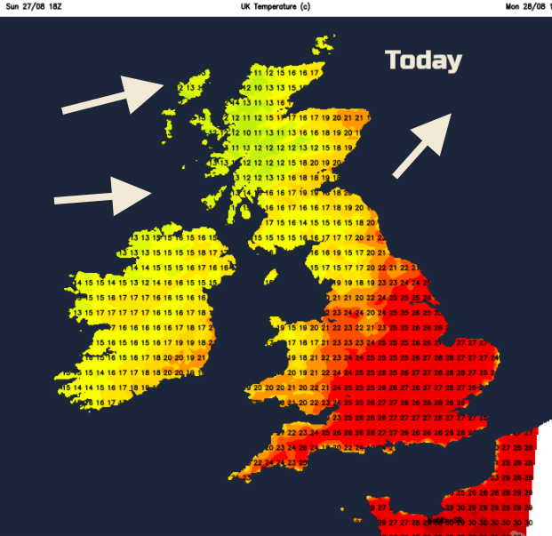
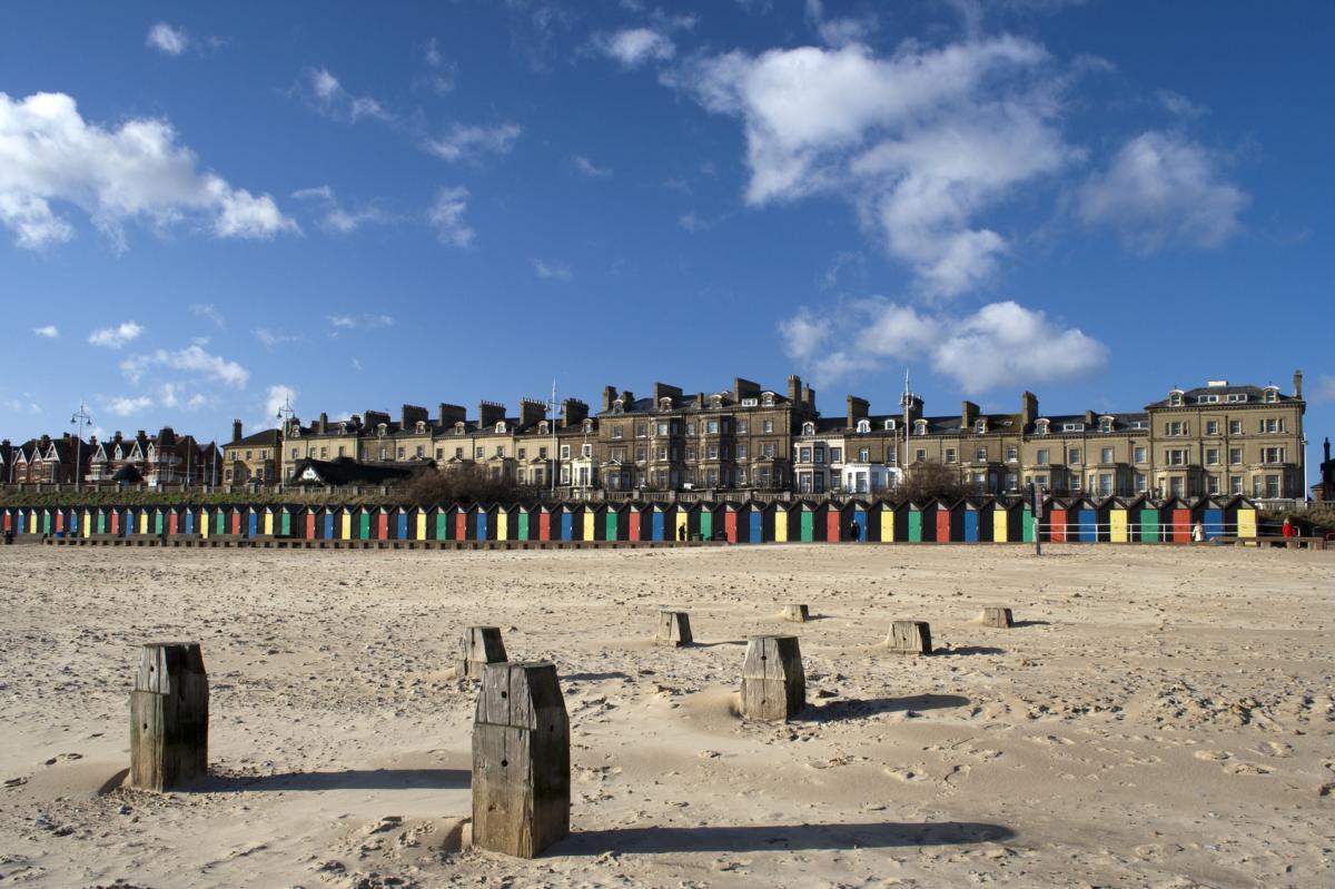
You've not got the wrong day, it is a Bank Holiday. Temperatures already this weekend reached 26.3C in Kent on Saturday and 27C in London on Sunday. 29 or 30C is possible today, 86F, which would make this the hottest late August Bank holiday on record.
It's not all sunshine and heat today. There is some low cloud and mist about first thing, but that will shift. We also have an occluding cold front heading into the far NW, bringing rain. With a brisk SW wind, western Scotland and later Tyrone, Londonderry and north Antrim will feel cooler, just in the mid to high teens. Cumbria and Gwynedd also just into the high teens with more cloud. However, eastern Scotland will be warm at 21C (70F)
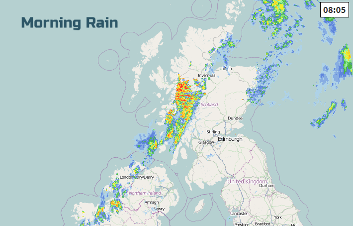
Whilst much of the UK will enjoy a fine day or at least a lovely morning, we do have this frontal band already over the NW Highlands and arriving at the western edge of Northern Ireland. There is more cloud here and showery outbreaks will edge over more of Northern Ireland during the day. By this afternoon the rain will have moved into Strathclyde and over SW Scotland, reaching Co Down too, but clearing in the far NW. Here the air will feel cooler and fresher and there will be clearer skies for the Outer Hebrides this afternoon.
By mid afternoon, we will have a split of cloudy, damp, blustery weather for the NW with temperatures of 15 to 22C and still fine, sunny, hot weather over the rest of Britain.
This week
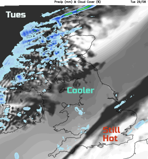
Tonight the frontal band sinks southwards and fades. The rain becomes patchy but there will be a distinct difference in temperatures. Nippy and fresh for N.Ireland and northern Britain but still warm for central and southern Britain around 13 to 18C. If you are going to feel grumpy at having to go back to work in all this summer weather, then for much of the UK, this heat and sunshine will have finished by Tuesday, The front pulling more cloud and fresher air down from the NW. However, in as school summer holidays enter their final stages in England, we do have one more hot and sunny day for the SE. Always the way.
By mId week, southern parts are looking unsettled with showers in the far north of Britain and in-between plenty of fair weather without the heat.Will just be worth watching developments in the SE later on Wednesday. Heavy thundery rain will be lurking over the continent, with other models showing this straying towards London. Thursday looks okay with bright spells and a scattering of showers before high pressure builds for the end of the week. So looking settled for Friday and hopefully much of Saturday.
Update on Texas and Harvey flooding