We're set for a mostly fine holiday weekend, with temperatures peaking into the high-twenties by Monday.
And here we are, the final long weekend until Christmas (121 days to go by the way!) unless you're in Scotland. Weather wise the forecast hasn't changed too much over the last few days, so we're still on course for a mostly fine and increasingly warm one, with temperatures peaking on Bank Holiday Monday.
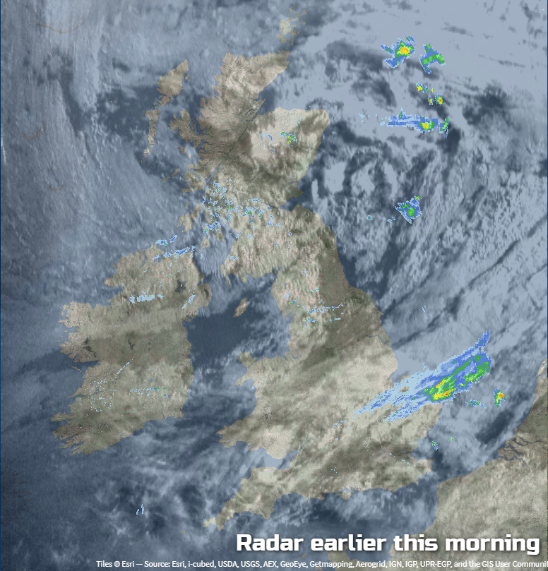
Not that you'd think that in one or two spots this morning, but don't despair, it will improve. The radar and satellite image from a short while ago shows what's going on. There's a fair bit of cloud about, along with some rain affecting parts of eastern England, and one or two showers in Scotland.
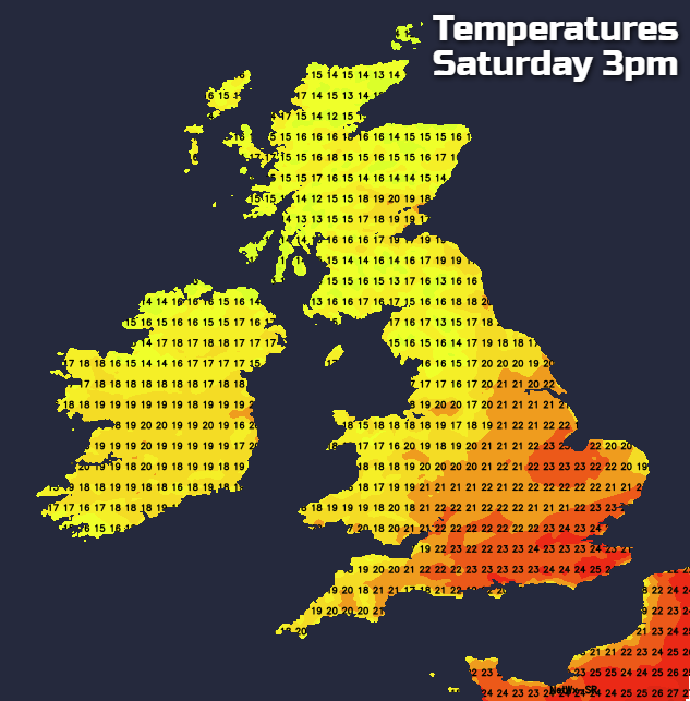
As the day wears on, the cloud should thin and break to leave many of us with sunny spells. There'll be a few showers around still though, these mostly affecting Eastern regions, especially in Scotland. Temperatures today will be warmest in the southeast, reaching 23-25c or so. Elsewhere, 19-22 will be more typical.
Overnight tonight, any showers should die back. Temperatures will fall into single figures in rural spots, mostly just hanging into double figures or the low-teens in towns and cities though. With light winds and coolish temperatures though, some misty patches may form by dawn, but these should quickly burn off tomorrow morning.
That leaves us with a similar, but not identical day to today. The most noticeable change will be that the shower risk will have switched from east to west, with northwestern parts, in particular, most likely to see a few popping up during the day. For the majority though, it's another bright, warm day with lots of sunshine. Temperatures will be about on a par with today.
During the day, southwest winds will start to increase, especially in northwest Scotland, northwest Ireland and through the Irish Channel. That's a sign of a more dramatic change on the way during Monday, as low pressure swings nearby.
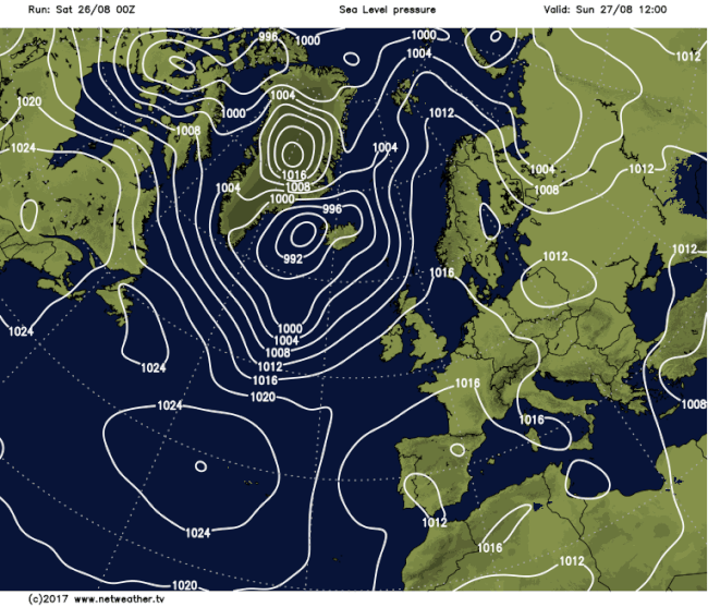
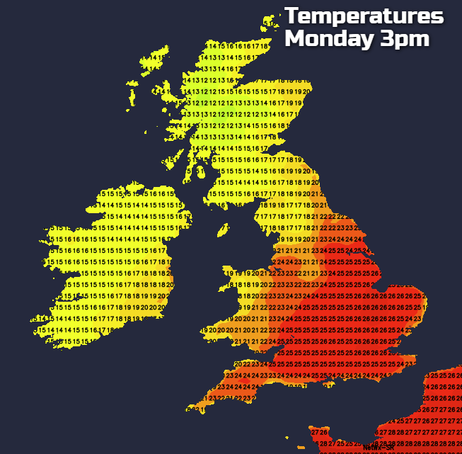
As you may have spotted on the animation above, it's only Scotland, Ireland and the far northwest of England that get dragged under the low pressure's influence on Monday. Leaving the majority of England and Wales still with high pressure and therefore another fine day. The only good news for those north of the border is that it's not a bank holiday at least!
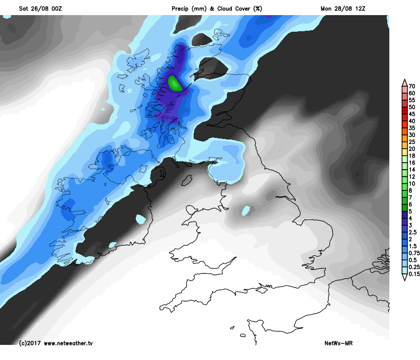
With the blustery wind, there'll also be a cold front moving down from the northwest during the day on Monday. This'll bring a spell of persistent and potentially heavy rain through, slowly edging further southeast. By lunchtime, it'll be half way across Ireland and nearly to southern Scotland, with brighter skies, fresher air and a few showers behind it.
Under the sunnier skies further south though, temperatures are going be up a notch on recent days. They'll peak into the mid-high twenties across a good part of central, southern and eastern England, the high teens or low twenties elsewhere. The northern half of British Isles will see those values tempered a bit by the wind though.
Into Tuesday, the cold front bringing the rain into Scotland will continue its journey southeast. The rain on it will fade pretty quickly though, so it'll eventually become a band of just cloud in the main. Even so, it's still going to be introducing fresher, cooler air behind it, which will leave just the southeast in the very warm, more humid air.
Further ahead, Wednesday could be a day to keep an eye on. We'll potentially have a two pronged attack with the weather front still in the southeast getting tangled with some thundery rain from the continent. At the same time, more rain will move up from the southwest across the northern half of the country. There's some uncertainty over all of this though, so stay up to date with the latest forecasts during the next few days.