It's Eclipse day in the US. Here we have tropical energy bringing warm and humid air and later the threat of heavy and thundery rain.
Americans and Eclipse tourists will be waking up today full of excitement and cloud dread. #Eclipseville is here with a total eclipse taking place right across the US around lunchtime local time, our evening in the UK. NASA TV will be streaming the evening live. Not quite the same as being there but still an incredible event which will pass over a huge amount of land and give great numbers of people the opportunity to view.
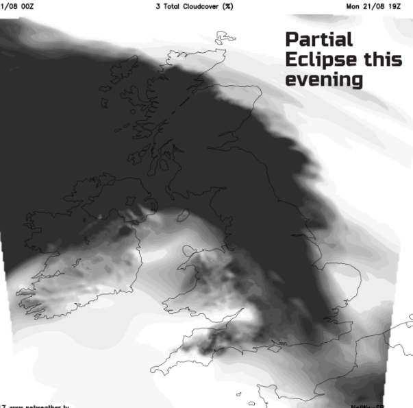
Back in the UK, we are going to have a lot of cloud. There'll be rain for northern and western areas, but you'll also notice how warm and humid it feels. Tropical air is being drawn up over the next few days, and it is going to feel muggy. The UK will fall under a partial eclipse this evening, but it could be quite tricky to see. The cloud for one thing, but also NE Britain is only under 1 or 2% partial eclipse, so barely noticeable and the sun will be very low in the sky, even below the horizon for the SE
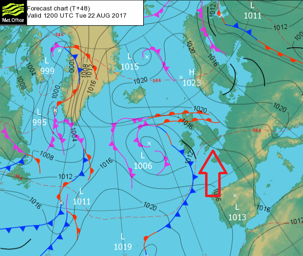
Our hot and humid air has tropical origins. Hurricane Gert was off the east coast of the US last week, and the remnants of this storm are now mixed up in an Atlantic low pressure slowly edging in from the west. It will churn about for days but will throw a lot of cloud our way, some heavy and persistent rain and feed up this sticky, warm airmass.
Today
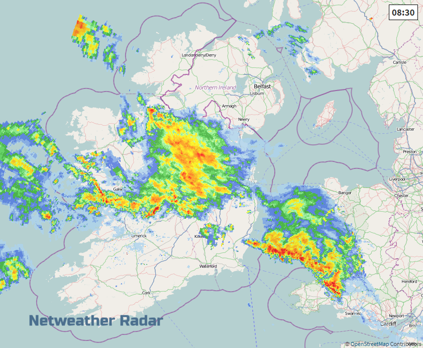
Eastern parts of Britain start the day with blues skies and sunshine, but there is cloud on the way. Much of the UK is starting Monday on a cloudy note, with mist and murk. There are outbreaks of light and patchy rain in the south and west. Heavier rain is already appearing over Ireland as the warm front appears. Behind this will be the much warmer and humid air. With so much cloud, temperatures should stay around 21C but it will feel close. Yet if breaks do peek through the cloud, then temperatures will rocket today and tomorrow
We have a light SE breeze this morning, veering to the South. The wind will pick up around Northern Ireland as the main area of rain arrives. This heavier rain will move over western Scotland later this afternoon and the frontal band will graze parts of Wales too and the Isle of Man. Elsewhere it will be a bright or cloudy day with sunny spells for the far NE, ahead of the frontal band and sunny spells appearing in for SW Britain.
Tonight
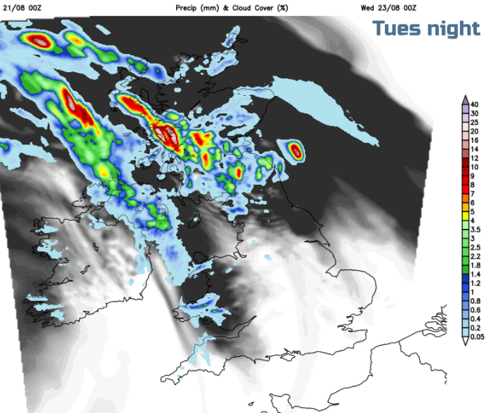
The area of persistent rain edges away from Antrim and Down and settles across the Central Belt of Scotland. Away from the north of Scotland, there will be the risk of heavy bursts of rain for central/southern and western Scotland with the frontal band weakening as it edges northwards by Tuesday morning.
Tomorrow
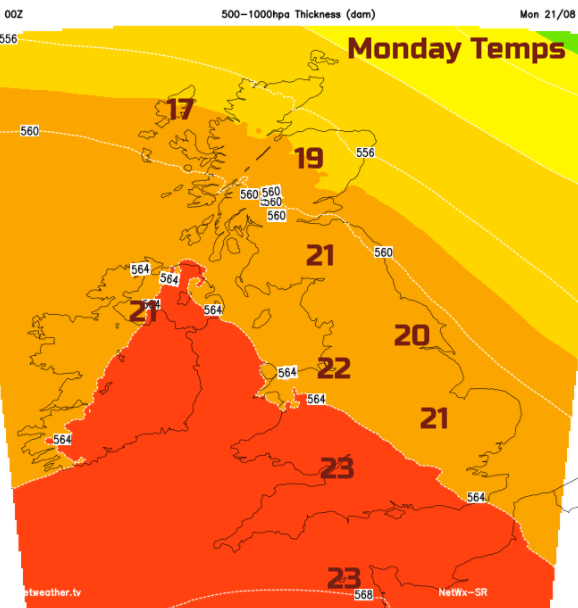
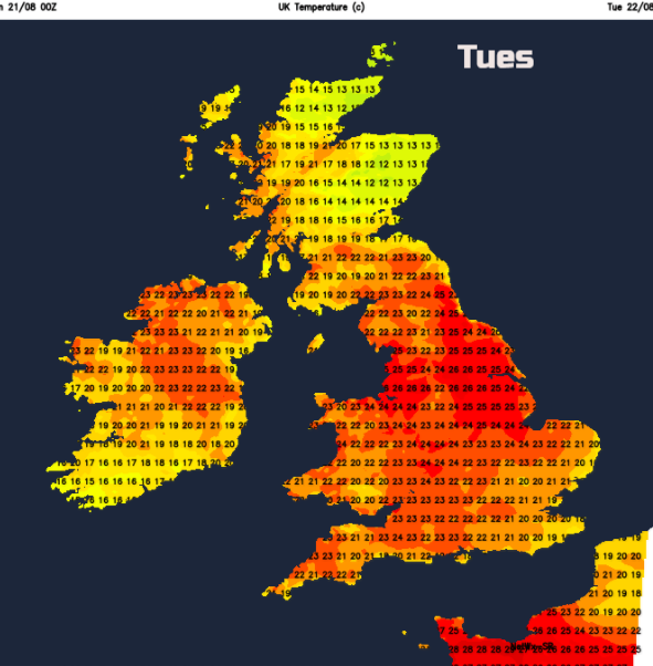
This leaves much of the UK in the warm sector with all the tropical air ready for Tuesday. Jersey could see 29C and mainland Britain 25 to 27C. The morning will start off quite grey and cloudy but sunshine will appear and the temperatures will then leap up.
There looks to be the risk of thundery showers breaking out for Northern Ireland and then western Scotland through the day. There could be localised flooding from these downpours. The rest of the UK will see another mixed day with cloudy, bright or sunny spells and this close warmth.
As the low pressure centre overs closer, the threat of heavy and thundery showers remains. More for northern and central parts of the UK during the second half of the week and the warm humid air will still be over SE Britain on Wednesday. Thursday and Friday look fresher, if the humidity is all too much for you.
.png)
More eclipse information and Chat on the Community forum Eclipse thread