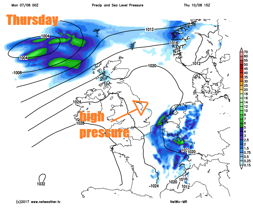
Low pressure will bring rain across much of England & Wales over the next few days, locally torrential. Drier conditions on Thursday before low pressure returns with wind and rain on Friday.
We start the new week with low pressure still in charge, which means an unsettled picture of showers or longer spells of rain over the next few days, in fact it could turn out to be a wash out for some on Tuesday and Wednesday, with rain locally torrential. Low pressure does move on east by the middle of the week, with a brief ridge of high pressure moving in for Thursday - bringing a day of dry and fine weather. However, on Friday it’s back to square one, as low pressure returns off the Atlantic bringing cloud and rain back. Staying rather cool for early August too, so not beach weather.
For now, a slow-moving cold front will bring a band of cloud and patchy rain this morning across SW England, Wales, through the Midlands and on towards East Yorkshire and Lincolnshire, the cloud and rain will eventually clear north Wales to brighter conditions. To the north of this, it’s a generally brighter or sunny picture this morning, though there will be some showers affecting NW England and western Scotland. The morning will stay mostly dry with some brightness across SE England, though cloud will thicken with some showery and mainly light rain arriving cross the northern Home Counties and East Anglia later this morning.
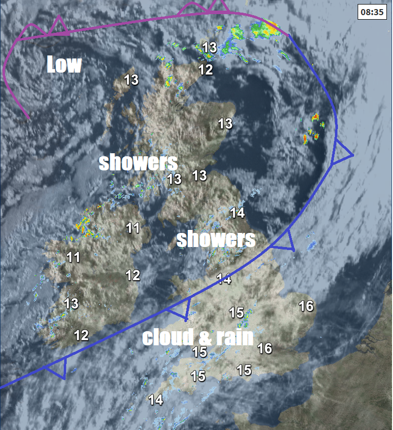
Rather cloudy across SW England, the far south of Wales, much of southern England, south Midlands and East Anglia through the afternoon, with some patchy light rain at times, perhaps some heavy and more persistent outbreaks towards the southwest. The far SE of England perhaps staying dry and bright. However, north Wales, north Midlands northwards staying bright or sunny though with some scattered showers across Scotland, N. Ireland and NW England, which will turn heavy and perhaps thundery across northern and eastern Scotland.
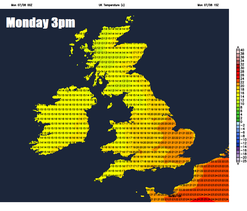
Temperatures disappointing again, reaching 17-19C for most areas away from SE England and East Anglia – where we could reach 20-22C with any sunshine.
As we head through the evening and overnight, the weather front across the south and southwest of England will begin to edge back north and pepping up too, so staying wet across SW England with rain returning to Wales, the Midlands and creeping into parts of northern England across to Lincolnshire by the end of the night. Becoming mostly dry and mild to the south of this rain band and to the north of it generally dry with clear spells and turning chilly, though showers will continue across the far northwest.
Tuesday will see a frontal wave lying roughly across central southern England, Midlands and on up to NE England which will pivot around an area of low pressure moving north to the east over the near continent. So, we will see further outbreaks of rain across SW and parts of central southern England, Wales, Midlands and northern England. To the east, some sunshine but also heavy and thundery downpours developing and pushing up from the south across SE England and East Anglia. Scotland and N. Ireland escaping with a drier and sunnier day, though some scattered showers developing. Rather cool again, temperatures reaching 15-18C generally, perhaps 19-20C towards SE England.
Still some outbreaks of heavy and perhaps thundery rain affecting central, southern and eastern England on Wednesday, locally torrential - bringing a risk of flooding. The rain only slowly clearing east, perhaps not clearing SE England and East Anglia until early Thursday. Elsewhere, drier and brighter with some sunshine – but everywhere rather on the cool side for early August.
Thursday is looking largely dry and fine with some good sunny spells and feeling pleasant in the sunshine with light winds. Cloud and rain arriving across the far northwest later on Thursday, heralding the next low pressure system approaching over the Atlantic, which will spread cloud, rain and strengthening winds southeastwards across many areas during Friday, though the SE of England and parts of East Anglia should stay mostly dry and turning drier across Scotland and N. Ireland in the afternoon.