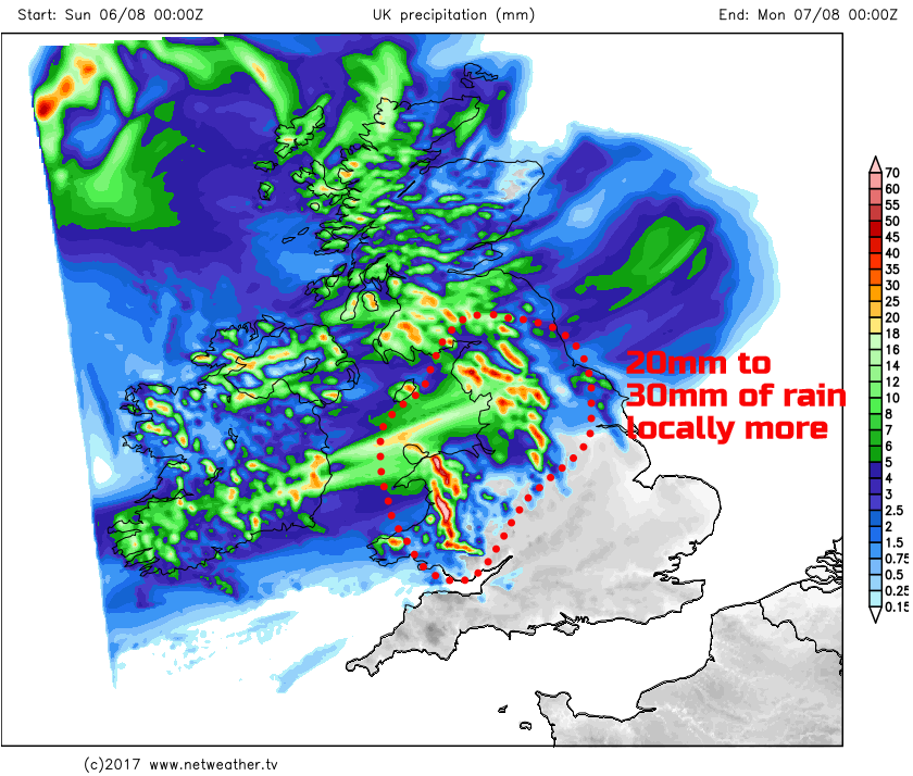
Longer spells of rain moving north and east today, locally heavy rain for Wales and NW England later.
The unsettled weather of the last few weeks is, unfortunately, set to continue and after the thundery downpours of Saturday, today brings a risk of longer spells of rain. Some persistent and heavy rain is forecast across parts of Wales and N England later on, bringing some locally large rainfall totals, more on that in a little while. Best of the weather today will be across more southern and south-eastern areas of England.
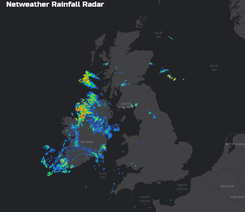
The next set of weather fronts is now producing some sporadic rain and showers across parts of Ireland, as evident on recent rainfall radar imagery. This wet weather will steadily move north and east through the rest of the day.
Ahead of the rain, there will be some drier and brighter weather this morning, particularly across some parts of northern and eastern areas of Scotland, along with eastern parts of England. Best of the weather though will be across central, southern and southeastern England. If you’re just getting up and about then it’s a glorious start here with plenty of sunshine present after what has been quite a chilly night for early August, with temperatures down to just 6C at Benson and Bournemouth.
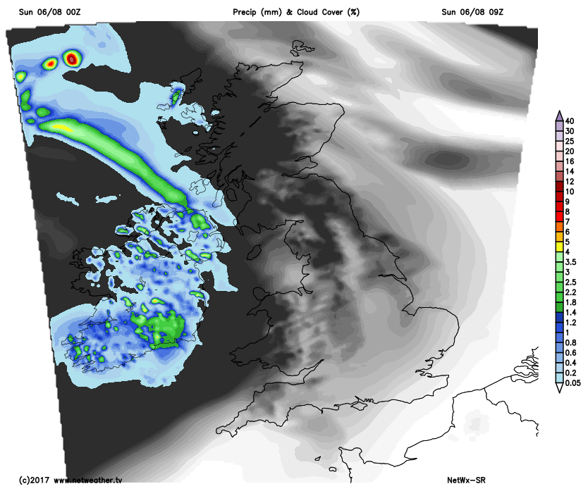
Towards the early afternoon and beyond and the wet weather will spread across much of Scotland and N England and Wales. As a result, if you’ve got any outdoor jobs to be done then definitely a case of getting them out of the way this morning. Once the rain sets in across parts of N England and Wales this afternoon, it will then become very slow moving. Persistent light or moderate, locally heavy rain will dominate the weather here throughout the rest of the day bringing about a particularly poor spell of weather this afternoon for early August. To the south and east of the wet weather, so across southern and south-eastern areas of England, it will remain dry with some bright or sunny spells despite increasing amounts of cloud.
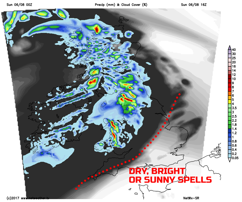
The persistence of the rain across parts of Wales and particularly NW England will mean some increasingly large rainfall totals through to the end of the day. Some areas, towards midnight tonight, may well have experienced up to 20mm to 30mm within 6 to 12 hours and the rain isn’t expected to clear until well into early Monday.
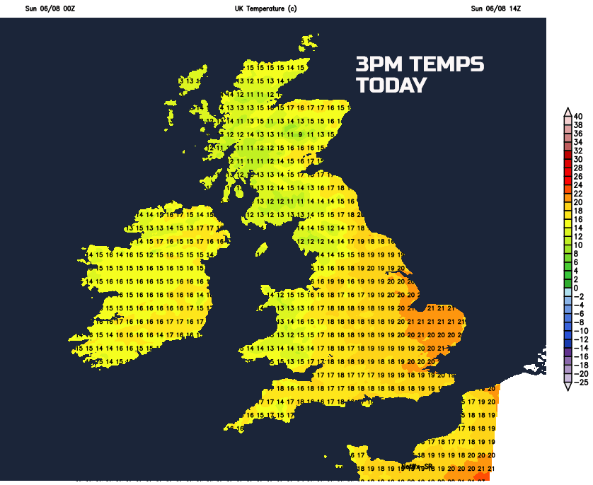
As you’d expect temperatures today will be highest across more southern and southeastern regions of England, where most of the sunshine will be. Maximum temperatures here ranging between 18C and 21C, which isn’t far from average. However, for many northern and western areas of the British Isles temperatures will be disappointing for early August. Beneath the wet weather across parts of Scotland, NW England and Wales temperatures may struggle to just 14C or 15C this afternoon.
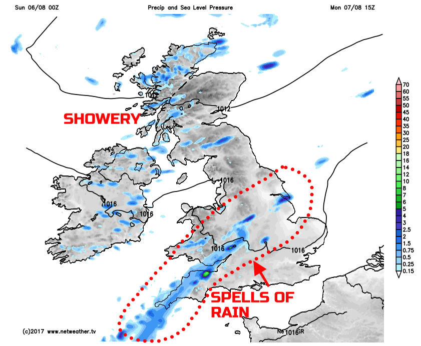
Overnight and through into the start of next week and those hoping for a change in the weather will, unfortunately, be disappointed. The wet weather that will plague parts of Wales and N England through the rest of Sunday will become slow moving through parts of the Midlands, Wales and SW England on Monday. As a result, a mostly cloudy and damp start to the new working week is forecast here. Further north and west, across Scotland and Ireland, it’s a mixture of the sunshine and scattered showers, these locally heavy across Scotland too with some possible downpours.
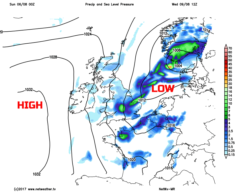
As we look further ahead through next week and it isn’t good news. While there are some uncertainties over the details, it does look as though low pressure will develop just to the south-east of England through Tuesday. The low-pressure will bring a more widespread risk of rain and showers across many areas through the day. Not only that a developing N or NE’ly wind is expected to, this making for an unusually cool spell of weather, especially across areas near to the North Sea. This low pressure is then set to maintain a risk of further heavy showers and perhaps longer spells of rain, across England and Wales during Wednesday, as a moderate or fresh, maybe even strong N or NE’ly wind continues.
There is a possibility that the region of high pressure to the west, by Wednesday, may well bring a more settled day into Thursday, but equally, this isn’t likely to last with further weather systems moving over the top of the high pressure into Friday. So, the wait for some summer weather does continue and at times some further poor weather, for August, is on the way through the coming week.