Met Eireann have named a low bringing severe gales to Ireland today Storm Ewan, which will also bring gales and heavy rain to northern and western UK. Colder conditions with heavy and thundery showers bringing hill snow to start the new week.
We will see more wet and windy weather later today and through much of the new working week, as a strong Atlantic jet stream ploughs across northern Europe, bringing a succession of low pressure systems across the UK. Some parts will see gales return, but aswell as more rain - hail, thunder and snow will be in the mix too.
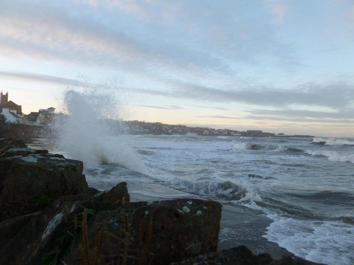
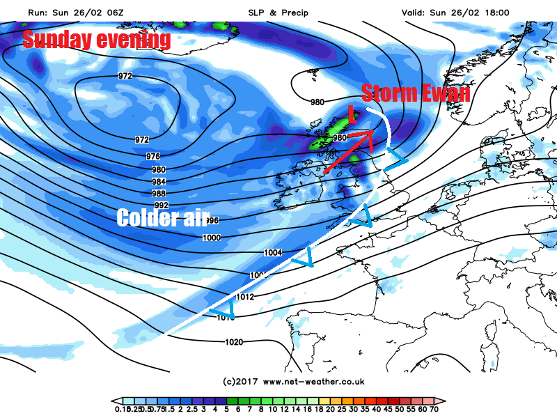
A frontal wave running northeast just north of EIRE today and deepening into a depression by the time crosses the north of Scotland tonight has been named Storm Ewan by Met Éireann, though has not been named by the Met Office. Storm Ewan will bring strong south to southwesterly winds gusting to 65-75mph across southern and southeastern coastal counties of Ireland today, with 55-65mph gusts elsewhere. But the deepening low will also bring a swathe of very strong winds northeastwards across the Irish Sea, north Wales, NW England and Scotland from late this morning through to Monday morning. For these areas, a spell of winds gusting up to 50-60mph inland likely, while up to 70mph possible with exposure over windward coasts and hills. Not on par with Storm Doris the other day though.
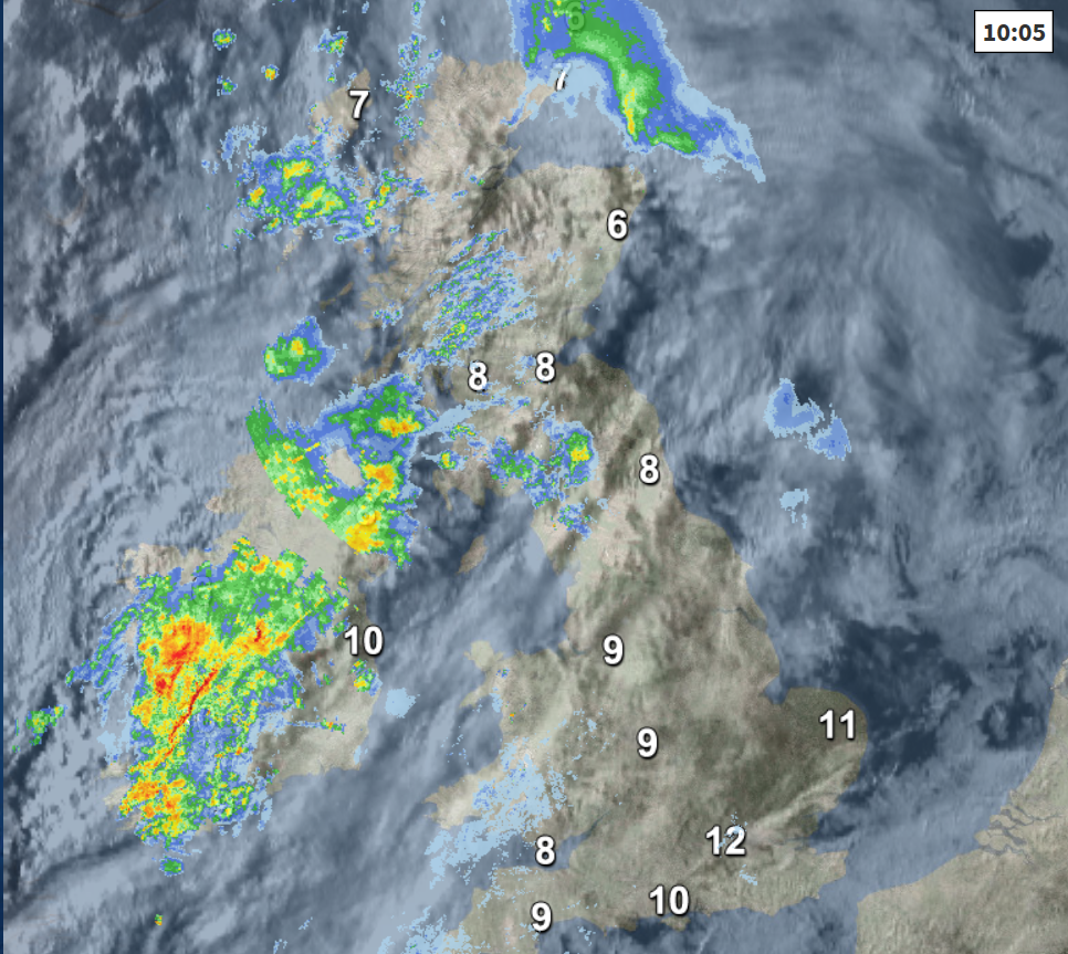
Starting off across the north and west this morning: Scotland, Northern Ireland, EIRE, north Wales and Cumbria are cloudy, wet and windy this morning, as a frontal system arrives ahead of Storm Ewan. After a cold start the rain is turning to snow over the Highlands of Scotland too. Southerly winds will continue to strength through the morning, already gusting to 40-50mph through the Irish Sea and north Wales.
Outbreaks of heavy and persistent rain continuing to spread east across Scotland, N. Ireland, northern England through today, while also spreading across Wales and SW England later this morning and into the afternoon after a drizzly morning, winds increasingly all the time, with gales across the west. Brighter but colder and showery conditions arriving from the west for EIRE and N. Ireland this afternoon.
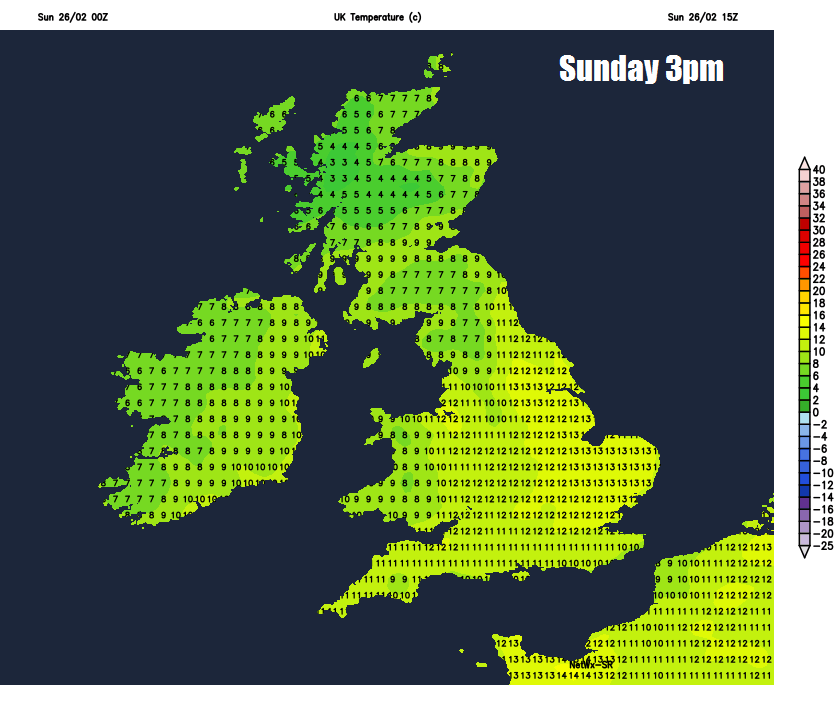
After a bright but mild start across eastern England, temperatures already 10-11C at 8am, it will it be a rather cloudy but dry Sunday, though the cloud thick enough to bring some patchy drizzle over hills and southern coasts.
Mild across England and Wales, temperatures reaching 10-12C. Colder across Scotland and N. Ireland, with temperatures reaching 7-9C at best.
Then this evening and overnight – a fragmenting band of rain spreading east across England and Wales, clearing southeast England in the early hours. Then colder and showery conditions following, most of the showers across western areas – where they’ll be heavy with hail and thunder near coastal areas and falling as snow over higher ground of the SW Moors, Wales, N. Ireland, NW England and Scotland. Windy for all, but severe gales across northern and western areas.
Colder for all on Monday, with a brisk southwesterly wind blowing heavy showers across all parts – accompanied by hail, thunder and falling as snow over northern and western hills. Strongest winds across the south this time, with gales through the English Channel. Temperatures reaching 5-6C across Scotland and N. Ireland; 7-9C across England and Wales. Feeling colder in the strong wind across the south.
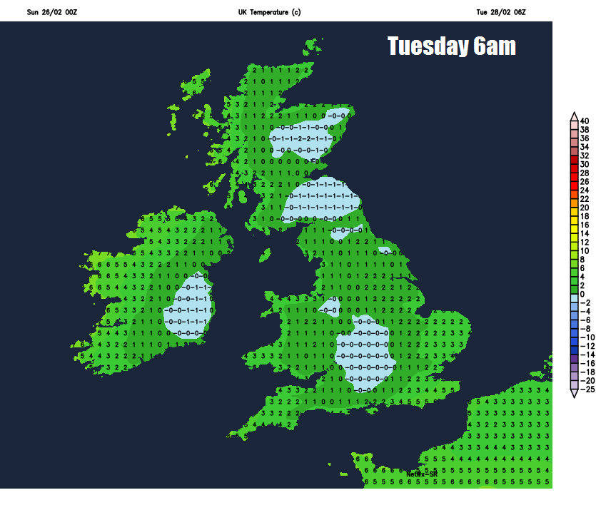
Showers and wind then easing away from southern and western coasts into Monday night, with a widespread frost likely inland, an air frost across the north. So, could be some icy patches forming where showers have fallen. So, a chilly but bright start to Tuesday, but further showers developing and pushing through and a strengthening northwesterly wind, showers heavy in places, with more general rain with hill snow across the north and gales developing across the northwest.
After a frosty, perhaps icy but mostly dry and bright start, Wednesday will see cloud thicken and outbreaks of rain spread northeast across most parts from late morning through to the evening. Thursday perhaps drier and brighter for England and Wales once early rain clears the east, cloudier with showery rain spreading across Scotland. Some uncertainty for Friday, but it looks likely to be windy with showers or longer spells of rain spreading northeast.