
Blog looking at a major winter storm arriving across eastern U.S Friday evening, bringing blizzard conditions from Virginia to New Jersey through to Saturday night. 1 to 3 feet of snow could fall around Washington D.C.
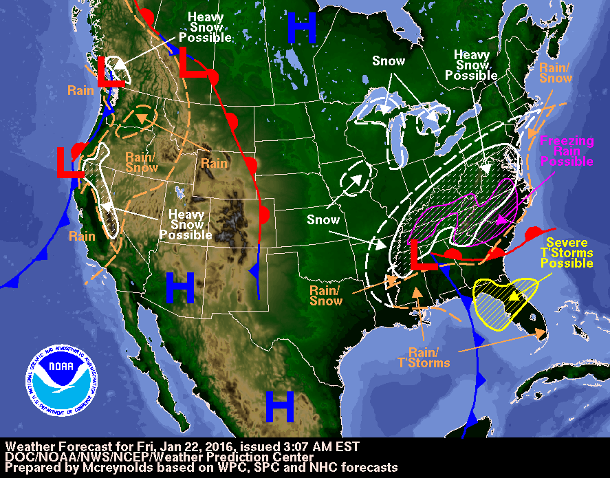
The Atlantic states of eastern USA are bracing for a major winter blizzard that is already starting to unfold and could bring 1-3 feet of snow to Washington D.C., Baltimore and Philadelphia and blizzard conditions as far north as New York City – where a foot of snow is possible.
An area of low pressure, which moved out of Texas earlier on Friday before crossing over the SE U.S. states of Alabama and Georgia early Friday afternoon local time, will deepen as it tracks NE before exiting somewhere along the Atlantic coast of Virginia later on Saturday local time.
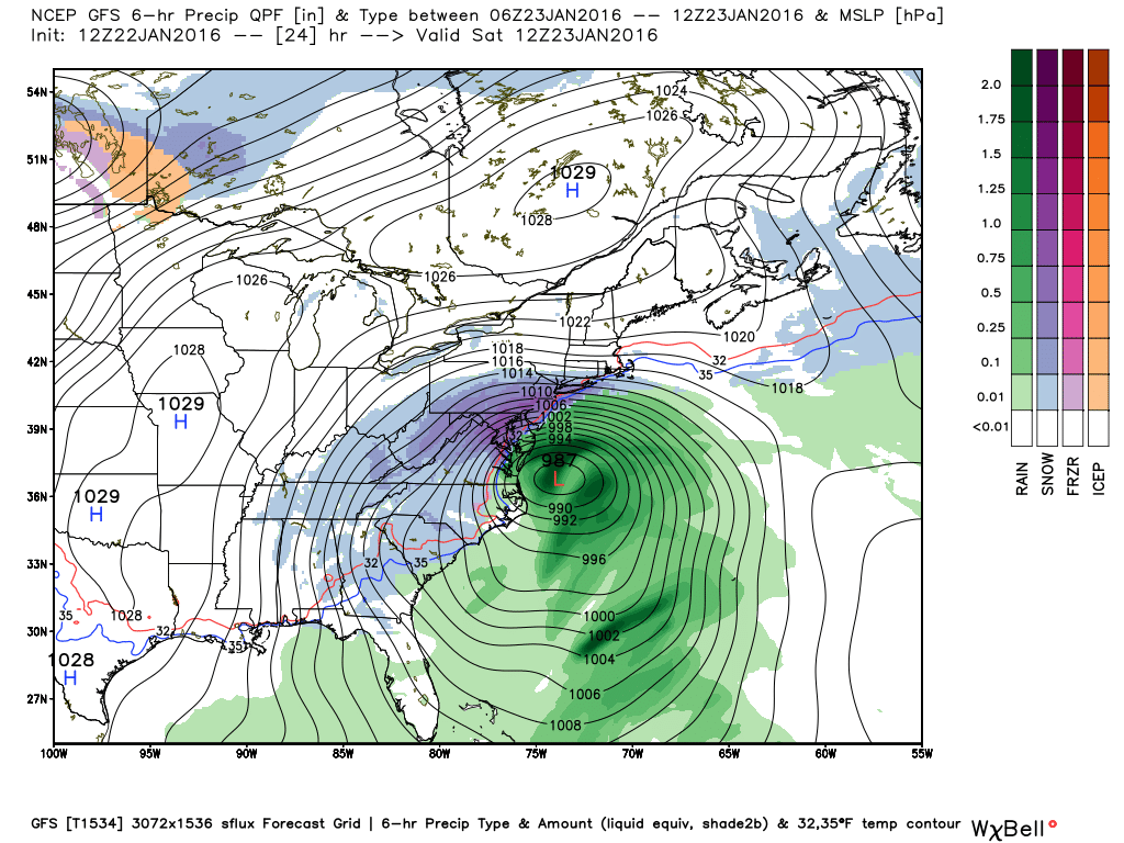
Deepening area of low pressure moves NE from Gulf States of SE U.S. towards Virginia over next 24 hrs (charts courtesy of Weatherbell.com)
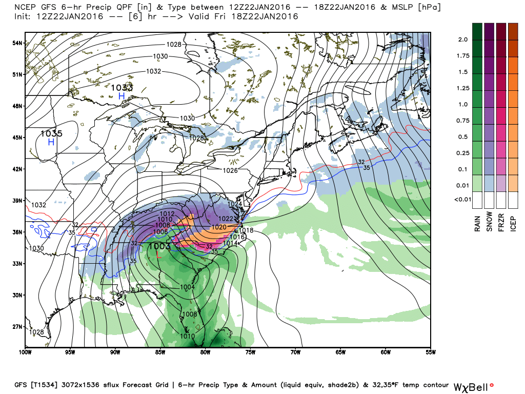
This is a classic set-up for a mid-Atlantic major blizzard, with an area of high pressure over the Great Lakes to the north which will feed in very cold air from the north into the northern flank of this low. The deepening low already has a lot of moisture wrapped up into it drawn from the Gulf of Mexico and will also draw in very moist air from the southeast off the sub-tropical Atlantic as it arrives later tonight and through Saturday. So where we have this cold air and moisture mixing – there will be a lot of snow.
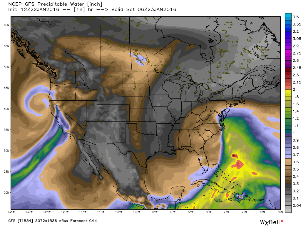
Cold dry air dragged in from the north and warm moist air from the south fuelling this winter storm

Precipitable Water (PWAT) chart below shows moisture being dragged into this system form the Caribbean - hence large snowfalls (image courtesy of Weatherbell.com)
Blizzard conditions will unfold from northern Virginia to southwestern Connecticut from Friday night through to Saturday night local time, crippling transport in major cities such as Washington D.C. Baltimore, Philadelphia and New York. Periodic whiteout conditions will occur farther west from south-central Pennsylvania to part of western North Carolina. The deepening storm arriving over Virginia Friday night and only slowly moving out into the Atlantic on Saturday will bring strong wind gusts of 40-60mph along coastal areas of the U.S. mid-Atlantic from Boston to the outer banks of North Carolina, which will cause large surf and coastal erosion.
So the low has been slowly trundling through SE USA Friday bringing severe thunderstorms here, and bringing snow on its northern flank from Little Rock in Arkansas through to Memphis and Nashville in Tennessee, even some thundersnow in places. So there is a lot of energy and moisture in this system. As it further deepens upon arriving across the mid-Atlantic states, the winds will strengthen and the snow will get even heavier on the lows northern flank from Friday night through Saturday.
Although the capital has seen snow flurries today, the heavy snow is expected to arrive in Washington around 3pm Friday local time (8pm UK time), Philadelphia 6pm Friday local time (11pm UK time), New York around midnight local time (5am UK time), but not across Boston until Saturday afternoon.
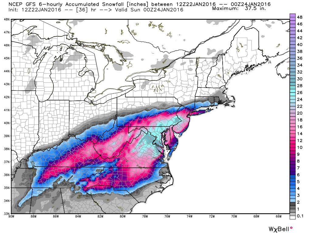
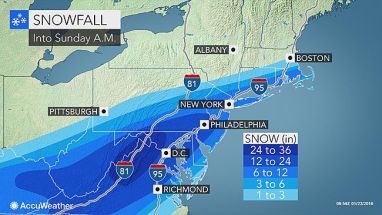
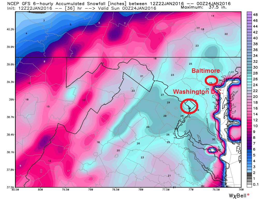
The highest amount of snow is forecast to fall around Washington, Baltimore and Philadelphia – where 1 to 2 feet (12 to 24 inches) of snow is likely, probably towards 3 feet (36 inches) to the west of D.C. towards the Appalachians. New York could see 6-12 inches – so up to a foot. Less than this in Boston which will be the very northern limit of the heavy snowfall.
12z GFS snowfall accumulation charts for eastern seaboard states and accuweather snowfall show areas seeing the heaviest snow (GFS chart courtesy of weatherbell.com)
Snowfall rates from Virginia to New Jersey will be 1-3 inches per hour at times, the strong winds will likely cause massive snow drifts, blocking roads and shutting down major interstates, not to mention the shut-down of airports and the knock on effect to international flights. The blizzards will likely bring down powerlines, with power out for days in some rural locations.
States of emergency declared in Maryland, North Carolina, Georgia, Pennsylvania, Virginia and the District of Columbia, with over 50 million people likely to be affected by this winter storm.
It is quite unusual for the mid-Atlantic to see this amount of snow forecast, the record for snowfall in Washington D.C. is 28 inches (71cm) that fell in a 2-day period in January 1922. So this storm, forecast to bring similar values in D.C. according to the 12z GFS (below), will be all the more paralysing compared to back then.
Will bring updates on how the winter storm progresses over 24-36 hrs.


