Synoptic Analysis - More rain woes for flood-affected parts over next few days and next week, but signs of a change to colder and wintry weather for the New Year?
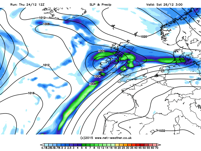
It really troubles me to discuss this with Christmas upon us, but I feel those that maybe directly affected and those who aren't should know about the disruption that further rain will bring over the coming days. A new Atlantic weather system following hot on the heels of Storm Eva, which brought heavy rain and strong winds earlier today, looks to bring a renewed risk of flooding this weekend, as rain arrives on Christmas Day and doesn’t look to clear parts of Wales and northern England until later on Boxing Day.
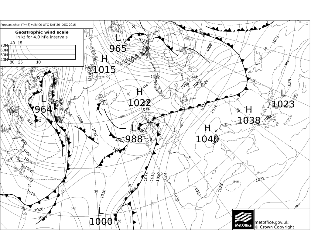
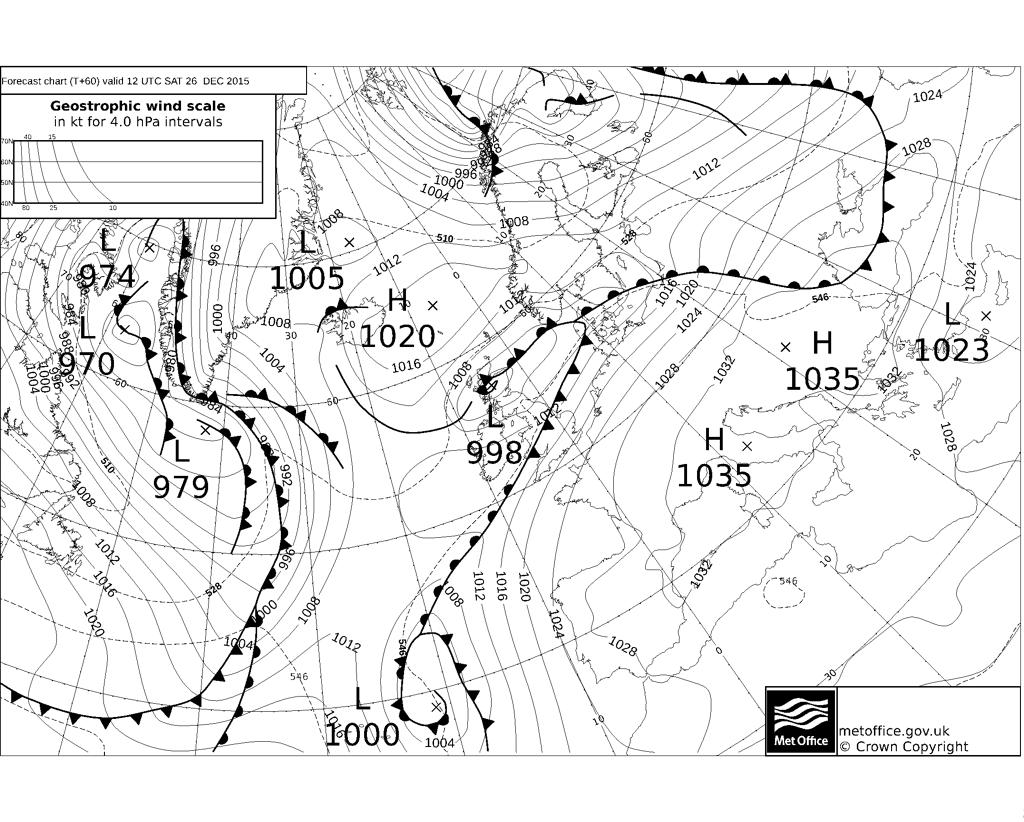
The next low pressure system to bring wind and rain to the UK later on Christmas day is currently mid-Atlantic to the north of Azores and will track northeast close to the west of Ireland later on Christmas Day before crossing northern Scotland on Boxing Day. It’s not just the rain wrapping around the rain this low that is an issue, the trailing cold front looks to become slow-moving across Wales and northern England before clearing SE Saturday evening.
Before then, a dry and chilly respite tonight, with a touch of frost and some wintry showers in the north, the Higlands, southern Uplands, Cumbrian Fells and northern Pennines may even wake up to some snow over the higher elevations. So a festively chilly start on Christmas Day, before cloud, rain, milder air and strengthening winds spread up from the SW across England and Wales during the morning and afternoon.
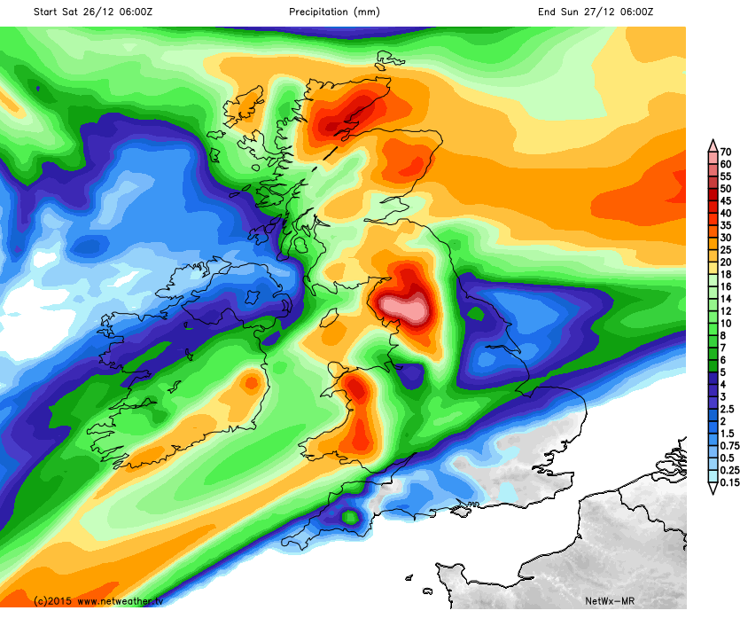
24 hrs rainfall totals from the Netweather Model indicates 70mm+ over Cumbria between 0600hrs Saturday and 06hrs on Sunday. Though this is the upper end of totals compared to GFS who have 40-50mm max.
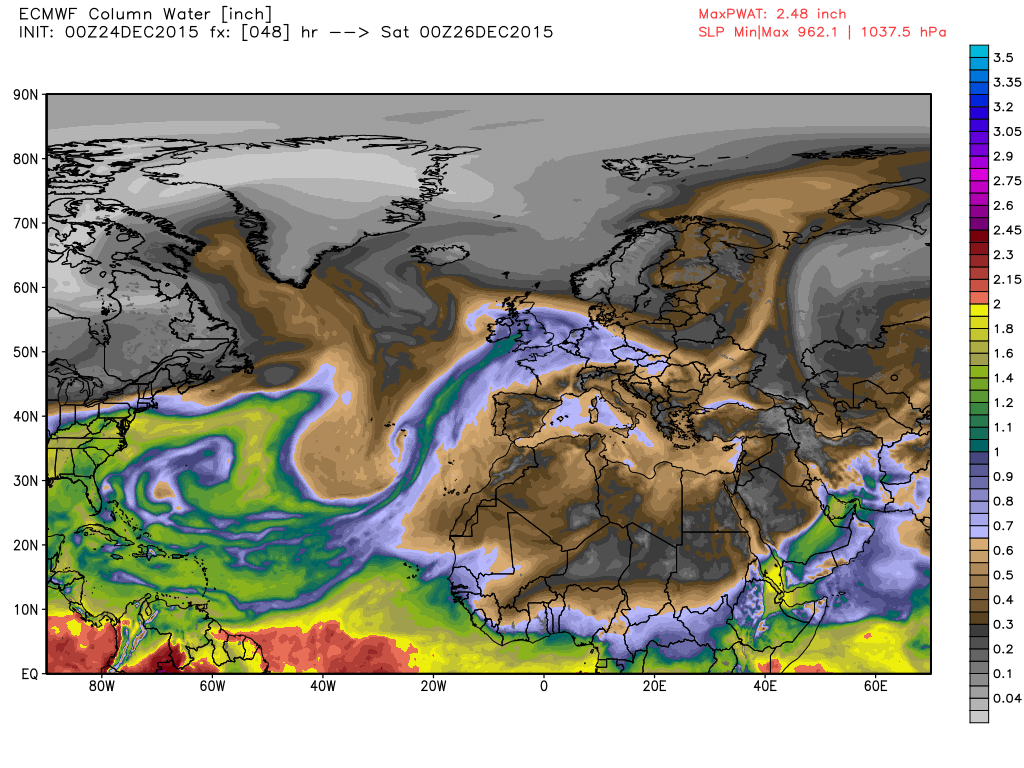
The UK will, again, be at the end of an ‘Atmospheric River’ of tropical moisture which will stream northeast from the sub-tropics, as the Precipitable Water (PWAT) chart below indicates:
This warm moist air forced to rise and condense into rain clouds along the frontal boundary across central parts from later tomorrow into Boxing Day – the rainfall amounts exacerbated and increased by the mountains of Cumbria and north Wales.
Fax charts from the UK Met Office below show the next troublesome low arriving later tomorrow, its trailing cold front slow to move from central parts on Boxing Day
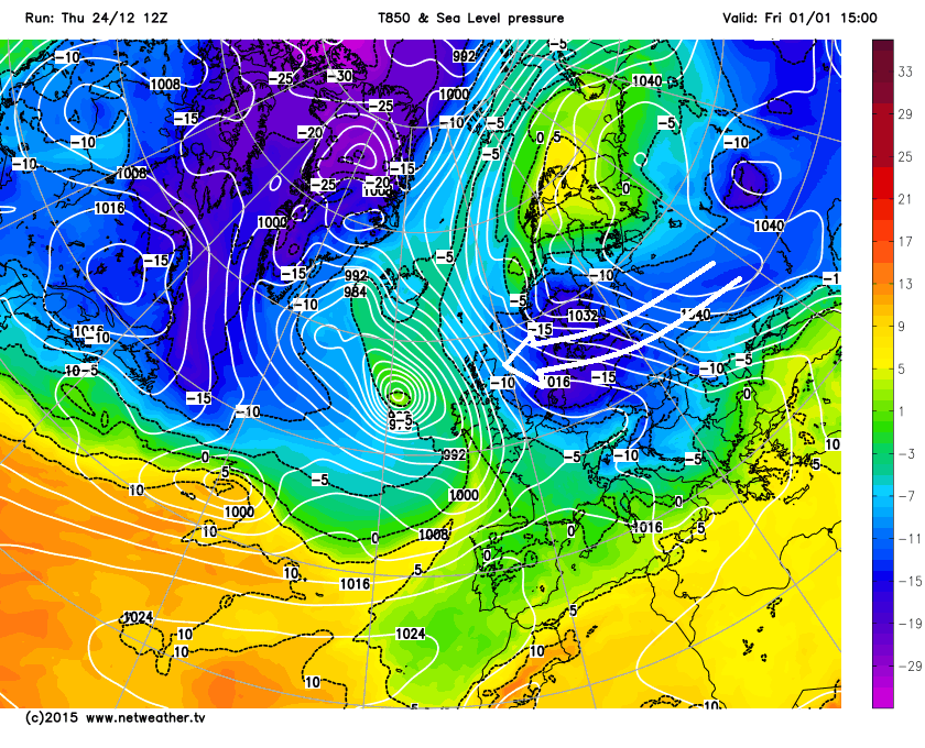
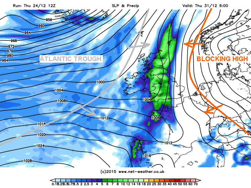
Unfortunately the weather models show more rain on the cards next week too, as further Atlantic frontal systems move in from the west. Worryingly, the fronts may become slow-moving later in the week, as a strong blocking high pressure system builds to the east over Scandinavia and eastern Europe.
Stalling front over the UK shown for next Thursday on 12z GFS this evening
This stalemate is causing GFS to throw out some interesting scenarios on the last few runs with regards to potentially much colder and wintry weather across the whole of the UK early January via cold air coming from the east. However, until there is support from the ensembles and other weather models, low confidence in this potential for now.