A look back at a wild Sunday courtesy of Storm Clodagh, which brought an 89mph gust and snow to Scotland. A look ahead to want's in store as we enter early November.

The weather is in a rather unsettled spell at the moment, thanks to a very strong 200mph+ Atlantic jet stream racing across the Atlantic and the UK this weekend, driven by a steep temperature gradient over the far north Atlantic created by cold air draining from a deep cold vortex over Greenland and warm tropical air to the south. A vigorous low pressure system caught under this strong jet, officially named Storm Clodagh by Met Eireann, has brought storm force winds to parts Ireland, Northern Ireland, Wales, northern England and SW Scotland on Sunday, with severe gales widely elsewhere.
The midday Sunday UK Met Office fax chart shows the centre of Clodagh at 980mb over SE Scotland at 12z. This central pressure is not particularly deep for a low in late November, however, a tight pressure gradient exists between the low centre and a high pressure of 1036mb centred over northern Spain on Sunday.
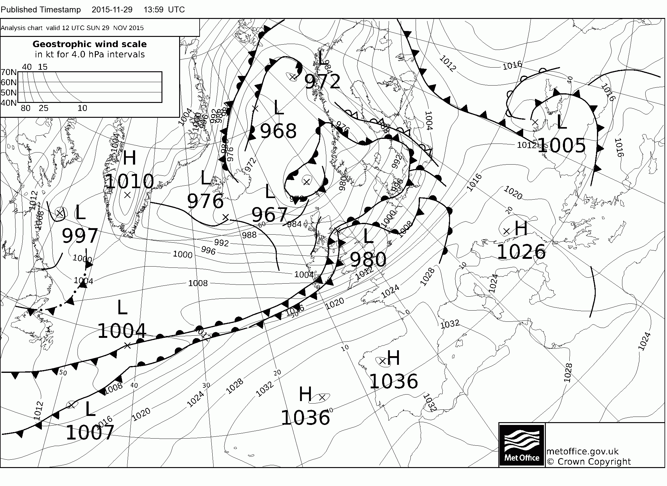
Top wind gust on Sunday was 93 mph at Capel Curig (215m) in north Wales, 75mph was recorded at Dundrennan in Dumfries and Galloway, 70mph at St Bee’s Head (123m) in Cumbria and also Aberdaron (93m) in west Wales. Gusts of 80-90mph were recorded above 250m over the Pennines. Ireland has seen gusts of up to 75mph along western coasts, with a number of flights cancelled, delayed or diverted. 4,000 homes were without power for a time as the strong winds struck this morning. Ferry services from Pembrokeshire to Ireland and ‘fast craft’ sailings from Angelsey have been cancelled. Clodagh moves across Denmark and on across the Baltic Sea/southern Sweden Sunday evening, a ‘sting jet’ similar to that seen in the Great Storm of 1987 is believed to have formed over the North Sea. Gust of 89mph has been recorded at Blåvandshuk on the SW coast of Denmark, with gusts of 80-90mph possible Sunday night across Denmark, southern Sweden.
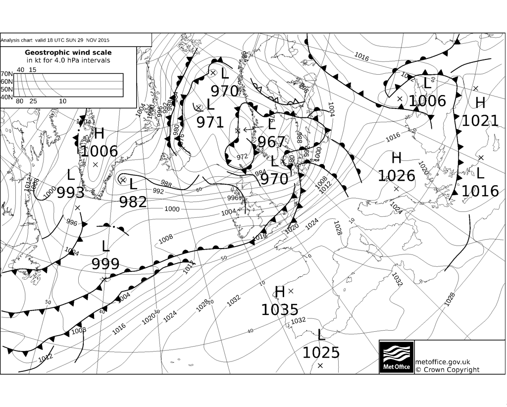
T+00 UKMet fax chart for 1800hrs Sunday 29th Nov 2015
To the north of this low pressure system crossing the far north of England/Scottish borders, it’s been quite a wintry day across parts of Scotland, with some parts waking up on Sunday to large amounts of snow. While all major north-south routes from the central belt to northern Scotland became impassable or closed at times today because of snow or crashes created by snow and ice. Snow fell in Aberdeen on the east coast this afternoon, with up to 6 inches(15cm) settling inland across Aberdeenshire, with more snow on the way Sunday night.
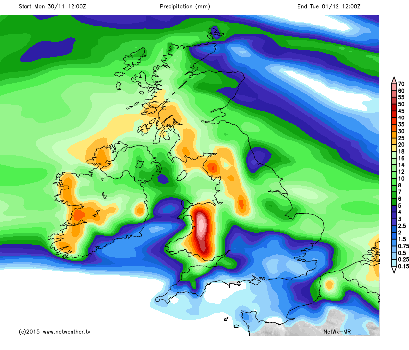
The wild weather looks set to continue into the new week too. The next low pressure system rolls in on Monday under the strong jet, following a path a little further south than Sunday’s system across northern England. Winds won’t be quite as strong, but still gusting to 40-50mph around southern and western coasts and over exposed hills. Rain with this system will be heavy and persistent across NW England, north and west Wales, so with the ground saturated from recent rains along with rivers on flood alert, there is a risk of rivers bursting their banks as up to 80mm (3 inches) falls over the next 24-36hrs. As the rain reaches Scotland and the hills of northern England, it will turn to snow as it hits the colder air to the north.
A very brief ridge of high pressure builds in from the west ahead of the next system early Tuesday, so we could see -10C over the snowfields in the Highlands of Scotland first thing. After a bright start, cold in the north, the next Atlantic frontal system rolls in spreading rain across most parts during Tuesday, preceded by snow across Scotland. Potential for quite a bit of snow Tuesday morning rush hour across Scotland, even at lower levels, as a frontal system arrives from the SW and bumps into cold air. Milder air floods northeast across all parts by the end of the day, temperatures reaching 12-14C across England and Wales, 8-11C eventually across Scotland after the cold start.
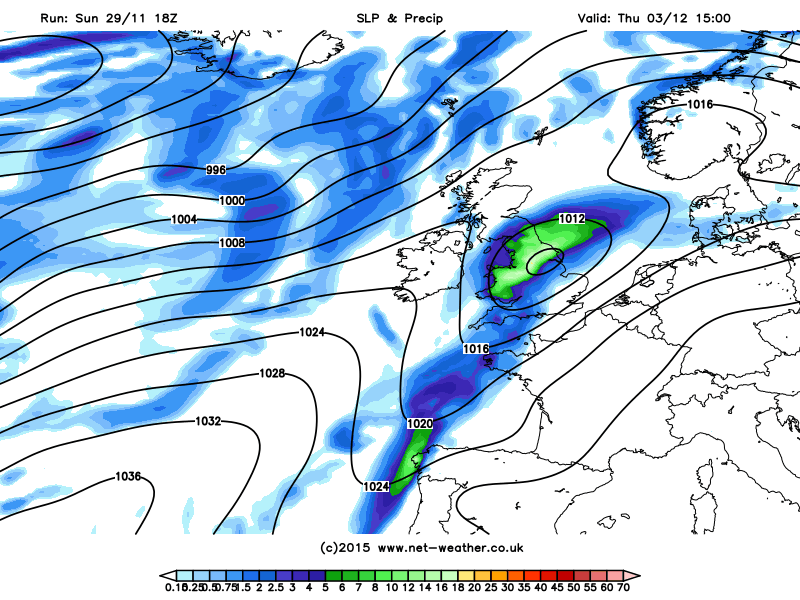
A cold front pushes in from the west on Wednesday, bringing some rain in across northern and western areas, followed by colder and showery conditions in the northwest. Staying mostly dry, bright and mild across central, southern and eastern parts The cold front moving southeast Wednesday then stalls across England and Wales on Thursday, as a wave develops from the southwest. This may bring a rather wet day across England and Wales on Thursday, before the rain clears to colder and clearer conditions on Friday across all parts.
Low develops along frontal wave on Thursday, bringing a wet day for some
Models then indicate winds turning from westerly to southwesterly later on Friday, with milder conditions returning for the weekend, Atlantic fronts and rain perhaps confined more to northern areas though, as the jet stream shifts north to allow pressure rise across southern parts, thanks to an upper ridge drifting east on the near continent. High pressure influence across the south is indicated not to last, though, beyond next weekend as the jet dives south again with wind and rain returning across all parts.
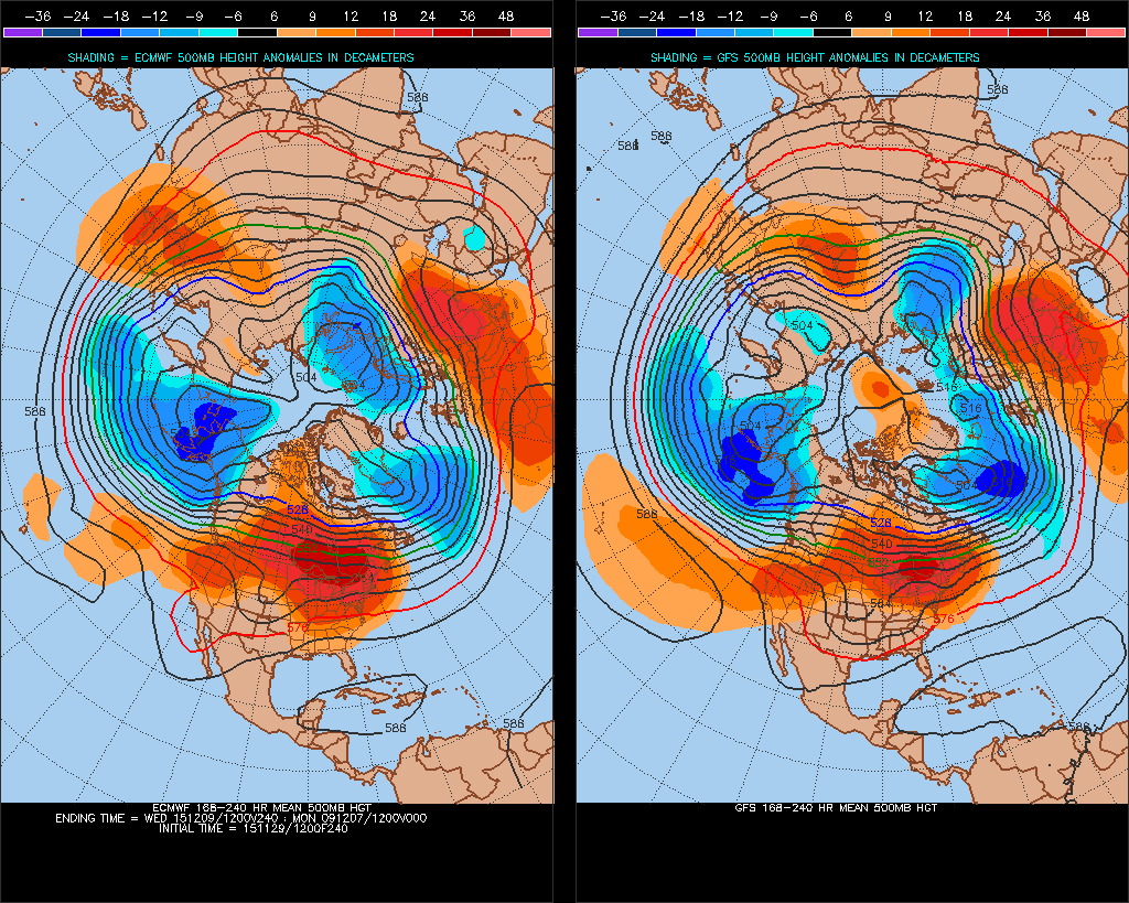
Indications are from extended model operational output and their ensembles that the very mobile westerly flow will continue bringing unsettled conditions through to mid-December and perhaps beyond, given there are no signs of blocking anywhere in the higher latitudes of the northern hemisphere. A strong and deep cold polar vortex within the arctic circle generally keeping cold air locked up there from Europe and North America, though there maybe be enough amplitude within the waves in the westerly flow to bring brief bouts of colder air to the UK, with wintriness to northern Britain.
ECMWF and GFS 8-10 day H500 comparison in generally good agreement of the mobile and unsettled flow continuing