Blog looking at Hurricane Joaquin which targets Bermuda Sunday and indirectly brings historic and devastating floods to South Carolina.
Hurricane Joaquin’s protracted assault on the Bahamas over the last few days has caught a number of numerical weather models out, which were originally taking the centre of the Hurricane north in across the central states along the east coast of the USA. However, Joaquin has proved to move slower than many models anticipated, a faster track would have meant it could have made landfall along the eastern seaboard.
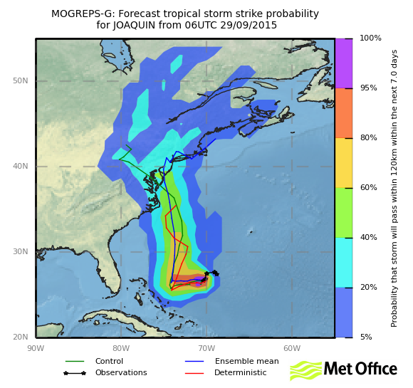
Most model guidance was originally making landfall with Joaquin along eastern U.S. (This image courtesy of UK Met Office)
One model run, the ECMWF deterministic turned out right though, it stuck to its guns, by turning it north from the Bahamas then NE away from landfall along the eastern Seaboard – which stood it alone from the other models and even its own ensemble consensus. But it paid off and turned out that it has handled correctly the likely path, probably because it had a better handle on the upper flow over North America. It was probably more accurate in modelling the faster digging of an upper trough over SE USA and slower movement of Joaquin. Had the trough been slower and Joaquin faster, it may have made landfall. Hurricanes tend to follow the path of least resistance, so will not move up against a deep trough, but Joaquin will instead move NE between the SE US trough and upper trough further east over the mid-North Atlantic – where upper winds will be weaker and pressure aloft higher. Hurricanes only maintain their strength or strengthen when upper winds are light and vertical shear is weak.
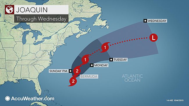
Hurricane Joaquin was downgraded today from a category 3 to a Cat. 2 Hurricane with 110 mph sustained winds and higher gusts to around 130 mph, so still a strong life-threatening storm. While it was over the Bahamas further south, it was a category 4 hurricane. Joaquin is forecast to track north-northeast, with the centre passing just west Bermuda Sunday afternoon and evening local time. Hurricane conditions are expected to reach Bermuda Sunday afternoon. 3-5 inches of rain are expected across Bermuda from late Sunday local time through into Monday, with large swells and large waves causing significant beach and dune erosion. The Hurricane is expected to further weaken as it continues northeast over the next 48 hours and encounters an increase of vertical wind shear and drying out of the mid-level environment. Joaquin is then expected to become an extratropical low in 3-5 days, as it moves over cooler waters further north and encounters stronger wind shear.
Hurricane Joaquin track and category through until Wednesday (courtesy of Accuweather)
Although Joaquin won’t make mainland USA landfall now, it will still have large indirect impacts along the eastern Seaboard. Copious amounts of tropical moisture wrapping around Joaquin and surging west towards the eastern seaboard combined with a stalled cold front and upper low over SE USA forcing ascent of this moist air, is unleashing large amounts of rainfall – more particularly across South Carolina and far SE of North Carolina, an area which has already seen days of rainfall. As of late Sunday AM local time, 18.39 inches of rain have fallen near Colombia, SC since the rain started on Friday, Charleston Airport, SC, has seen 16.6 inches of rain for the same period, with some stations recording close to or in excess of 20 inches of rain, with Boone Hall Plantation just east of Charleston near the Atlantic coast recording 24.23 inches – which is around 2 feet of rain!
Image courtesy of The Weather Channel

This is an historic rainfall event, with meteorologists already suggesting this is a 1-in-500 year rainfall event. This amount of rainfall is already causing some catastrophic flooding in South Carolina, which is life-threatening, with at least 5 people killed as a direct result of the floods with worries this number may rise. President Obama has called a State of Emergency for South Carolina with Federal Reserves being used to help those with the worsening situation. Lives and property are at threat, with water rescues increasing as river levels rise affecting peoples’ homes and submerging roads, exacerbated by numerous dams being breached. The storm/low pressure system bringing the rainfall is not likely to clear until Tuesday, so another 4-8 inches of rain is possible across the Carolinas towards the Atlantic coast. So the situation will likely worsen further as we head into Monday.
In addition to the emergency situation created by the historic rainfall, high seas whipped up by Hurricane Joaquin to the east are producing coastal flooding and beach erosion along the eastern seaboard as far north as New England, particularly at high tide.
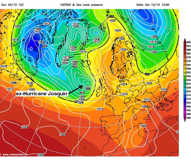
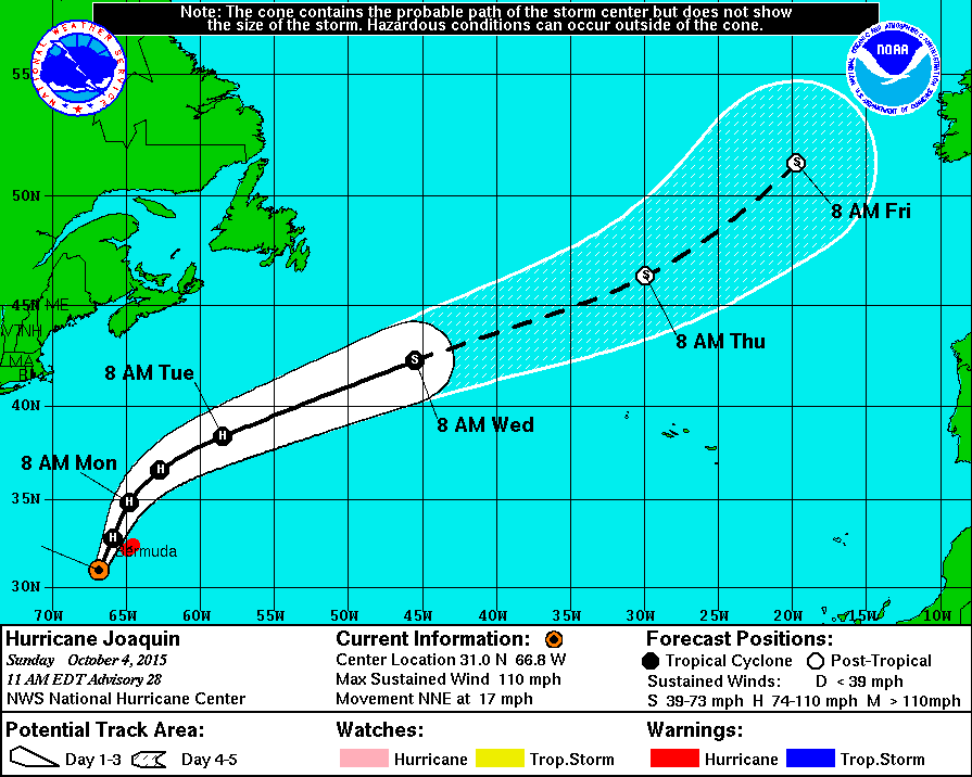
Hurricane Joaquin is forecast to become post-Tropical on Wednesday as it continues NE over the mid-Atlantic. The USA National Hurricane Centre suggests a probable path of the ex-tropical depression below.
12z GFS has it as a deep depression that moves NE to the west of Ireland by the weekend, before swinging north towards Iceland on Sunday. It’s movement northeast towards northern Britain thwarted by a stubborn blocking high over Scandinavia. So although it looks like the UK will be spared from this potentially vicious ex-tropical depression, the exact track shouldn’t be relied on from model output this far off.