
While today feels cold for late April, with a touch of frost first thing in some places, it's a far cry from the icy freeze of the 1981 blizzard.
Today marks the 43rd anniversary of the great snowfall of 1981, when a two-day blizzard brought chaos to the country, blocking roads and causing power outages. At midday on the 25th, we saw 10cms of lying slushy snow at my station in Nottingham, with a remarkably low top temperature of just 2C throughout the day.
You may say it's a freak, but when studied more closely, the period between around 22nd to 28th April is one of the most interesting in the meteorological calendar. It has a reputation for being cold, so it's no surprise today to see air of Arctic origin across the country, despite the current spate of warming making a repeat of such late wintry events less likely.
Some places woke to a touch of frost this morning, even as far south as Sussex, with another chilly day expected for most. Large amounts of cloud will often give scattered showers, with the best of the sunny intervals mainly across Northern Ireland and West Scotland. We already have some light showers, mostly in the East, with an embedded trough moving South, enhancing the shower activity across central and southern areas later. Some of the showers could be pretty sharp, giving hail and maybe a crack of thunder, and they'll fall as snow on northern hills.
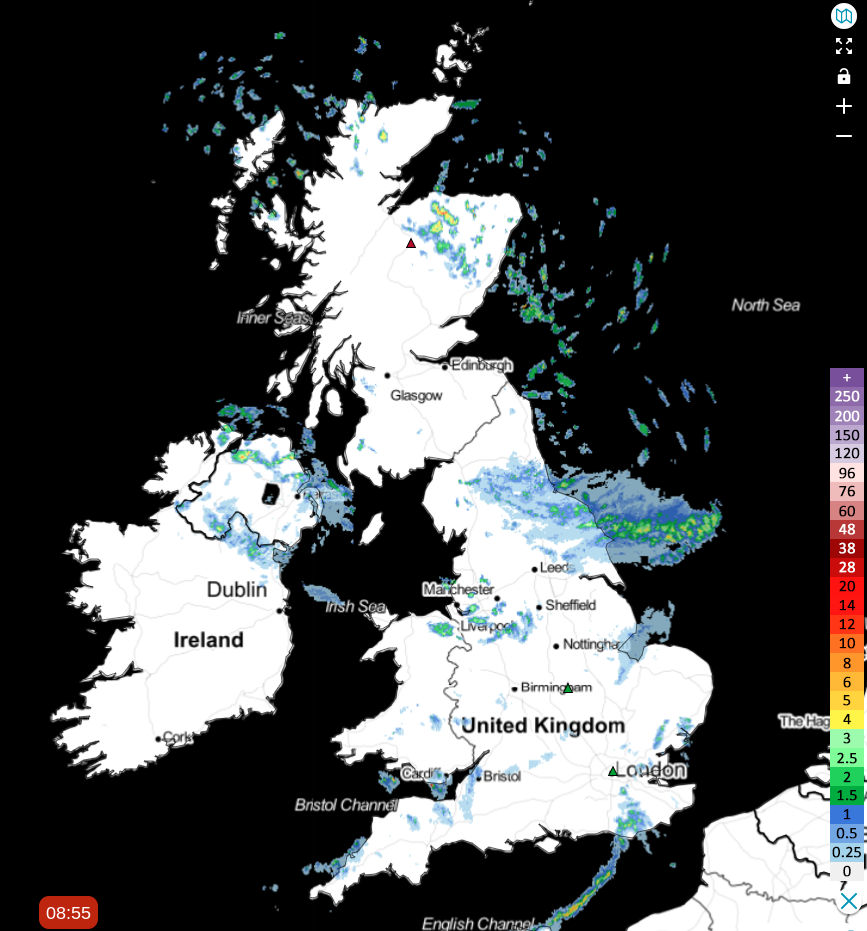 Check the latest on the live radar
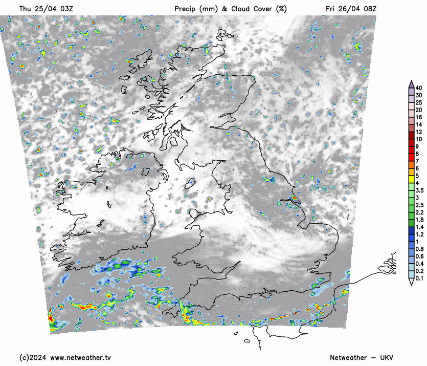
Although pleasant enough in any spring sunshine, it'll feel raw when a shower comes along, although not everywhere will catch one. As winds (lighter than yesterday) turn into the North, it'll feel particularly chilly along the East coast. Top temperatures are 7 to 9C in the North and along North Sea coasts, 10 to 13C elsewhere.
Further scattered showers into the evening, some bringing hill snow from the Peak District northward, will occur, but they should essentially become confined overnight to coasts exposed to the North and the far South West, where it'll be milder. Clear intervals and light breezes allow it to turn quite cold, with a touch of frost likely again where skies remain well broken. Short-lived rural mist or fog patches may also form towards dawn, when temperatures will mostly be from zero to +5C.
After another early touch of frost in places, it'll be a sunny start for some, but clouds will build again to produce scattered showers. These'll be most frequent over the far North of Scotland, where some will be wintry, with some snow, and also likely on hills further south. At lower levels, the showers will mostly fall as rain or hail, but it's possible you could see sleet or even wet snow in a few of the heavier showers. Again, some places will miss them, and there'll continue to be sunny intervals. But with a northerly breeze, although mostly light of polar origin, it'll feel raw out of the sun, with top temperatures from North to South only 7 to 12C.
The far South will be the exception, where it'll be grey with patchy rain or drizzle that'll move a little further northward overnight. Otherwise, it'll be as you were after dark, with fewer showers and a touch of frost in places again, mainly in light winds. Lowest temperatures -1 to +6C, with a North Easterly breeze springing-up in the South towards morning.
The coming weekend sees milder air moving into much of England and Wales, but it'll be unsettled with occasional rain. Further, in the North and west, it should be drier and brighter, but it'll remain chilly with the continued risk of a touch of frost overnight.


