Short-to-medium range outlook - warming up later this week and over the weekend, perhaps into the high 20s in the south and east of England on Monday. But turning cooler and unsettled from Tuesday.
After a cool and showery week for many so far, with temperatures more reminiscent of early October than late July, the south at least will see a return to more summer-like temperatures this weekend. Temperatures look set to rise to reach the mid-20s across the south on Sunday. But Monday looks to be the hottest day, at the moment, with 30C not out the question, before, you guessed it, temperatures fall back from Tuesday.
Wednesday saw a cool northwesterly wind bringing an autumnal feel for many, with frequent showers and temperatures staying in the teens with London just about struggling to reach 20C, which is below norm for late July. The showers fade tonight and with the unseasonably cool polar flow and clearing skies, temperatures will take a tumble during the night, especially across northern areas, where temperatures look set to fall into low single figures - which means a ground frost is not out the question across rural spots in Northern Ireland, Scotland, northern England and even Wales.
After a rather chilly start, Thursday's looking a bright and mainly dry with showers more isolated and confined to the east of the Pennines down to East Anglia. Feeling more pleasant in the sun with lighter winds than Wednesday, temperatures reaching 14-16C in the north, 17-21C in the south.
Another chilly night on Thursday night, though this time colder in the south, as across the north we will see a strengthening southwesterly wind bring milder air and eventually cloud and rain by the end of the night, which will spread across Ireland, Scotland, northern England and north Wales during Friday. Drier, sunnier and feeling warmer towards southeast Britain - where we could reach 20-23C.
We keep the southwesterly flow and low pressure close to the NW on Saturday, a weakening front will sink towards the south bringing more in the way of cloud and showers, followed by some showers across the north though dry and sunny across central parts, but it least it will be warmer than recently everywhere, particularly where the sun comes out.
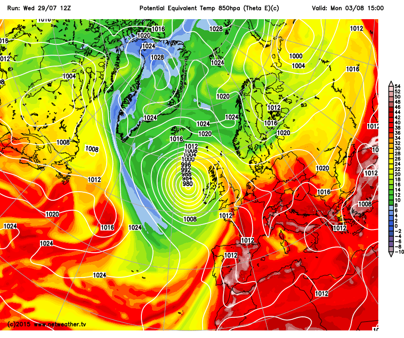
Showery start to the weekend, with low close to the north and front across the south, but at least it'll be warmer:
Sunday's looking warmer still, as winds turn southerly, although it looks like there will be cloud and rain pushing in across the far west later in the day, for many it looks like being a sunny and dry day, temperatures reaching the low to mid 20s in the south, mid to high teens in the north.
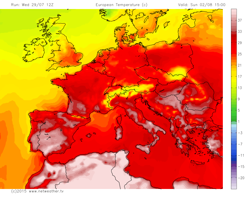
A deepening area of low pressure to the west of Ireland to start the first week of August will continue to draw in a warm and increasingly humid south to southeasterly flow on Monday, so with sunny spells towards eastern England still, it could turn locally hot across the SE of England and East Anglia with temperatures reaching high 20s or perhaps 30C. Fronts moving in from the west look like bringing more in the way of cloud across the north and west and a threat of showers or longer spells of rain.
A deep low moves in to the west Monday, drawing in a warm and humid southerly flow and temps into high 20s in the SE.
But, as has been the case for much of the summer, the warm and dry spell in the south and east of Britain will be short-lived, as the low to the west spreads its fronts across the UK on Tuesday and turns winds more southwesterly or westerly with that familiar cool and showery regime returning for the rest of the week, with a threat of longer spells of rain.
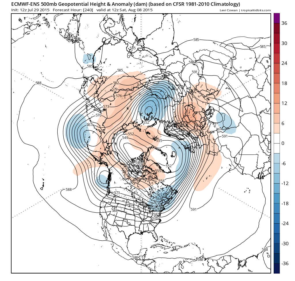
And it looks like low pressure will never be too far away from NW Britain as we march on inextricably towards mid-August, though pressure will be high on the near continent, meaning southern and eastern England will be generally drier and warmer, the northwest more unsettled and cooler. But everywhere at risk of rain at times and temperatures close to average.
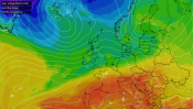
12z ECMWF 500mb ensemble/anomaly out to T+240 (8th August) shows low heights and strong SWly flow towards NW Britain, keeping the changeable theme with lack of ridging to bringing settled weather (image courtesy of www.tropicaltidbits.com:


.png?w=350)