


Latest Blog - looking at the severe heat continuing to grip southern Europe, cooler and fresher conditions over UK and other parts of northern Europe and severe storms in between.

With the school holidays now in full swing across the UK and many travelling abroad to other parts of Europe for their annual summer holiday, I thought I'd have a look at what the weather's doing around Europe over the coming week or more.
An ongoing heatwave looks set to continue to scorch much of southern Europe over the coming week. The severe heat started in late June and has persisted across southern Europe ever since, with some monthly records and even some all time records broken in Spain and France The heat has spread further north at times too, since the start of the month, with Germany setting a new temperature record on the 5th with 40.3C (104.5F) recorded at Kitzingen in southern Bavaria. The heat over Europe had only briefly reached the UK at the beginning of July, when we saw the UK July highest temperature record broken, when the mercury climbed to 36.7C at Heathrow on the 1st.
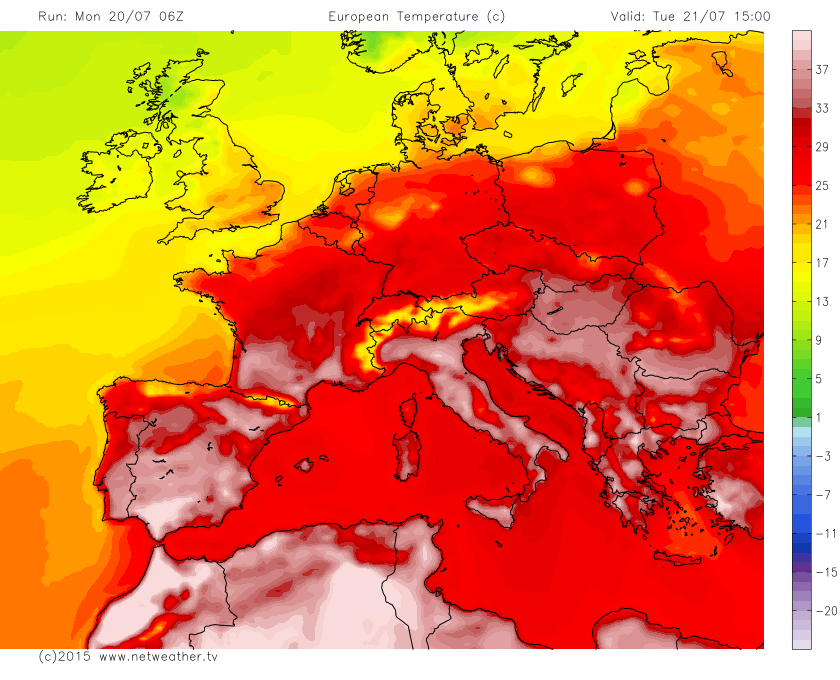
A persistent belt of high pressure from Spain across southern France, The Alps, Italy and right across to the Balkans to western Turkey will keep the heat locked in and mean temperatures are set to remain well above average here, with temperatures set to reach 41C in Seville in southern Spain, 38C in Faro on the Algarve and temperatures in Rome and Florence in Italy perhaps reaching 40C. Although these temperatures are not unheard of in these cities, the sheer persistence of heat across southern Europe since late June coupled with oppressive humidity and high night-time temperatures - mean there is a real health risk, particularly for the elderly and other vulnerable groups. Rome has seen temperatures fall no lower than 30C some nights recently.
Tuesday's temperatures soaring into the high 30s and low 40s degrees centigrade over southern Europe:
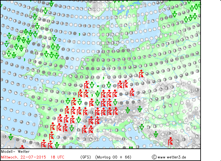
Towards NW Europe successive Atlantic weather systems moving in across the UK then heading towards Scandinavia recently and over the coming week will keep the heat at bay across The UK, Ireland, The Low Countries, northern Germany and Scandinavia. A frontal boundary will exist from northern Spain, through central France, Germany and into eastern Europe for much of the week, marking the boundary between cooler and fresher Atlantic air over NW Europe and the heat over southern Europe. This boundary will trigger some severe thunderstorms along it, as has occurred recently, with a risk of flash flooding and large hail - particularly from mid-week across central and southern France, southern Germany, The Alps, Czech Republic, Slovakia and southern Poland.
Risk of storms over parts of Europe along frontal boundary between cooler Atlantic air and heat over southern Europe from mid-week (images courtesy of wetter3.de and UK Met Office):
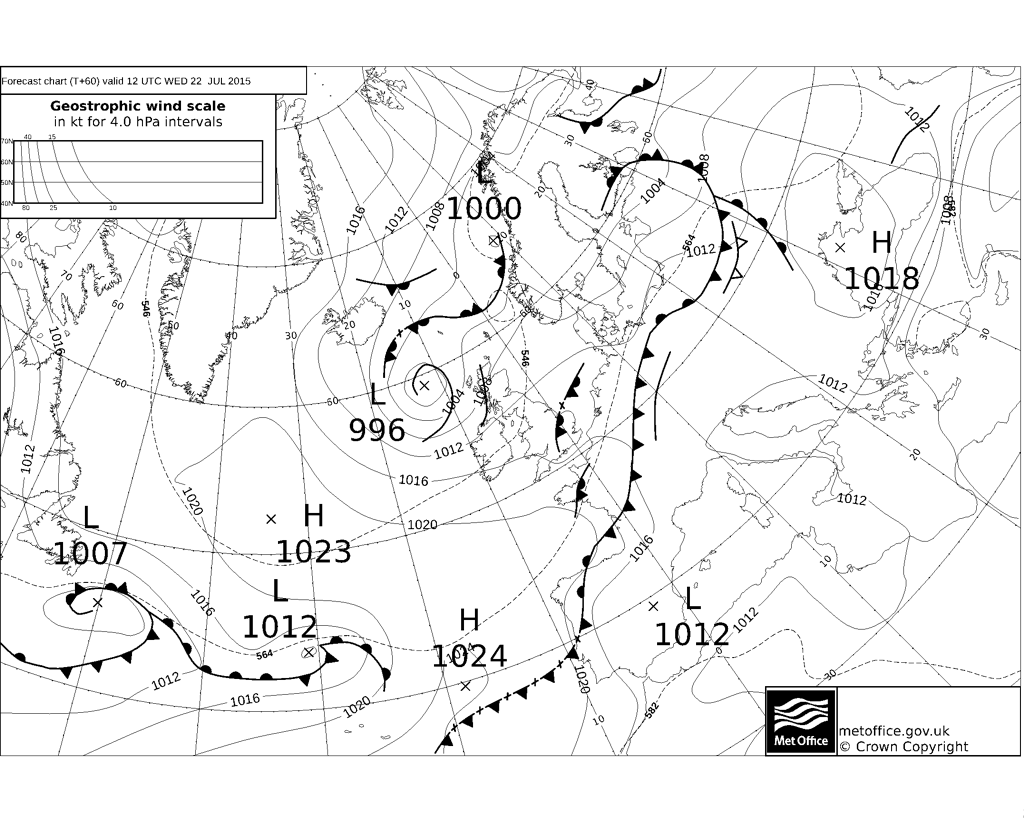
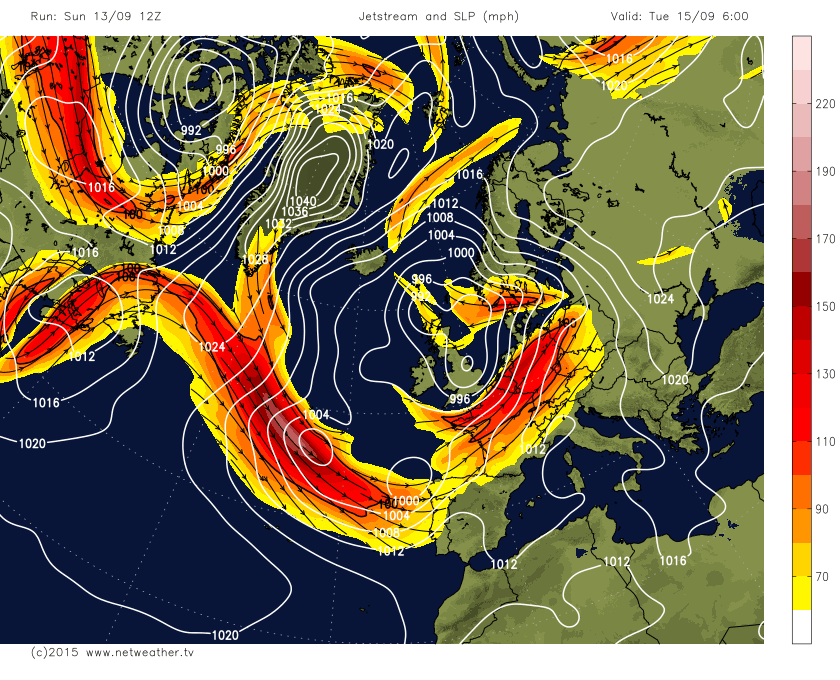
To the north across NW Europe, the jet stream will stay overhead and low pressure will remain close by for much of this week, with a southwesterly or westerly flow bringing fairly average temperatures, with spells of rain or showers at times, mostly towards the north and west of the UK from Tuesday onwards. Temperatures reaching the low 20s degrees centigrade across the southern Britain and further east across Denmark and southern Sweden. Temperatures reaching the mid-to-high teens at best across Ireland and northern Britain. Across northern France, Low Countries, northern Germany and northern Poland, we will see temperatures creeping into the high 20s, then south of that we will see the heat with temperatures into the low to mid 30s, higher across southern Spain, Italy and the Balkans.
Jet stream and low pressure over NW Europe including the UK much of the week and still by the end of the week;
No signs in the foreseeable future of this heat spreading north to the UK, in fact it may turn cooler if the low pressure parked close to northern Britain shifts east and high pressure build north over the Atlantic to the west to allow a northwesterly flow, as some models have hinted at recently. Though this morning's runs seem to be backing off this idea a little for now, though still keeping pressure low near NW Europe with a changeable southwesterly or westerly flow.


