


Latest short to medium range outlook - no signs of last week's heat returning in the next few weeks, thanks to a generally changeable westerly flow off the Atlantic, though we will see some warmth at times in the south.
The heatwave of last week seems like a fading memory on a cool and grey morning, like today. And, at the moment, it seems unlikely such heat, certainly temperatures of 30C+, will return in the next few weeks at least - looking at medium to longer range model output.
In fact, it will turn cooler today compared to recent days, as a northerly breeze develops and brings colder air down directly from the arctic. So this afternoon, temperatures will struggle into the mid-teens at best in the north, high teens at best in the south, perhaps 20-21C in the southeast.
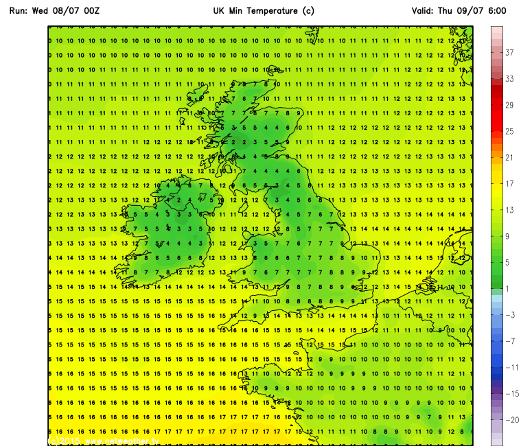
There is even a risk of frost across the far north Wednesday night, even though it’s early July. The cool polar flow under clearing skies and lighter winds overnight will allow temperatures to tumble in rural areas in the north. Despite the short nights at this time of year, temperatures in the countryside in Scotland and Northern Ireland could be just 1-3C above freezing at dawn on Thursday. A cool night further south across England and Wales too.
A ridge of high pressure builds in from the southwest on Thursday, as low pressure close to the east moves on northeastward across Scandinavia tomorrow. So it will be a drier and sunnier day than today and with a lighter more northwesterly breeze, it should feel a little warmer, though temperatures in the mid to high teens at best for most, perhaps low 20s in the SE.
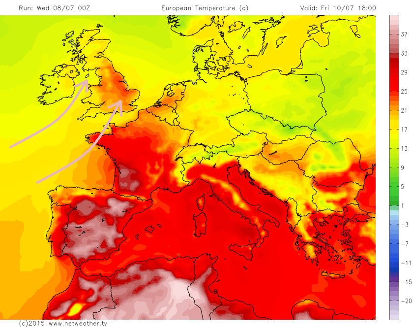
It turns warmer to end the week though, as we lose the cool flow from way to the north and see warmer air return from the southwest. Unfortunately, the southwesterly winds will bring cloud and rain to Scotland and Northern Ireland, but for much of England and Wales, away from the far north, Friday is looking a glorious day with plenty of warm sunshine, temperatures reaching 23C in Manchester, 26C in London.
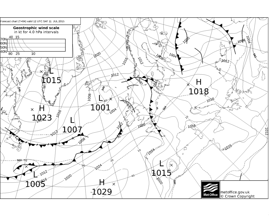
A cold front then looks to move east across most parts Friday night, though little rain along it across the south as it clears through. Fresher conditions following from the Atlantic across all areas for Saturday, brightest conditions in the south and east, where we could hit 23-24C still, cloudier and cooler with showery rain at times in the north and west. An Atlantic frontal system looks to move down across southern parts Sunday morning, bringing cloudier conditions and some showery rain here, sunshine and showers further north.
After Friday's brief return of warmth, weakening cold front clears Saturday morning followed by a fresher westerly flow for the weekend.
Into next week, and it looks like we keep the changeable conditions running in off the Atlantic in a generally westerly flow. Southwesterly winds to start the week then more northwesterly to end the week. Daytime temperatures generally look close to average each, i.e. highs of the low 20s in the south, mid to high teens in the north, though beginning of the week does look warmest before temperatures drop later in the week, particularly across the north, as a northwesterly flow develops. Given the flow will be off the Atlantic, it will be cloudy at times, with passing fronts bringing some rain at times, most of which looks to fall across the northwest, though some rain perhaps making it south across southern areas on a few occasions, but nothing particularly meaningful here.
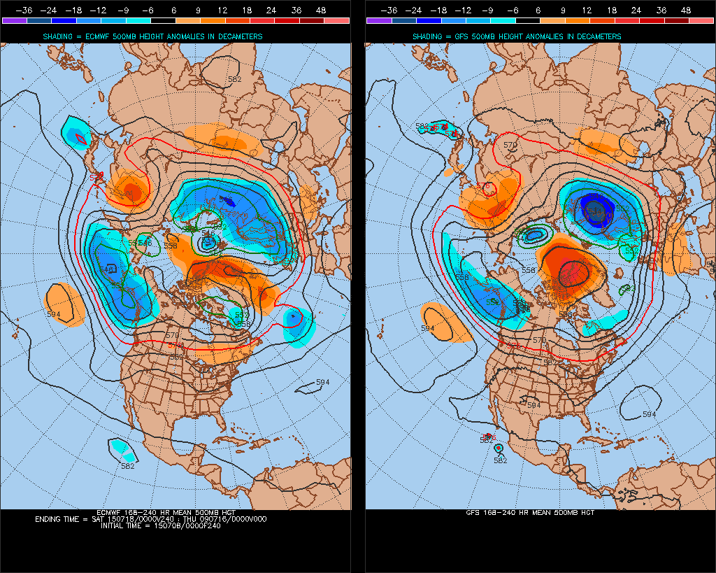
8-10 day ECM and GFS H500 comparison points toward a changeable westerly flow off the Atlantic dominating:
Then there are hints from the models for the end of next week and following weekend that high pressure may re-build from the southwest, like the end of this week, which will allow temperatures to rise a little across the south back into the mid 20s. But the general theme is for Atlantic low pressure system dominated weather, with the flow from a generally westerly direction (SW/W/NW’erlies) – so no signs of a heatwave returning anytime soon!


