May parts of the UK are finally feeling a bit warmer today but Friday could bring the highest temperatures so far this year and thunderstorms. Where and when?
Update 10:45am
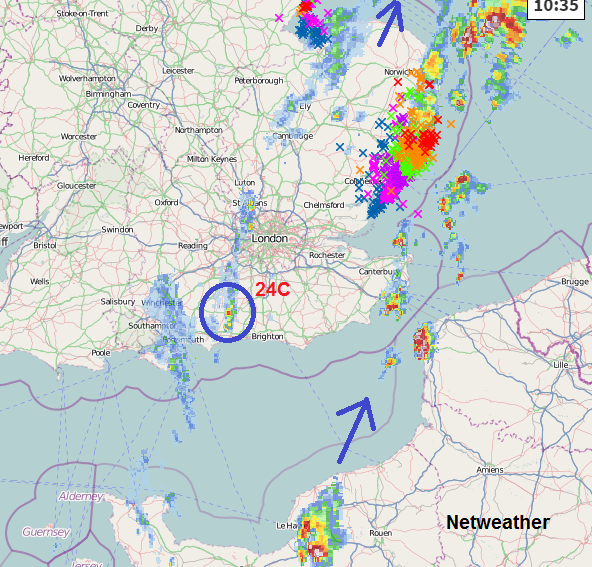
Drift of storms NE across central southern and eastern England earlier today. Now main action is confined to eastern parts but cell over N.France could still clip E.Kent once it crosses the Channel. Surrey has seen temperatures at 10am close to 24C, so the heat and humidity is there to invigorate smaller cells, like the one circled in blue. Worth watching on the radar. Eastern areas will be more at risk up through lunchtime, as western areas cloud over from approaching cold front
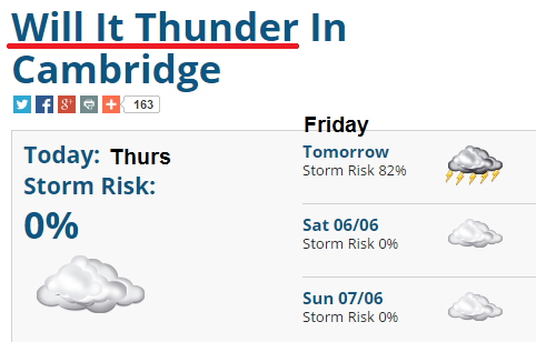
Thurs
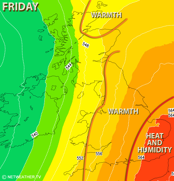
Friday’s storms and heat
Much of Britain will have a warm day, although a cold front with cloud and rain will keep the temperatures in N.Ireland and NW Britain subdued.
Many parts will reach over 17C and feel close and warm.
Very warm and humid air is set to move over SE Britain (over 23C) from the continent and will bring a heat and humidity for the end of the working week. The cloud cover from the incoming cold front, making it cooler for N.Ireland and W.Britain could inhibit the temperatures elsewhere. Thursday saw 23.8C in NW London
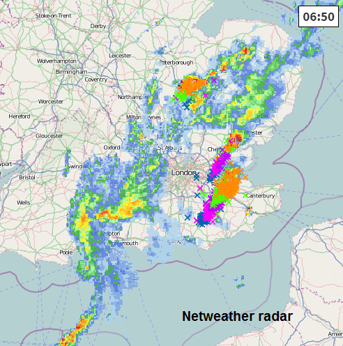
During Thursday night heavy showers will begin to feed up from the south, into central southern England heading north and east towards the Wash. These showers will be thundery with lightning. This feed continues through the day as the temperatures rise and the drift of heavy showers moves eastwards over SE England and East Anglia. Here the very warm humid air will enable large thunderstorms to build, clearing eastwards in the afternoon. It looks like many of the showers won't combine with the main heat of the day, with the most lively showers over N.Europe, the Channel, S.North Sea but maybe one or two still clipping Kent.
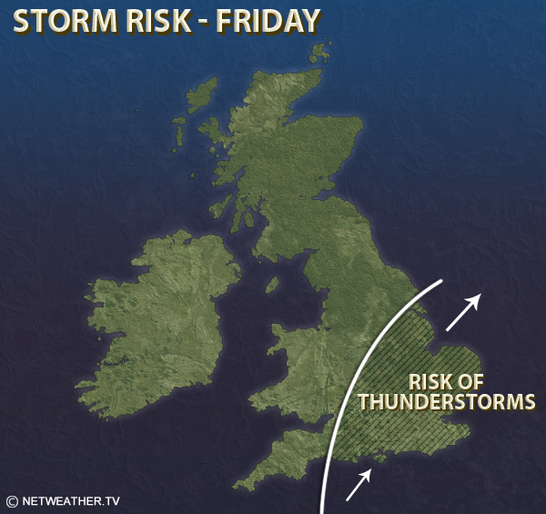
There is the risk of localised flooding from these intense downpours. However, there will not be rain/thunderstorms for everyone. Keep an eye on the Netweather radar for the progress of the cells
Also check out Will it Thunder for your location