Synoptic Analysis - looking at the next 7 days - warming up in the south early in the week, but no heatwave.

We will see warm summer-like temperatures return early this week across parts of England and Wales, with temperatures perhaps reaching 24C in southeast England on Monday, but it doesn't look to be like a heatwave as some newspaper headlines have been making out.
A deep area of low pressure approaching NW Britain over the next few days will pull an increasingly warm southwesterly flow across southern Britain, with temperatures back into the high teens today across southern England, perhaps 20C in the south. Then on Monday we could see temperatures approach the mid-20s degrees C across SE England in the sunshine. However, it's not going to be warm and dry for all, with the weather going downhill across Scotland and Northern Ireland on Sunday, as we see weather fronts moving northeast ahead of the deep low to the west bring cloud and increasingly persistent rain, particularly over western hills.
Weakening cold front moving SE on Monday, warm ahead of it across SE England and E Anglia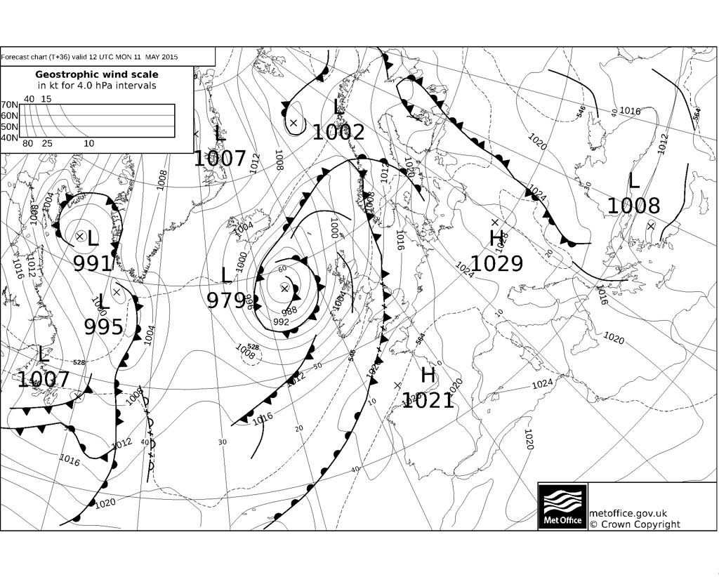
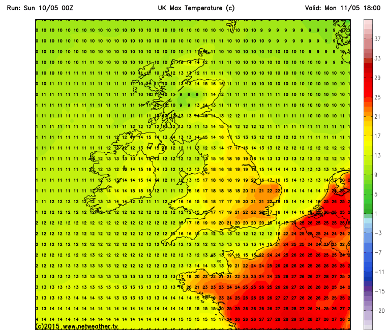
The warmest temperatures on Monday, up to 23-24C, will be ahead of a weakening cold front moving east across England and Wales, which will bring just a band of cloud and a few spots of rain by the time it reaches The Midlands, southern and eastern England. Before the front reaches eastern areas of England, it will bring a spell of rain to northern and western areas Monday morning, followed by showers and quite a brisk southwesterly wind as that low approaches NW Britain.
Monday looks to be the warmest day of the week though, as the weak cold front clears east to bring cooler westerly flow on Tuesday. A ridge of high pressure will build across the south on Tuesday, but low pressure will be close to the north of Scotland, so a breezy day across northern areas, with further showers - especially across western parts of Scotland. With lighter winds and sunshine in the south, we could still reach 20C in London and the southeast.
Wednesday should see lighter winds across most parts and with a ridge of high pressure across the UK, it should be mostly dry with some sunny spells, temperatures reaching 14-17C in the south, 12-13C in the north.
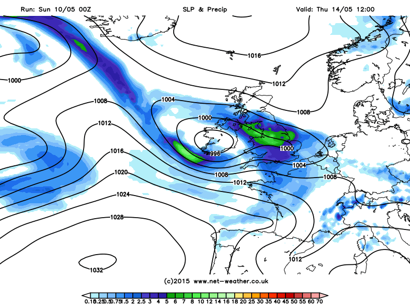
We see a big change on Thursday though, as an area of low pressure swings in off the Atlantic, bringing with it wind and rain. Some uncertainty over the exact track of this low, but for now it looks most likely to take a path across Ireland then southern Britain. So Scotland, away from the far south, may escape with a dry and bright day.
Low arriving Thursday, bringing wind and rain:
The wind and rain clears off the scene by Friday, so a mostly dry end to the week, though the exiting low will pull in a cool northerly wind for a time on Friday.
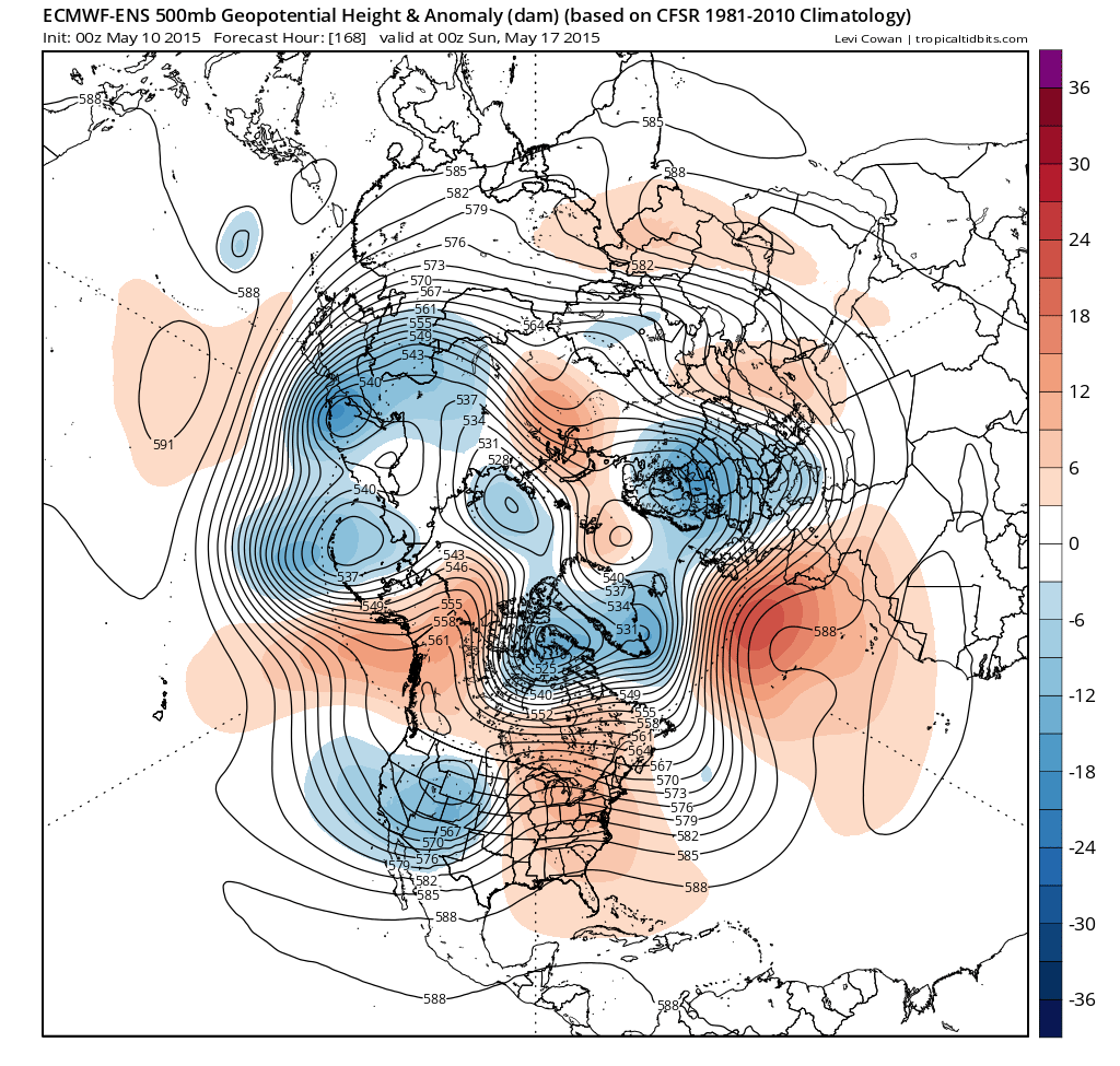
The general theme from the model output after this week, is for a dry start to next weekend, but then another deep low passing southeast close to the north of Scotland, bringing wind and rain southeast across most parts by Sunday. Thereafter, signs that high pressure may build across southern Britain again, but northern areas at mercy of more unsettled conditions and all parts in a cool northwesterly flow.
ECM ensemble 500mb heights and anomaly for next Sunday - lower heights close to the north, higher heights to the S and SW, cool northwesterly flow: