It's looking fair for the London Marathon on Sunday, but feeling a bit cool for spectators until the sun appears. Mostly dry this weekend, but chilly by night.
Overall this weekend is looking much drier. A welcome relief after so much rain in recent months. High pressure will be over the UK and that means mostly light winds. If you do see the sunshine it will feel warm but under cloudy skies, it will still feel cool.
It’s London Marathon weekend. There aren’t any weather warnings, there isn’t any unusual heat or heavy rain nor flooding. Sunday in London might start off quite cloudy but sunny spells should appear by lunchtime, so remember your sunscreen if outside for any length of time. The tree pollen season has begun. Oak pollen is around with low levels of birch, ash and plane. The air is still cool and with a bit of a northerly breeze, it will feel nippy until the sun appears.
The weekend forecast
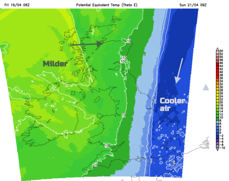
The weekend starts with cold air over northeastern Scotland which extends down to the North Sea to Kent during Friday night. This cooler eastern then southeastern portion of Britain will feel chilly for those exposed to the breeze or after dark but fine in any sunshine. Milder air will topple in over Ireland and northwest Britain later on Saturday.
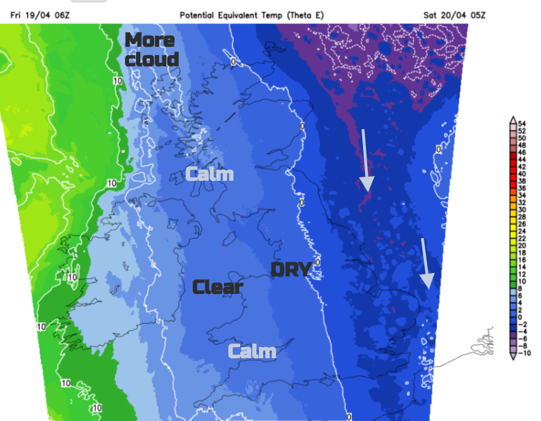
Friday night will feel cold in the northerly flow. It will become dry and clear as the few lingering showers fade. Temperatures will fall into single figures with a widespread grass frost and a little inland fog in the west. Some spots will see an air frost but the breeze along North Sea coasts will stir up the atmosphere.
Saturday
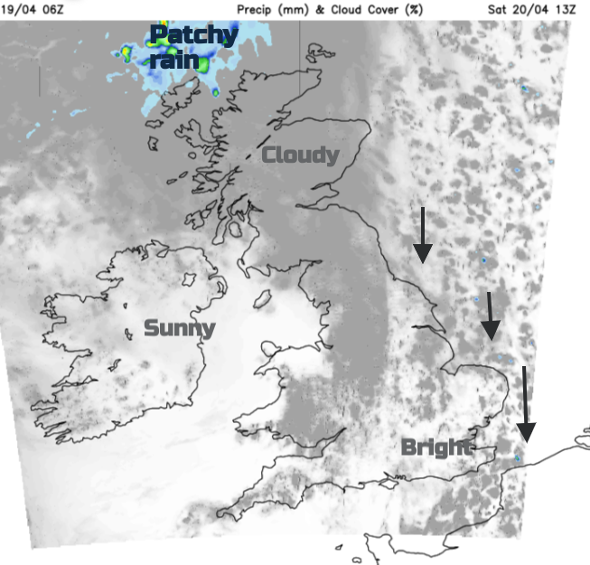
Saturday will start off fine and sunny for most but nippy with a frost in places. There will be some convective cloud for eastern counties and frontal cloud arriving for the far northwest of Scotland. A low pressure between Iceland and Greenland will be throwing a warm front towards Scotland. This boundary stalls into Sunday with more cloud and pulses of rain. Behind this will be the milder air with the chilly northerly still ahead over the North Sea.
The warm front will be quite weak, just introducing more cloud with patchy rain for northern Scotland. It isn’t to be forgotten though. Northern Ireland should see 14 to 15C in the sunshine with a pleasant Saturday afternoon. East Anglia and Kent will feel nippy at only 9 or 10C but feeling colder in the breeze.
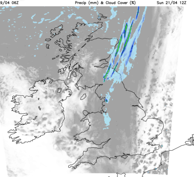
During Saturday night the frontal cloud band extends down through Britain with outbreaks of rain for the Northern Isles, the Moray Firth and down through Lothian into Cumbria.
It will be calm for most overnight but with this band of cloud it won’t be as cold as on Saturday night.. It should be clear for Northern Ireland, SW Britain, East Anglia and Kent and later for western Scotland.
Sunday
The northerly breeze will be noticeable for coasts and hills in the SE corner of Britain on Sunday morning. Further west, depending on the cloud breaks, temperatures could reach 15 to 19C. The warm front is still lurking. This will bring thicker cloud and patchy light rain from Grampian down into northern England and this cloudy damp band lasts during the day down a good portion of Britain.
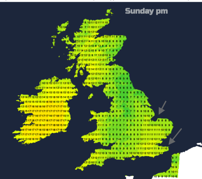
There will be drizzle for the far north of Scotland but fine, sunny weather for Northern Ireland and bright spells for SE England, London and East Anglia.