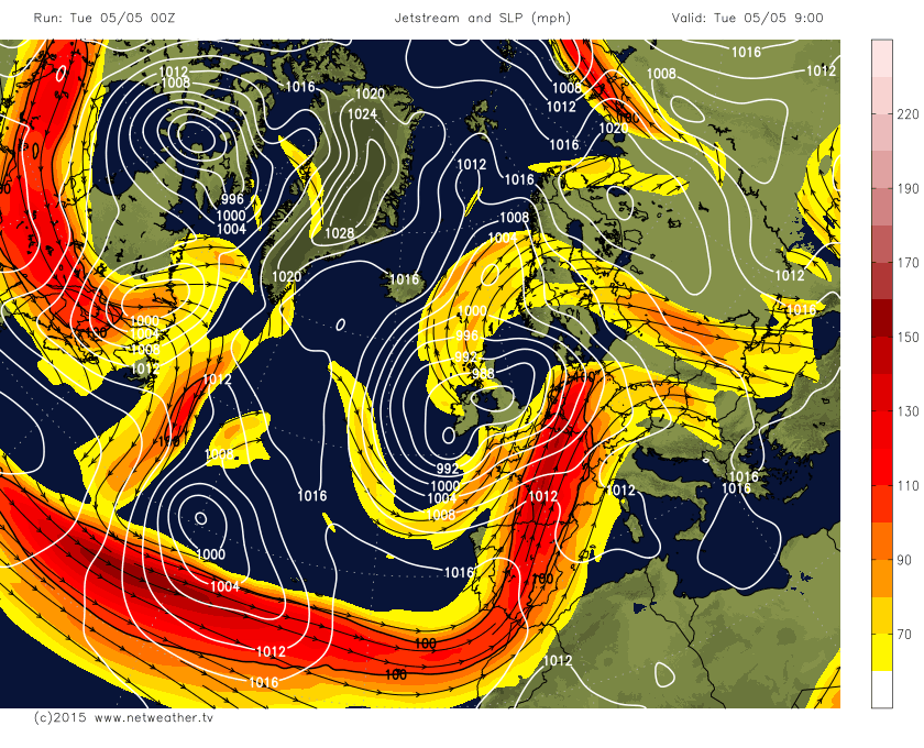
Following a lot of dry and settled weather in April, since the start of May we have seen the weather turn increasingly unsettled across the UK and much of western Europe, as an active and disturbed Atlantic pattern has become established. This features a strong and active jet stream between Bermuda and western Europe which is tracking unusually far south for the time of year and would be more usual for December than May! The jet stream is far south as 35N in latitude, moving across the Azores before taking a sharp left turn as it hits Iberia before heading NE across northern Europe. A jet max or streak in this jet stream (with winds of 150mph+) has moved NE across France and the Low Countries overnight. An area of low pressure deepened in the left exit of this jet streak to the west of Iberia yesterday, before moving NE over the Bay of Biscay and on across SW England and Wales overnight and the low is now across NW England.
Jet stream over Atlantic tracking unusually far south before taking a left turn towards northern Europe, low pressure over the UK
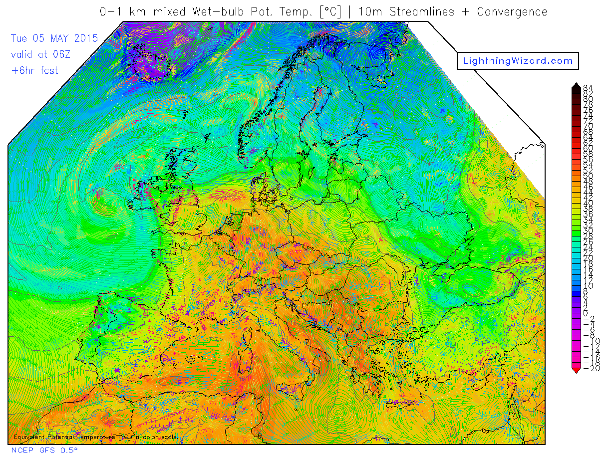
As the low's been tracking NE towards the UK, it's been pulling a plume of deep sub-tropical warmth and moisture way from the SW ahead of it across Iberia and France and into southern Britain overnight, bringing a broad area of moderate to heavy rain along an active warm front which moved north across Ireland, England and Wales overnight. This band of rain continues to spread north across Scotland and Northern Ireland this morning, before grinding to a halt here for much of Tuesday. So we could see as much as 12 hours of continuous rainfall across these areas, with 15-30mm in places, perhaps as much as 50mm over higher ground. So a risk of some localised flooding.
Large amounts of moisture and warmth being drawn north across Europe by low pressure moving north up western side of the UK:
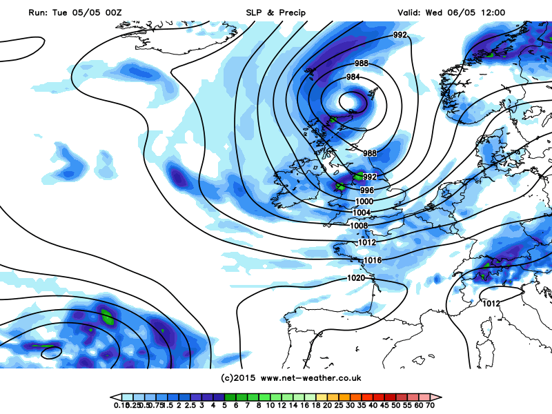
The low over NW England will continue to drift north across Scotland and will merge with another low just SW of Ireland to become quite a complex low pressure system that will become slow-moving over northern Britain over the next 24-36hrs before finally drifting away NE towards Norway during Thursday.The isobars around this low pressure system will be tightly packed today and tomorrow, so it will be rather windy - particularly in the south today, with winds gusting to 40-50mph inland and perhaps higher gusts along southern coasts. The rain across Scotland and N. Ireland will eventually become confined to northern Scotland tomorrow, but we will see bands of blustery showers spiraling around the low pressure system over the north and affecting England and Wales today and most areas tomorrow, some of these showers heavy with hail and thunder - especially in the west.
Low over Nern Britain on Wednesday with bands of rain or showers spiraling around it:
So the low moves off on Thursday and we see a ridge of high pressure build in from the SW on Thursday, bringing mostly fine, dry and settled conditions for many, though still a risk of showers across Scotland and perhaps N. Ireland and still windy across northern Scotland.
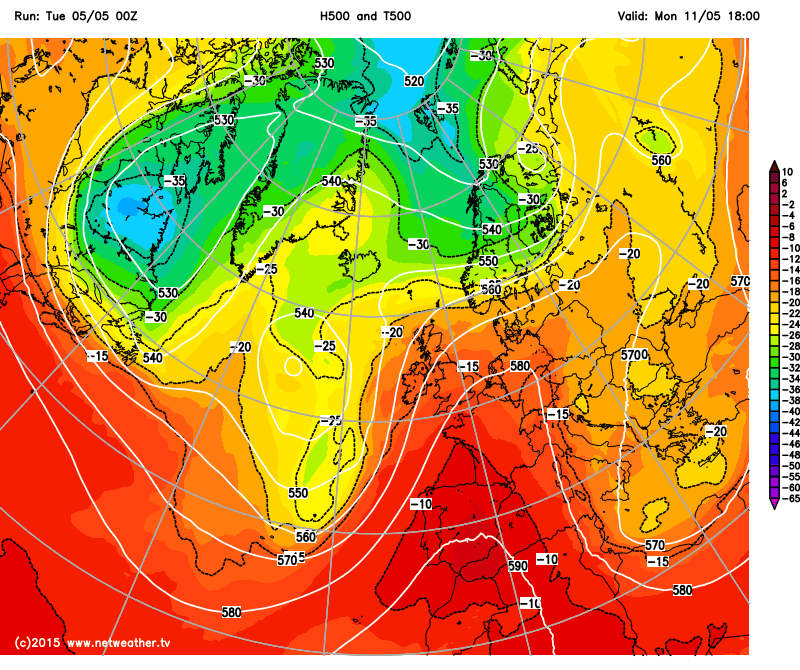
All change again on Friday though, as the southerly tracking jet stream across the Atlantic and western Europe still remains rather active which will see another low pressure system waiting in the wings over the Atlantic move in across Ireland. Fronts associated with this low will move NE bringing rain across England and Wales during the day, though Scotland may stay dry until the evening. The low over Ireland then is forecast to move east across central Britain during Saturday, bringing a cool, unsettled and windy day with rain or showers for many. The low moves east out of the scene by Sunday though, with a ridge of high pressure replacing it as the jet stream starts to buckle north. This buckling of the jet looks to allow an upper ridge to build north from North Africa across western Europe later in the weekend and early next week, which will keep low pressure systems at bay to the west of the UK and bringing warmer conditions north too, with temperatures perhaps getting into the low to mid-20s degrees C across England and Wales early next week at least. There is a risk of showers or rain indicated for western areas, closer to the lows in the Atlantic, but central, southern and eastern areas are looking warm and sunny.
Ridge of high pressure building north from Spain early next week
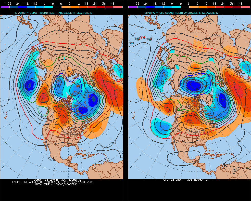
Some uncertainty thereafter over how long these warmer and settled conditions late weekend and early next weekend will last, 00z ECMWF and GFS operational and ECMWF ensemble mean this morning indicating unsettled and windy conditions returning to all areas from the west by the end of next week, 00z GFS ensemble mean hinting that there may be tendency for drier conditions and more settled conditions towards the southeast.
More unsettled conditions trying to push back in from the W later next week: