Latest synoptic analysis - heat subsides in the south, cooler into the weekend and increasingly windy in the south but remaining dry and settled into next week.
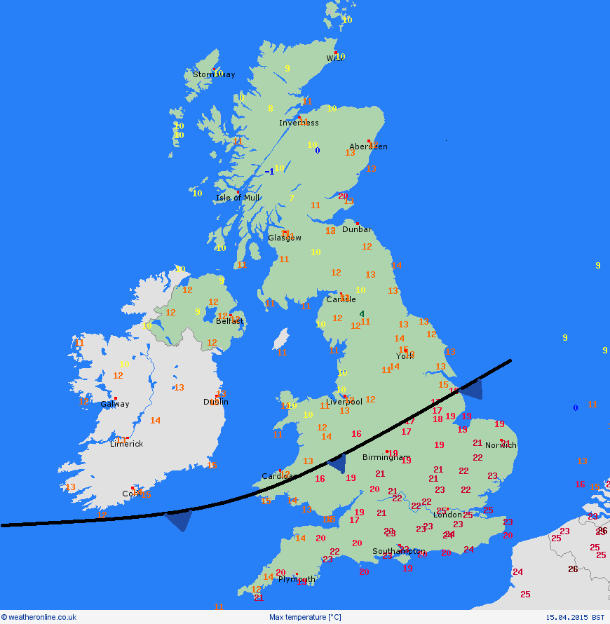
We saw a mini-heatwave across southern England on Wednesday, with temperatures reaching 25C in the London area, making it feel more like high summer than the middle of spring. This was in contrast to temperatures further north, on the cold side of a cold front sinking south across England and Wales today. In Manchester the max temperature reached a disappointing 12C, whilst in Glasgow we saw a paltry 11C.
Temperature contrast can be seen on the maximum temperature chart for 15th April below (courtesy of Weatheronline)
The cold front that has been slipping south today grinds to a halt across Wales, The Midlands and East Anglia during Thursday, so it will be a cloudier day here and we won't see the wall-to-wall blue skies across southern England either, so although the colder air to the north still hasn't arrived here, temperatures down on today and feeling fresher, though with some brightness or sunny spells we could see 17C in London and 19C in Plymouth. Northern England northwards and we are into the colder and clearer air, so frost to start Thursday in some spots. And despite the bright spells, northern England, Northern Ireland and Scotland on the cool side, with 10-13C at best which is on par with Wednesday's values.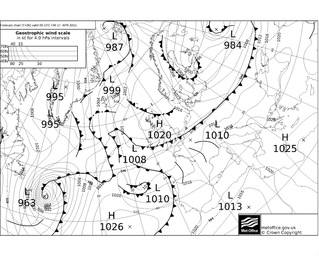
The cold front finally clears south of the UK Thursday night (above) with the cooler air moving across southern parts too, then on Friday high pressure will be centred over northern Britain and we pick up a more northerly or northeasterly flow, which will be most noticeable in the east. Many areas will be dry and settled with sunny spells on Friday, with the same true over the weekend, with high pressure centred over northern Britain. However, we will see isobars tighten across southern Britain on Saturday, so a chilly northeasterly or easterly wind will pick up further here.
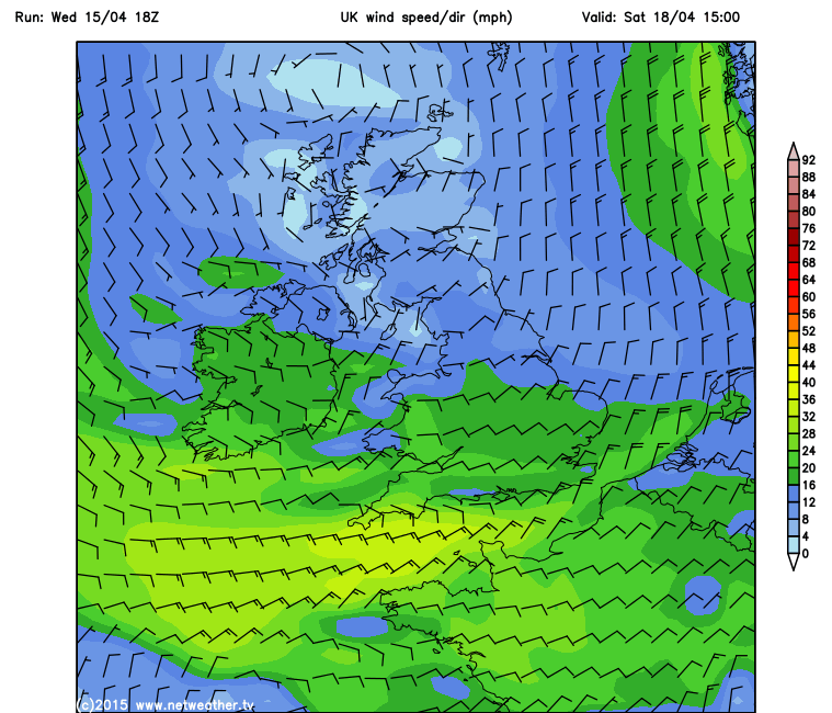
Chilly wind in the south on Saturday:
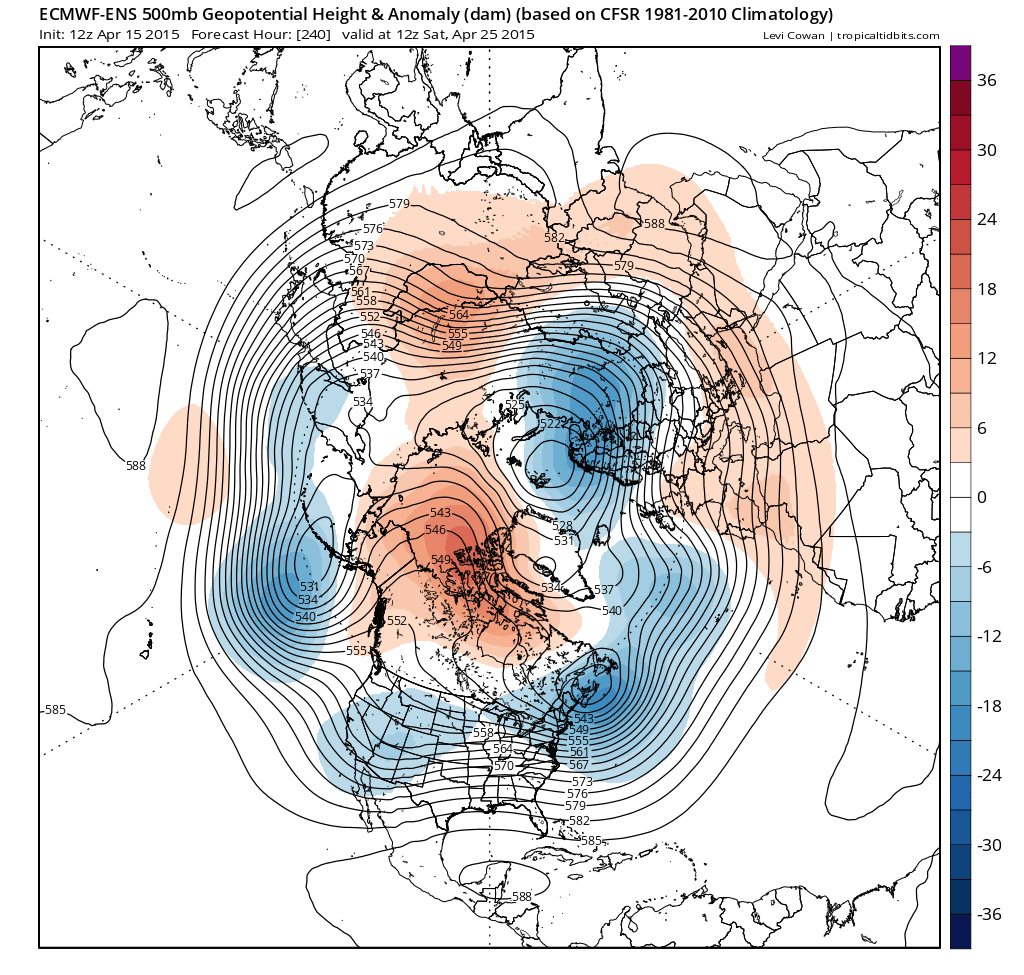
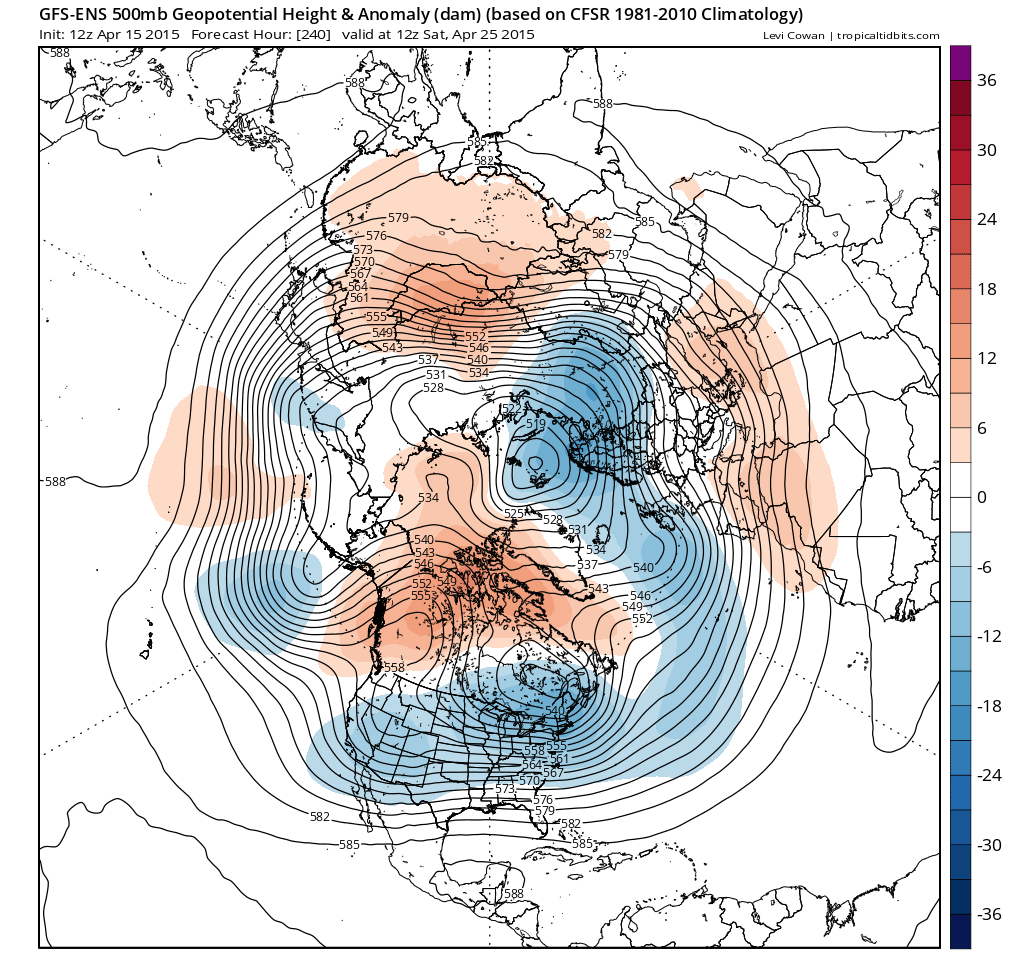
Into next week, high pressure looks to be over the UK up until the middle of next week at least and perhaps up until the end of the week. However, 12z GFS and ECM ensemble means and the CPC prognostic 8-14 day 500mb heights and anomaly chart issued today suggest falling heights/pressure from the west by day 10 (Sat 25th April), so perhaps a breakdown of the dry and settled conditions over that weekend:
GFS ensemble mean at day 10 (Topicaltidbits.com):
ECMWF ensemble mean at day 10 (Topicaltidbits.com):