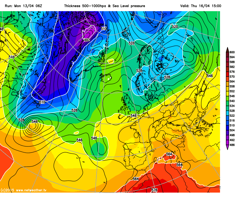
While the south of the UK, particularly the south east, will see temperatures heading towards the mid twenties mid week, further north it's a different picture with cooler air, and more cloud and rain as a cold front slowly sinks south.
While the south of the UK, particularly the south east will see temperatures heading towards the mid twenties mid week, further north it's a different picture with cooler air, and more cloud and rain as a cold front slowly sinks south.
The headlines at the moment are all excited for the high temperatures expected mid week, with 24-25c possible locally in the south east and East Anglia, but away from the south of the UK it's a more typical April week, with cooler temperatures and plenty of rain, especially for the west of Scotland at first.
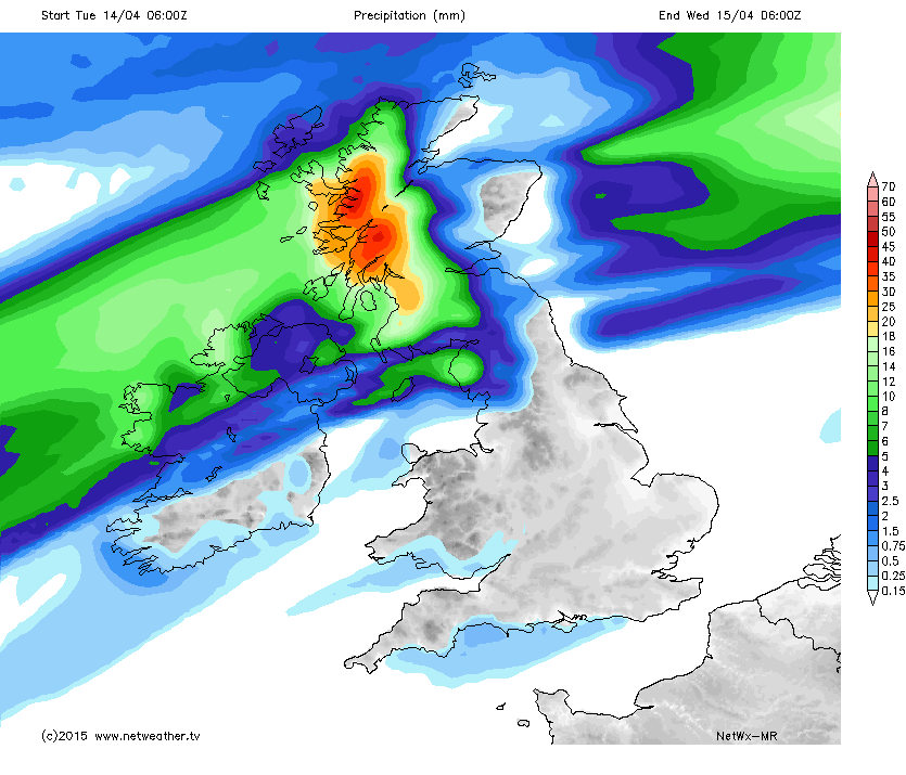
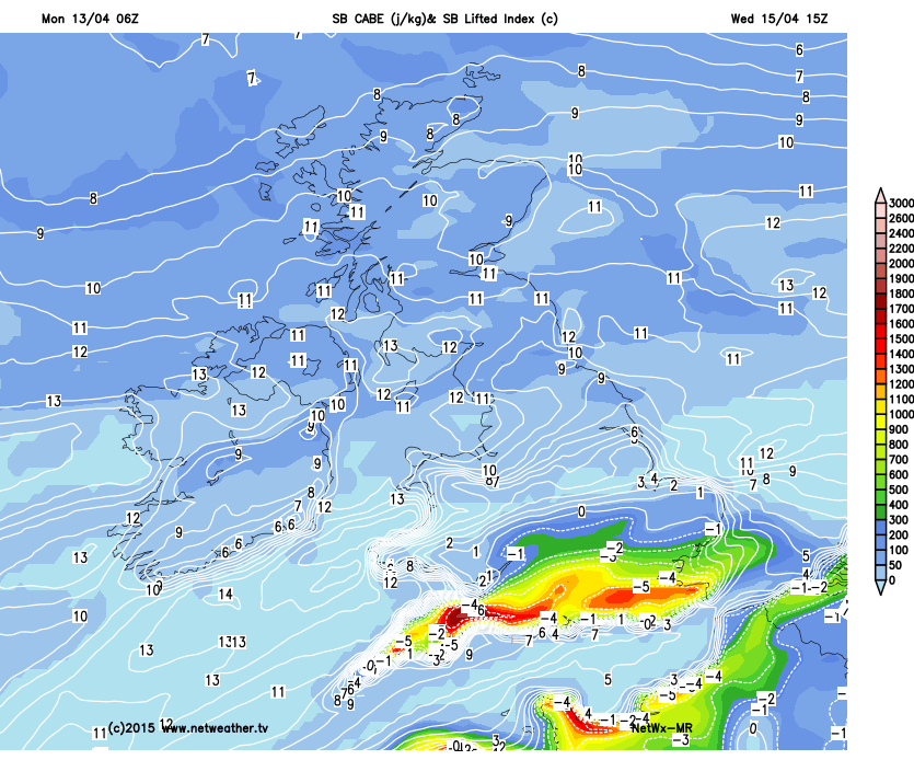
A cold front will make slow progress heading south across the UK, and the west of Scotland in particular will get a soaking over the next day or two, and as the cooler air slowly spreads southwards, the warmer temperatures will become more confined to southern areas. By Wednesday there is a clear north south split, which will see the warmest temperatures in the far south/south east, and with those higher temperatures there is a chance of some sharp showers or storms bubbling up in the heat of the afternoon.
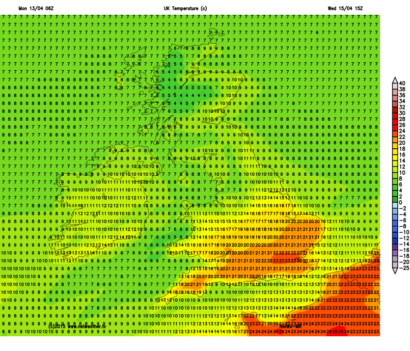
By Thursday the cooler air will have spread across much of the UK, with the far south still clinging on to milder temperatures of 16-17c, but everywhere else closer to average for the time of year.