


Third part of Partial Solar eclipse blog. Looking at the forecast for Friday morning, and at the moment the cloud cover is poor for many areas.
Tues 17th update
The charts for northern parts just get worse but there seems more hope for southern Britain
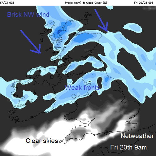
SW England still seems to have the best chance of a clear view. Plymouth is expecting a view of 88% obscured. Cardiff also looking good with 87% of the sun getting blocked out around 9:30am. Belfast could see 93% obscured but there is a lot of cloud on the forecast and Glasgow was at 94%. It looks like a weak front will be moving over northern Britain and maybe N.Ireland that will bring more cloud and some patchy rain. So far it doesn't affect southern Britain in the eclipse timeframe of 0830 til 1030 but watching the progress of things over the past few days, the damp weather has spilled further south on the charts each day.
There will be a brisk NW wind, and that could help a few spots. The Highlands of Scotland will force the air up and in the lee of the hills and mountains there could be breaks and I want one in SE Scotland. So really it is looking disappointly cloudy but there will be some spots that do catch a lucky view.
Monday 16th
I'm glad the eclipse wasn't this morning, because there wasn't a lot to be seen at the end of my street never mind 93 million miles away. There is a lot of low cloud about for Monday and it comes and goes this week, with worries for Friday.
Last week I had a look at how to view the eclipse and where the totality zone will be in part 1 then times and glasses in part 2
The forecast is now within the more comfortable 5 day ahead zone but forecasting layer cloud within a high pressure is tricky. Breaks can appear at just the right moment, as happened for some lucky people in the south west of the UK for the 1999 total eclipse, whereas others 20 miles down the road saw very little.
High pressure is still over the UK for Friday, but seems to be fading and slipping to the south west. This will allow a cloudy flow from the North Sea, with a light North Wind. Away to the north west the winds will become south westerly as a weather front edges in. Timings on this could change as it is still 5 days away and hopefully they will.
Anyone who has booked to go to the Faeroe Islands will be looking at today's charts and grimacing as there is a cold front with rain right over that region. A front will clear and should bring clearer skies but it could be a tense wait with totality only 2 minutes around 0930. This front with its cloud and rain could pester the Western Isles and NW Scotland at completely the wrong time. So we'll wait for some changes over the next few days.
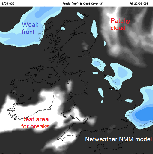
Elsewhere, SW Britain looks most favoured for breaks and a view of the sun. The cloud for NE Britain does also look quite patchy, but it seems there could be disappointment for some viewers on Friday.
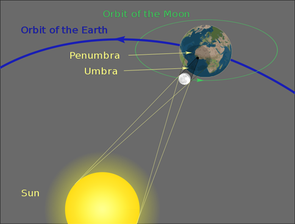
Picture credit: Sagredo (Own work) [Public domain], via Wikimedia Commons


