


Latest Blog - looking at a cold wintry few days to start March, but turning milder later in the week, perhaps culminating in spring warmth next weekend.
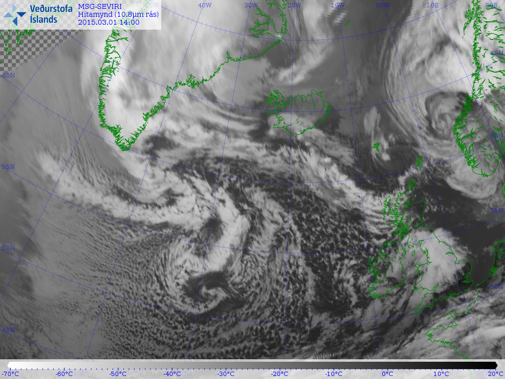
The first day of meteorological spring saw pretty much everything the weather could throw at us, with gales, heavy rain, hail, thunder and lightning, sunshine and even snow falling and settling at lower levels in the north. What was missing was some early 'spring-like' warm sunshine, but roll a week forward to next Sunday and the weather models this Sunday evening are all pointing to such conditions perhaps becoming reality.
The weather system moving across England and Wales brought squally winds, heavy rain, hail, thunder and hill snow. Snow showers further north across Scotland: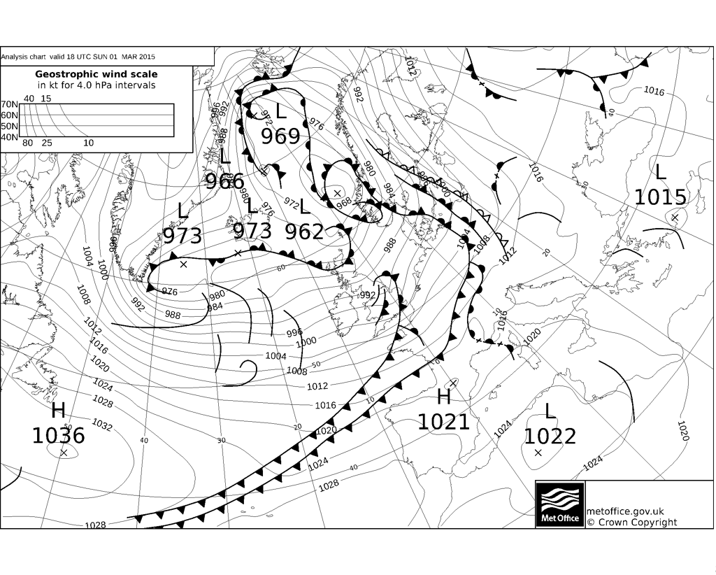
Cold westerly Monday - with its origins over northern Canada.
For now, a cold westerly flow originating from northern Canada sees winter hang on over the next few days - more especially in the north, with the prospect of wintry showers bringing settling snow overnight - even to lower levels across Scotland, N. Ireland, EIRE and N England. This overnight snow could pose some problems for travel Monday morning across Scotland, N. Ireland and Pennine routes of northern England before the March sunshine gets work. Snow falling and settling becoming increasingly confined to hills Monday afternoon. However, the wintry showers continue across the north and west Monday night, so we could see snow falling and accumulating more widely and to lower levels again across the north after dark. Sunny spells and further wintry showers on Tuesday - as the cold westerly flow continues.
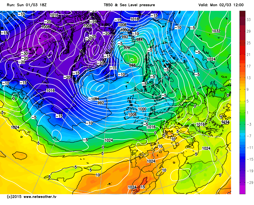
By Wednesday, we see a brief ridge build of high pressure in from the west, as fewer showers and more in the way of sunshine, but still quite a chilly day with a cold northwesterly flow.
We see a change later in the week though, as winds switch to come from the southwest, bringing in milder air from Thursday. The southwesterly winds will be accompanied by a band of cloud and rain spreading southeast Thursday, which may drag its heels across the far south on Friday with more cloud and rain arriving in the far north. However, high pressure lurking close to the SW is indicated to build north across southern UK next weekend, this may allow more in the way of sunshine to develop across the south, which combined with the mild southwesterly flow, could allow temperatures to reach 16C across central, southern and eastern areas of England on Sunday. The north may remain cloudy and damp though, but still mild.
Temperatures reaching 16C next Sunday on 12z GFS:
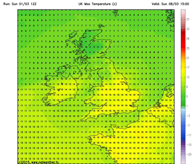
There is, however, a chance that the high pressure may remain further south, meaning a moister and cloudier flow further south for all, like Thursday and Friday, with temperatures pegged back to the low teens for many.


