


Synoptic Analysis - a look at the last few days of February and the prospects of a stormy start to March.
Wednesday looks to bring a brief pause in the storminess after quite a windy and wintry start to this week. It will also turn milder too, as a warm sector moves in head of the next Atlantic low pressure system arriving for Thursday, with temperatures reaching 10-12C across southern Britain and Ireland. However, as is common in milder Atlantic martime airmasses at this time of year, it will be rather cloudy, with some patchy rain moving east.
It turns windy again as we head into Thursday, thanks to a deep area of low pressure to the NW – which moves east just south of Iceland on Thursday before heading into the Norwegian Sea. We will see some gusty winds as the cold front moves through Thursday morning ahead of this low and it will stay windy across the north as that deep low moves in the Norwegian Sea. Turning colder as the rain clears, cold enough for wintry showers across the north and west – which look to increasingly fall as snow to lower levels across Scotland and N Ireland through the afternoon and evening.
Friday sees winds ease as a transitory ridge of high pressure builds in, promising a mostly dry and bright day save some showers across northern and western Scotland. Saturday marks the last day of February and of meteorological winter – and it looks set to turn milder again as the southwesterly wind strengthens and we see an Atlantic front pass through bringing cloud and outbreaks of rain eastwards across most parts through the day.
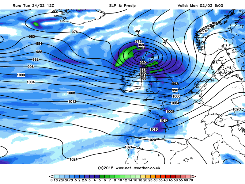
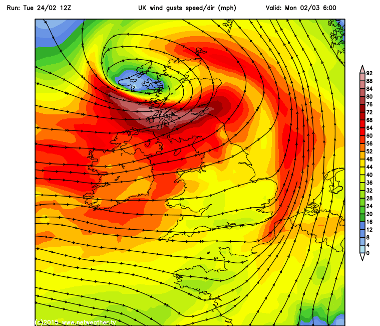
However, the last few days of February look fairly benign in comparison to what maybe brewing for the first few days of March. This evening’s models differ in timing, but 12z GFS operational proposes a very deep and intense low tracking NE across Scotland Sunday night and through Monday morning. 18z GFS has the deep low too on Monday, though a little further north, but still with damaging wind gusts for Scotland, especially the north. 12z ECMWF and UKMO quite a bit sooner, with a deepening low passing NE near Scotland during Sunday. Clearly there are some differences between the models in the phasing of a low coming off the eastern seaboard with a shortwave trough and jet streak moving out of NE Canada later this week. But all models show a worryingly deep low glancing Scotland in the first few days of March. GFS indicated wind gusts in excess of 80mph through the central belt of Scotland towards the start of the Monday morning rush hour:
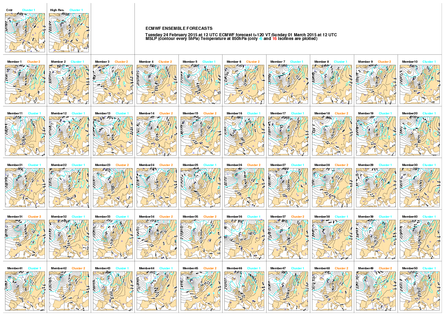
By no means are the track and depth of this low showing Sunday and Monday nailed yet, though a fair few of the 51 12z ECMWF EPS ‘postage stamps’ (below) indicate a deep low passing near or over Scotland on Sunday (courtesy of ECMWF):
So, it looks, at the moment, that March will roar in like a lion! But, most model output and its ensembles recently has suggested the weather calming down later next week, as high pressure builds in from the southwest.


