We're back into see-saw mode, as spells of colder weather are interrupted by wet, windy and milder conditions blowing through courtesy of low pressure systems passing west to east. So it's a real mixed bag for the last week of meteorological winter in Michael's weekly update.
We're back into see-saw mode, as spells of colder weather are interrupted by wet, windy and milder conditions blowing through courtesy of low pressure systems passing west to east. So it's a real mixed bag for the last week of meteorological winter in Michael's weekly update.
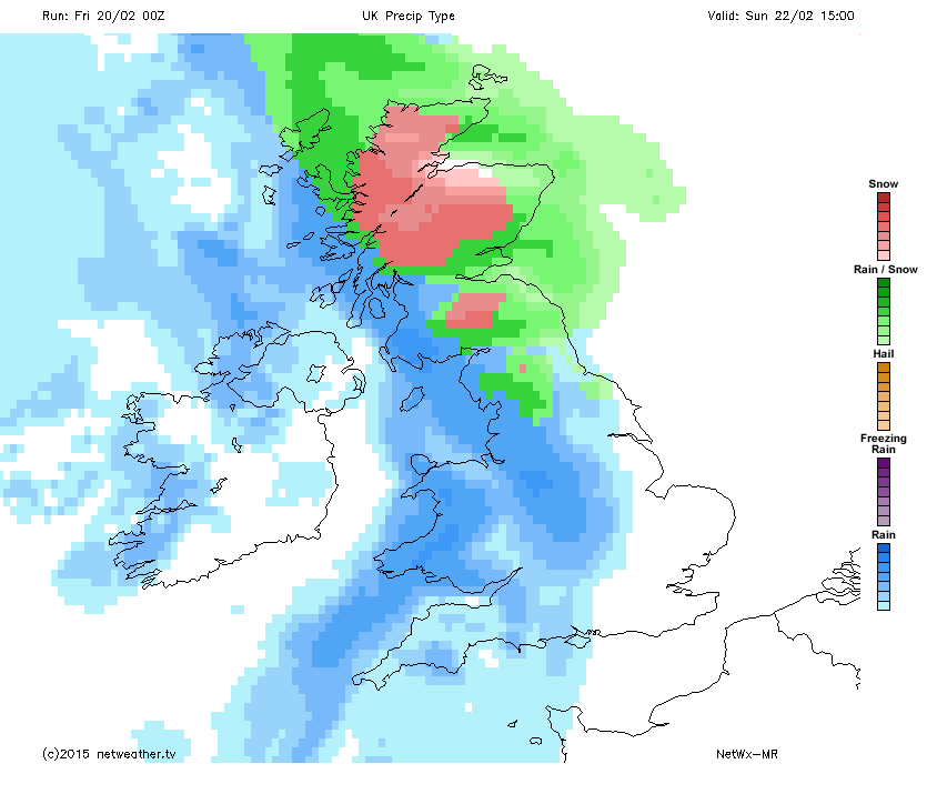
A chilly start for many as rain and cloud slowly clear the south east in the early hours, with a risk of ice and frost in a cold north westerly wind that will blow showers in through much of the day. Some these will be wintry, especially over higher ground to the north and west. Overnight temperatures will quickly fall to below zero leading to an early frost that will lift from the west as cloud and rain arrives from the Atlantic leading to a wet and blustery Sunday, with snow for some on the leading edge of the rain as it heads east.
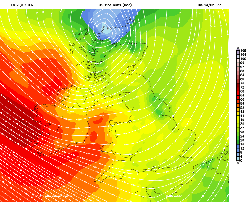
And it's a case of repeating the weekends pattern, though the winds will be stronger later on Monday and into Tuesday with gales for exposed western areas driving rain and wintry showers eastwards followed by a night frost as colder air once again arrives, before swinging back to milder, windier and wetter conditions later in the week.