High pressure is on the way this weekend. The chilly winds will ease but clear nights could still bring a frost. By day, mostly dry but tricky low cloud will affect temperatures.
Wednesday had a chilly start, especially in the breeze. Gardeners have been watching tender plants as temperatures dip down to near freezing. Some sheltered spots temperatures did fall below zero with a frost. This colder flow is coming down from the north with another cold night forecast for Wednesday night into Thursday.
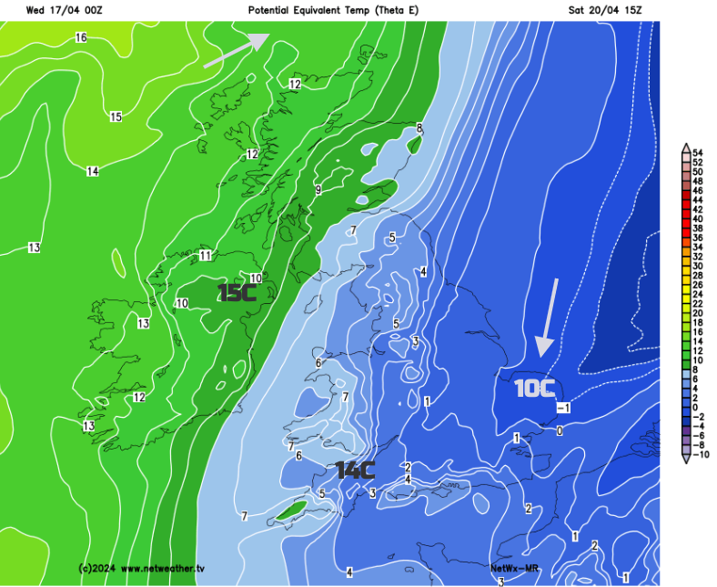
Mild air briefly creeps over Ireland on Thursday with rain over northern Britain but colder air returns from the north early on Friday. The proverb says “Cast ne’er a clout til May is out” so keep your coat nearby, the blankets on your bed and take care of seedlings. The brisk north to northwesterly wind on Friday will be noticeable.
 The Weekend
High pressure will build from the Atlantic for the weekend. This should bring more settled, drier conditions with light winds but a good deal of cloud. This high doesn’t necessarily mean sunshine and heat.
Friday night will be chilly again with the risk of frost in places. The cold air takes its time to draw away eastwards. Southeastern Britain will keep the cold air for longest this weekend. That means it will feel cold after dark with an ongoing risk of frost, it will feel chilly in the shade or breeze by day. There will be a light to moderate north to northeasterly wind off the North Sea, around the Wash and the Thames estuary for East Anglian and Kent coasts. For most of the weekend the winds will be light, quite a change from Friday.
Last weekend there was warmer air for parts of the UK. This Saturday, you will need to be in the sunshine to feel warm, and the UV rays are becoming stronger as we pass through April.
The last of Friday’s showery rain will clear away over the North Sea on Friday evening. As the high pressure glides over the UK there will be clear skies, and dry weather but falling temperatures. Around the top of the high, low cloud will be drawn into northern Scotland and eastern Britain. There could be dampness from this cloud early on Saturday, with rain in the far north of Scotland. Through the weekend there will be large areas of cloud, often over northern or eastern Britain. Here the temperatures will stay in the low teens maybe up to the mid-teens on Saturday. By Sunday, the sunnier spots could reach 18 to perhaps 20C. Again it looks like eastern and northeastern areas will see more low cloud but it will depend on the position of the high pressure. This cloud could be thick enough to give patchy rain to parts of Britain. There is uncertainty in this part of the forecast.
Belfast will have a fine weekend with bright or sunny weather and temperatures on Sunday up to around 16C. Cardiff and Bristol look fair with temperatures around 14C but could jump to 19C in sunshine if the milder air remains. Norwich looks chilly with daytime temperatures around just 9C. 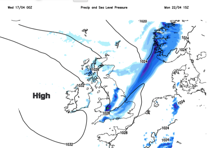
Eastern and northern areas look more likely to see more cloud whereas southern and western parts of the UK could get more sunshine and so the higher temperatures. A similar steady picture continues for most into Monday although with a few showers for southeastern Britain and patchy rain for Scotland and Northern Ireland